geo.wikisort.org - River
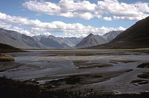
The Canning River flows through parts of the North Slope in the U.S. state of Alaska.[1] The river begins in the Franklin Mountains of the Brooks Range in the northeastern part of the state.[3] It flows generally north for 125 miles (201 km)[1] through the Arctic National Wildlife Refuge and enters Camden Bay west of Kaktovik on the Beaufort Sea.[3]
| Canning River | |
|---|---|
 Confluence with Marsh Fork | |
 Location of the mouth of the Canning River in Alaska | |
| Location | |
| Country | United States |
| State | Alaska |
| Borough | North Slope |
| Physical characteristics | |
| Source | Franklin Mountains |
| • location | Brooks Range |
| • coordinates | 69°04′40″N 145°06′07″W[1] |
| • elevation | 5,157 ft (1,572 m)[2] |
| Mouth | Camden Bay |
• location | Beaufort Sea |
• coordinates | 70°04′42″N 145°33′56″W[1] |
• elevation | 0 ft (0 m)[1] |
| Length | 125 mi (201 km)[1] |
See also
Wikimedia Commons has media related to Canning River, Alaska.
References
- "Canning River". Geographic Names Information System. United States Geological Survey. March 31, 1981. Retrieved September 2, 2013.
- Source elevation derived from Google Earth search using GNIS source coordinates.
- Alaska Atlas & Gazetteer (7th ed.). Yarmouth, Maine: DeLorme. 2010. pp. 135–37. ISBN 978-0-89933-289-5.
На других языках
[de] Canning River (Alaska)
Der Canning River ist ein ca. 200 km langer Zufluss der Beaufortsee in der North Slope im Norden von Alaska.- [en] Canning River (Alaska)
Текст в блоке "Читать" взят с сайта "Википедия" и доступен по лицензии Creative Commons Attribution-ShareAlike; в отдельных случаях могут действовать дополнительные условия.
Другой контент может иметь иную лицензию. Перед использованием материалов сайта WikiSort.org внимательно изучите правила лицензирования конкретных элементов наполнения сайта.
Другой контент может иметь иную лицензию. Перед использованием материалов сайта WikiSort.org внимательно изучите правила лицензирования конкретных элементов наполнения сайта.
2019-2025
WikiSort.org - проект по пересортировке и дополнению контента Википедии
WikiSort.org - проект по пересортировке и дополнению контента Википедии