geo.wikisort.org - River
The Caddo River is a tributary of the Ouachita River in the U.S. state of Arkansas. The river is about 82 miles (132 km) long.[2]
| Caddo River | |
|---|---|
 Caddo River at Norman | |
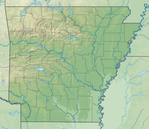 Location of the mouth of the Caddo River in Arkansas | |
| Location | |
| Country | United States |
| State | Arkansas |
| Physical characteristics | |
| Source | Caddo Mountains |
| • location | Ouachita Mountains |
| • coordinates | 34°27′9″N 93°55′22″W[1] |
| • elevation | 1,400 ft (430 m)[2] |
| Mouth | Ouachita River |
• location | near Arkadelphia, Arkansas |
• coordinates | 34°10′48″N 93°2′36″W[1] |
• elevation | 144 ft (44 m)[2] |
| Length | 82 mi (132 km)[2] |
| Discharge | |
| • location | USGS gage 07359610, near Caddo Gap, AR[3] |
| • average | 267 cu ft/s (7.6 m3/s)[3] |
| • minimum | 16 cu ft/s (0.45 m3/s) |
| • maximum | 28,600 cu ft/s (810 m3/s) |
Course
The Caddo River flows out of the Ouachita Mountains through Montgomery, Pike, and Clark counties in Arkansas before flowing into DeGray Lake and then to its terminus at the Ouachita River north of Arkadelphia, Arkansas.
The upper Caddo is known as a good family canoeing river and is a popular destination for fishing. Smallmouth and spotted bass are found in quantity, as are longear and green sunfish. The lower course of the Caddo, below Degray Dam, is also a popular fishing and canoeing river, although the length of river remaining is only a few miles at that point.
Communities through which the Caddo River passes are:
- Black Springs, Arkansas
- Norman, Arkansas
- Caddo Gap, Arkansas
- Glenwood, Arkansas
- Amity, Arkansas
- Caddo Valley, Arkansas
- Arkadelphia, Arkansas
Flood of 2010
On the night of June 11, 2010, a flash flood along the Caddo and Little Missouri Rivers killed twenty people.[4]
Etymology
The Caddo River is named for the Caddo Native American tribes that, at one time, lived along its banks.
See also
References
- U.S. Geological Survey Geographic Names Information System: Caddo River
- Calculated in Google Maps and Google Earth
- "Water resources data for the United States, Water Year 2009; gage 07359610, Caddo River near Caddo Gap, AR" (PDF). USGS. Retrieved 4 August 2010.
- Holmes, Robert; Wagner, Daniel (2011). "Flood of June 11, 2010 in the Upper Little Missouri River Watershed, Arkansas". U.S. Geological Survey Scientific Investigations Report 2011-5194: 31.
External links
Другой контент может иметь иную лицензию. Перед использованием материалов сайта WikiSort.org внимательно изучите правила лицензирования конкретных элементов наполнения сайта.
WikiSort.org - проект по пересортировке и дополнению контента Википедии