geo.wikisort.org - River
Butrum Creek is a 3.88 mi (6.24 km) long 1st order tributary to Lawsons Creek in Halifax County, Virginia.
| Butrum Creek Tributary to Lawsons Creek | |
|---|---|
 Location of Butrum Creek mouth  Butrum Creek (the United States) | |
| Location | |
| Country | United States |
| State | Virginia |
| County | Halifax |
| Physical characteristics | |
| Source | unnamed tributary to Coleman Creek divide |
| • location | about 1 mile northeast of Alton, Virginia |
| • coordinates | 36°35′28″N 078°58′52″W[1] |
| • elevation | 530 ft (160 m)[1] |
| Mouth | |
• location | about 1 mile west of Cedar Grove, Virginia |
• coordinates | 36°37′20″N 079°00′30″W[2] |
• elevation | 390 ft (120 m)[2] |
| Length | 2.88 mi (4.63 km)[3] |
| Basin size | 2.63 square miles (6.8 km2)[4] |
| Discharge | |
| • location | Lawsons Creek |
| • average | 3.42 cu ft/s (0.097 m3/s) at mouth with Lawsons Creek[4] |
| Basin features | |
| Progression | Lawsons Creek → Dan River → Roanoke River → Albemarle Sound → Pamlico Sound → Atlantic Ocean |
| River system | Roanoke River |
| Tributaries | |
| • left | unnamed tributaries |
| • right | unnamed tributaries |
| Waterbodies | Blanes Millpond |
| Bridges | none |
Course
Butrum Creek rises about 1 mile west of Cedar Grove, Virginia, and then flows northeast and to join Lawsons Creek about 3 miles northeast of Alton.[2]
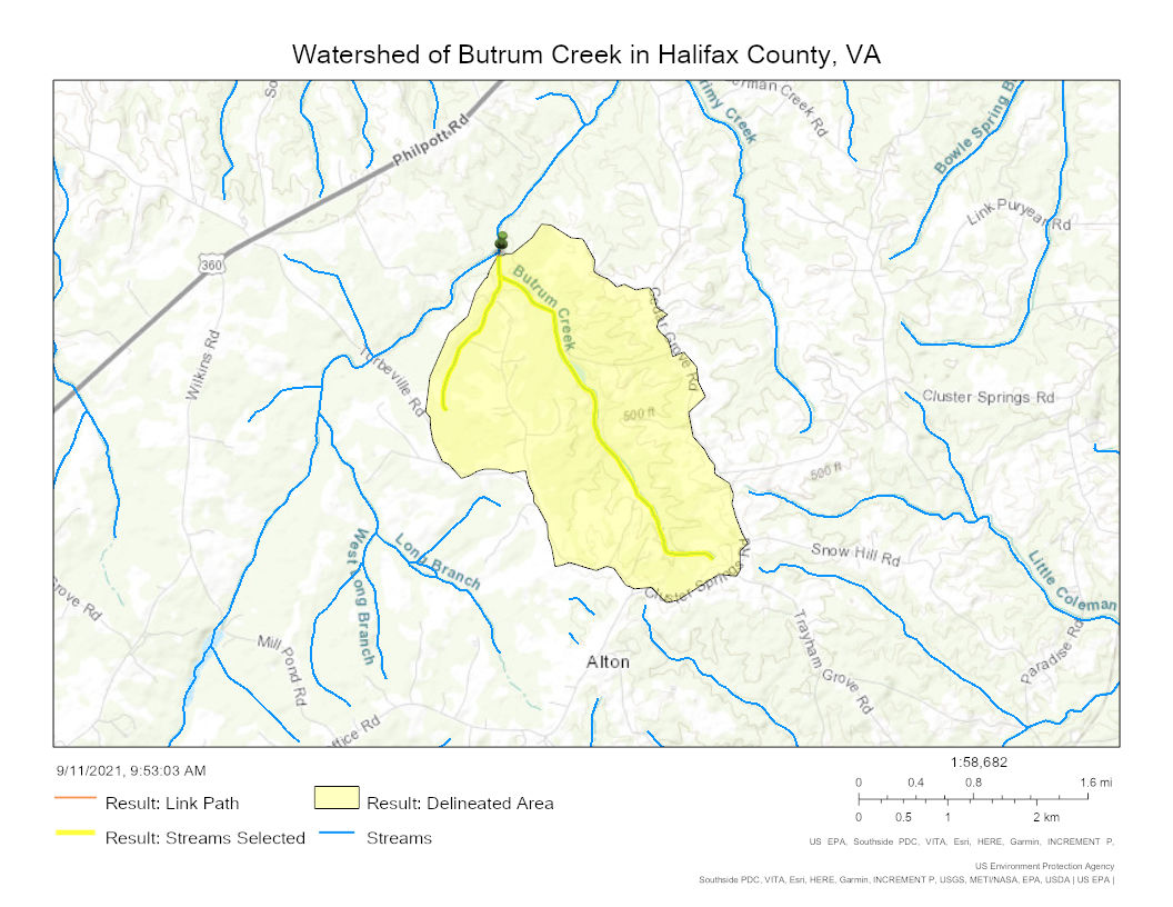
Watershed
Butrum Creek drains 2.63 square miles (6.8 km2) of area, receives about 45.8 in/year of precipitation, has a wetness index of 387.82, and is about 45% forested.[4]
See also
- List of Virginia Rivers
References
- "Get Maps". USGS Topoview. US Geological Survey. Retrieved 11 September 2021.
- "Get Maps". USGS Topoview. US Geological Survey. Retrieved 11 September 2021.
- "ArcGIS Web Application". epa.maps.arcgis.com. US EPA. Retrieved 11 September 2021.
- "Butrum Creek Watershed Report". US EPA Geoviewer. US EPA. Retrieved 11 September 2021.
Watershed Maps

Текст в блоке "Читать" взят с сайта "Википедия" и доступен по лицензии Creative Commons Attribution-ShareAlike; в отдельных случаях могут действовать дополнительные условия.
Другой контент может иметь иную лицензию. Перед использованием материалов сайта WikiSort.org внимательно изучите правила лицензирования конкретных элементов наполнения сайта.
Другой контент может иметь иную лицензию. Перед использованием материалов сайта WikiSort.org внимательно изучите правила лицензирования конкретных элементов наполнения сайта.
2019-2026
WikiSort.org - проект по пересортировке и дополнению контента Википедии
WikiSort.org - проект по пересортировке и дополнению контента Википедии