geo.wikisort.org - River
Buffalo Creek is a tributary of the Monongahela River, 30.2 miles (48.6 km) long,[3] in northern West Virginia, in the United States. Via the Monongahela and Ohio rivers, it is part of the watershed of the Mississippi River, draining an area of 125 square miles (320 km2)[4] on the unglaciated portion of the Allegheny Plateau. The stream's entire course and drainage basin are in Marion County.
| Buffalo Creek | |
|---|---|
 Buffalo Creek in Mannington in 2010 | |
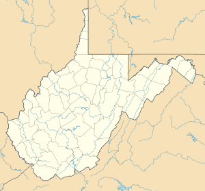 Location of the mouth of Buffalo Creek in Fairmont, West Virginia | |
| Location | |
| Country | United States |
| State | West Virginia |
| County | Marion |
| Physical characteristics | |
| Source | |
| • location | near Brink |
| • coordinates | 39.5395288°N 80.4895332°W[1] |
| • elevation | 1,355 ft (413 m)[2] |
| Mouth | Monongahela River |
• location | Fairmont |
• coordinates | 39.4956401°N 80.1250769°W[1] |
• elevation | 860 ft (260 m)[1] |
| Length | 30.2 mi (48.6 km) |
| Basin size | 125 sq mi (320 km2) |
| Discharge | |
| • location | Barrackville |
| • minimum | 0 cu ft/s (0 m3/s) |
| • maximum | 10,400 cu ft/s (290 m3/s) |
| Basin features | |
| Tributaries | |
| • left | Pyles Fork |
Buffalo Creek rises near Marion County's western boundary, near the community of Brink, and flows generally eastward through the communities of Logansport, Mannington, Rachel, Farmington, Pine Grove, and Barrackville to Fairmont, where it flows into the Monongahela River from the west. Among other tributaries, it collects the Pyles Fork from the north at Mannington. Downstream of Mannington, the creek is paralleled for much of its course by U.S. Route 250.[5]
According to the West Virginia Department of Environmental Protection, approximately 84% of the Buffalo Creek watershed is forested, mostly deciduous. Approximately 14% is used for pasture and agriculture.[4]
Flow rate
At the United States Geological Survey's stream gauge at Barrackville, 4.4 miles (7.1 km) upstream of the creek's mouth, the annual mean flow of the river between 1907 and 2012 was 169 cubic feet per second (5 m³/s). The highest recorded flow during the period was 10,400 cu ft/s (294 m³/s) on February 19, 2000. The lowest recorded flow was 0 cu ft/s (0 m³/s) for an extended period in 1908.[6]
See also
- List of rivers of West Virginia
- Barrackville Covered Bridge
References
- Geographic Names Information System. "Geographic Names Information System entry for Buffalo Creek (Feature ID #1536638)". Retrieved 2011-10-14.
- Google Earth elevation for GNIS source coordinates. Retrieved on 2011-10-14.
- United States Environmental Protection Agency. "Watershed Assessment, Tracking & Environmental Results: Assessment Summary for Reporting Year 2008, West Virginia, Upper Monongahela Watershed". Archived from the original on 2011-10-14. Retrieved 2011-10-14.
- West Virginia Department of Environmental Protection. "Monongahela River". Watershed Atlas Project. Archived from the original on 2005-04-04. Retrieved 2011-10-14.
- West Virginia Atlas & Gazetteer. Yarmouth, Me.: DeLorme. 1997. p. 25. ISBN 0-89933-246-3.
- "Water-Data Report 2012, 03061500 Buffalo Creek at Barrackville, WV" (PDF). United States Geological Survey. 2012. Retrieved 2014-01-07.
Другой контент может иметь иную лицензию. Перед использованием материалов сайта WikiSort.org внимательно изучите правила лицензирования конкретных элементов наполнения сайта.
WikiSort.org - проект по пересортировке и дополнению контента Википедии