geo.wikisort.org - River
Bridalveil Falls is a seasonal waterfall located at Pictured Rocks National Lakeshore, Michigan.[2] Directions: From H-58 from Munising go east 4.5 miles (7.2 km) to Miners Castle Road, then 5 miles (8.0 km) to the Castle. You can see this from afar from here. You can also see it from the Lake in a boat, or hiking on the Lakeshore Trail (Although only partial views from a distance can be seen from the trail itself. A dangerous view of the crest can be seen after a short hike from the trail.)[1]
This article uses bare URLs, which are uninformative and vulnerable to link rot. (August 2022) |
| Bridalveil Falls | |
|---|---|
 Bridalveil Falls, Michigan | |
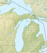 | |
| Location | Alger County, Michigan, United States |
| Coordinates | Maps 46°30′30″N 86°31′23″W[1] |
| Type | Plunge Horsetail |
| Total height | 140 feet (43 m) |
References
- http://www.easternwaterfalls.com/michigan.htm
- "Waterfalls - Pictured Rocks National Lakeshore". Nps.gov. Retrieved 2012-10-04.
This waterfall-related article is a stub. You can help Wikipedia by expanding it. |
This Alger County, Michigan location article is a stub. You can help Wikipedia by expanding it. |
Текст в блоке "Читать" взят с сайта "Википедия" и доступен по лицензии Creative Commons Attribution-ShareAlike; в отдельных случаях могут действовать дополнительные условия.
Другой контент может иметь иную лицензию. Перед использованием материалов сайта WikiSort.org внимательно изучите правила лицензирования конкретных элементов наполнения сайта.
Другой контент может иметь иную лицензию. Перед использованием материалов сайта WikiSort.org внимательно изучите правила лицензирования конкретных элементов наполнения сайта.
2019-2025
WikiSort.org - проект по пересортировке и дополнению контента Википедии
WikiSort.org - проект по пересортировке и дополнению контента Википедии