geo.wikisort.org - River
The Blanco River (Spanish: Río Blanco) is a river of Naguabo, Puerto Rico. This river begins at the junction of the Cubuy River, the Icacos River and the Prieto River in the Luquillo Forest Reserve at an approximate elevation of 558 feet (170 meters) above sea level. It is approximately 8.5 miles (13.6 kilometers) in length, from its origin until its discharge into the east of Puerto Rico in Río barrio in the municipality of Naguabo. It runs from north to southeast.[1][2]
| Blanco River | |
|---|---|
 Río Blanco in Naguabo | |
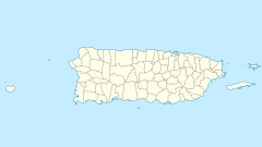 Location of mouth | |
| Native name | Río Blanco (Spanish) |
| Location | |
| Commonwealth | Puerto Rico |
| Municipality | Naguabo |
| Physical characteristics | |
| Source | |
| • elevation | 558 ft. |
| Length | 8.5 miles |
See also
References
- Suarez, Victor. "Inventario de los ríos más importantes de Puerto Rico" (in Spanish). Archived from the original (PDF) on October 23, 2008.
- "Jacksonville District Navigable Waters Lists" (PDF). saj.usace.army.mil. SAJ. Archived (PDF) from the original on 2017-01-26. Retrieved 18 February 2019.
- U.S. Geological Survey Geographic Names Information System: Río Blanco
External links
Текст в блоке "Читать" взят с сайта "Википедия" и доступен по лицензии Creative Commons Attribution-ShareAlike; в отдельных случаях могут действовать дополнительные условия.
Другой контент может иметь иную лицензию. Перед использованием материалов сайта WikiSort.org внимательно изучите правила лицензирования конкретных элементов наполнения сайта.
Другой контент может иметь иную лицензию. Перед использованием материалов сайта WikiSort.org внимательно изучите правила лицензирования конкретных элементов наполнения сайта.
2019-2025
WikiSort.org - проект по пересортировке и дополнению контента Википедии
WikiSort.org - проект по пересортировке и дополнению контента Википедии