geo.wikisort.org - River
The Belle Fourche River (pronounced bel FOOSH; Lakota: Šahíyela Wakpá[1]) is a tributary of the Cheyenne River, approximately 290 miles (470 km) long, in the U.S. states of Wyoming and South Dakota.[2] It is part of the Mississippi River watershed via the Cheyenne and Missouri rivers. In the latter part of the 19th century, the Belle Fourche River was known as the North Fork of the Cheyenne River.[3] Belle Fourche is a name derived from French meaning "beautiful fork".[4]
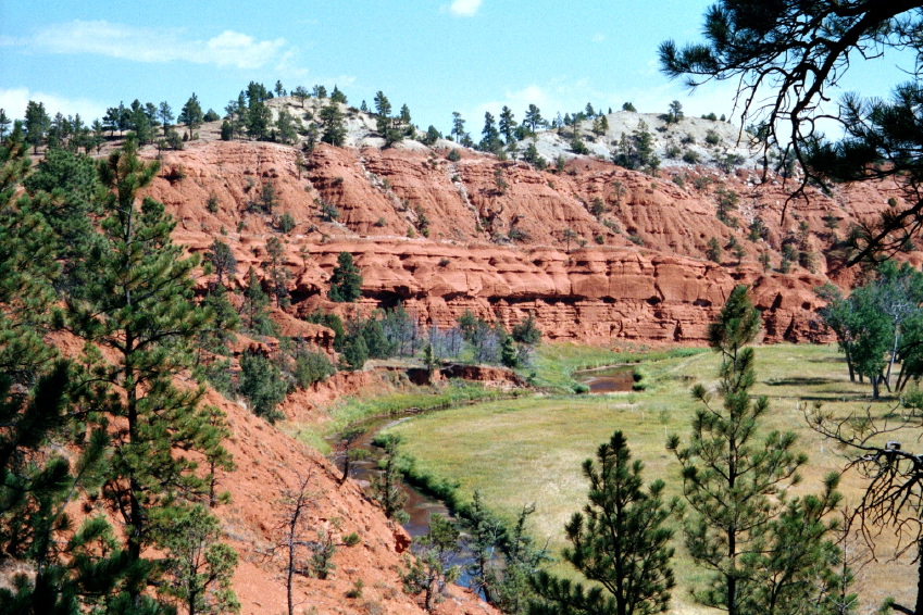

Description
It rises in northeastern Wyoming, in southern Campbell County, approximately 15 miles (24 km) north of Wright. It flows northeast around the north side of the Bear Lodge Mountains, past Moorcroft and Devils Tower. Near the state line with Montana, it turns abruptly southeast and flows in western South Dakota, past Belle Fourche and around the north side of the Black Hills. In southern Meade County near Hereford, it turns ENE and joins the Cheyenne approximately 50 miles (80 km) ENE of Rapid City.
The point at which the river flows out of Wyoming and into South Dakota is the lowest elevation point in the state of Wyoming at 3,099 feet (945 m). This is the second-highest low point of any U.S. state.[5] At Elm Springs, the river has an average discharge of 397 cubic feet per second (11.2 cubic metres per second)[6]
The river provides significant recreation and irrigation for agriculture in western South Dakota. The total irrigation area of the river in South Dakota is approximately 57,000 acres (230 km2).
See also
References
- Ullrich, Jan, ed. (2011). New Lakota Dictionary (2nd ed.). Bloomington, IN: Lakota Language Consortium. p. 861. ISBN 978-0-9761082-9-0. LCCN 2008922508.
- U.S. Geological Survey Geographic Names Information System: Belle Fourche River
- Nebraska, and the territories of Dakota, Idaho, Montana and Wyoming (Map). 1:3,000,000. Atlas of the United States. Cartography by H.F. Walling, O.W. Gray, and H.H. Lloyd & Co. Cincinnati: Stedman, Brown & Lyon. 1872.
- Federal Writers' Project (1940). South Dakota place-names, v.3. American guide series. University of South Dakota. p. 4.
- U.S. Geological Survey. "Elevations and Distances". Archived from the original on 16 January 2008. Retrieved 2008-01-22.
- "USGS Surface Water data for South Dakota: USGS Surface-Water Annual Statistics".
External links
| Wikimedia Commons has media related to Belle Fourche River. |
- The National Map Viewer (Map). United States Geological Survey. Retrieved 2012-09-20.
Authority control | |
|---|---|
| General |
|
| National libraries | |
На других языках
[de] Belle Fourche River
Der Belle Fourche River ist ein linker Nebenfluss des Cheyenne River. Er hat eine Länge von 470 km und verläuft in den US-Bundesstaaten Wyoming und South Dakota. Er gehört zum Einzugsgebiet des Mississippi River.- [en] Belle Fourche River
[ru] Белл-Фурш (река)
Белл-Фурш[1] (англ. Belle Fourche River /bɛlˈfuːʃ/; лакота Šahíyela Wakpá[2]) — приток реки Шайенн длиной около 470 км, протекающий по территории североамериканских штатов Вайоминг и Южная Дакота.Другой контент может иметь иную лицензию. Перед использованием материалов сайта WikiSort.org внимательно изучите правила лицензирования конкретных элементов наполнения сайта.
WikiSort.org - проект по пересортировке и дополнению контента Википедии