geo.wikisort.org - River
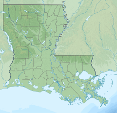
Bayou Manchac is an 18-mile-long (29 km)[1] bayou in southeast Louisiana, USA. First called the Iberville River ("rivière d'Iberville") by its French discoverers,[2][3] the bayou was once a very important waterway linking the Mississippi River (west end) to the Amite River (east end).[4][3] East Baton Rouge Parish lies on its northern side, while its southern side is divided between Ascension Parish (to the east) and Iberville Parish (to the west). The large unincorporated community of Prairieville and the city of St. Gabriel both lie on its southern side.
| Bayou Manchac | |
|---|---|
 Location of mouth | |
| Location | |
| Country | United States |
| State | Louisiana |
| Physical characteristics | |
| Mouth | |
• coordinates | 30°20′44″N 90°53′31″W |
Etymology
Dr John R. Swanton, a linguist who worked with Native American languages, suggested that the name Manchac is derived from Imashaka, which is a Choctaw word meaning "the rear entrance."[5][6] An early Choctaw language dictionary written by Cyrus Byington defines the word im as a preposition meaning "place" and ashaka meaning "the back side or rear" [7]
Exploration
In March 1699, Pierre Le Moyne d'Iberville made his way up the Mississippi and came to the area that is now the city of Baton Rouge. He wished to find a quick way back to the Gulf of Mexico, where his ships were moored at Ship Island. On March 26, 1699, the chief of the Bayogoula tribe, who had accompanied him to the future site of Baton Rouge, showed him the bayou that the Bayogoula used to travel between the present-day Mississippi Gulf Coast and their village.[8] Though it once formed an international boundary, attempts to navigate the bayou as a shortcut between the Mississippi and Amite rivers, or to make it navigable, were generally unsuccessful.
Fort Bute
In 1764 the British established a trading post on the Iberville River and called it Fort Bute at Manchac.[9] The British traded with boats traveling down the Mississippi and encouraged trading at Manchac rather than with the Spanish farther down at New Orleans. The fort at Bayou Manchac was a strategic position for the British and was positioned to compete with Spain for the fur trade, valued at that time at 100,000 pounds sterling annually.[10]
San Gabriel de Manchac
Soon after the British built Fort Bute, the Spanish responded by building a trading post on the opposite side of the river.[11] On September 28, 1766, an English ship arrived in New Orleans from Maryland carrying 224 exiled Acadians. The Spanish Governor Antonio de Ulloa at the Isle of Orleans gave them supplies, and they settled around San Gabriel de Manchac.[12]
For about three months, from April 30 to August 4, 1812, Bayou Manchac was the northern border of eastern Louisiana, until the addition of the Florida Parishes was approved by the state legislature.[13]
Industrial use and today
Bayou Manchac became one of the most important waterways of southeastern Louisiana. It served the vital role of linking Baton Rouge to Lake Pontchartrain via the Amite River and Lake Maurepas. Through time, as ships became larger and faster, Bayou Manchac was too small to support modern traffic. In the 20th century, when the Mississippi River levees were built, Bayou Manchac was cut off from the river, and later the upper sections dried out or were cut off by roads. Now the bayou is only useful for drainage and recreation, but the area is still regarded by those who live in the vicinity as one of Louisiana's most beautiful examples of nature.[4]
See also
Sternberg, Mary Ann (2007). Winding Through Time: The Forgotten History and Present-Day Peril of Bayou Manchac. Louisiana State University Press. ISBN 978-0-8071-3253-1.
References
- U.S. Geological Survey. National Hydrography Dataset high-resolution flowline data. The National Map Archived 2012-03-29 at the Wayback Machine, accessed June 20, 2011
- A Map of part of West Florida : from Pensacola to the mouth of the Iberville River, with a view to shew the proper spot for a settlement on the Mississippi, [London] : [Publisher not identified], [1772], https://www.loc.gov/resource/g3860.ar165000/?r=-0.063,0.075,0.335,0.151,0, last accessed 10 Feb 2019.
- Suite du cours du fleuve St. Louis depuis la rivière d'Iberville jusq'à celle des Yasous, et les parties connues de la Rivière Rouge et la Rivière Noire, https://www.loc.gov/resource/g4042m.ar077900/?r=0.549,0.465,0.411,0.185,0, last accessed 10 Feb 2019.
- https://www.webcitation.org/query?url=http://www.geocities.com/mybayou2/index.html&date=2009-10-26+02:28:12 [dead link]
- William A. Read (12 October 2008). Louisiana Place Names of Indian Origin: A Collection of Words. University of Alabama Press. p. 40. ISBN 978-0-8173-5505-0.
- Clare D’Artois Leeper (19 October 2012). Louisiana Place Names: Popular, Unusual, and Forgotten Stories of Towns, Cities, Plantations, Bayous, and Even Some Cemeteries. LSU Press. pp. 156–. ISBN 978-0-8071-4738-2.
- Cyrus Byington (1915), A Dictionary of the Choctaw Language, Native American Book Publishers, p. 59, ISBN 9781878592071
- "Pierre LeMoyne d' Iberville: Discoverer of the Mississippi Gulf Coast". Archived from the original on 2007-09-27. Retrieved 2007-08-22.
- James Dunwoody Brownson De Bow (1854). Encyclopaedia of the Trade and Commerce of the United States: More Particularly of the Southern and Western States: Giving a View of the Commerce, Agriculture, Manufactures, Internal Improvements, Slave and Free Labour, Slavery Institutions, Products, Etc., of the South ... Trübner & Company. pp. 1–.
- Mary Ann Sternberg (April 2007). Winding Through Time: The Forgotten History and Present-Day Peril of Bayou Manchac. LSU Press. pp. 47–. ISBN 978-0-8071-3577-8.
- James Dunwoody Brownson De Bow (1852). The Industrial Resources, Etc., of the Southern and Western States: Embracing a View of Their Commerce, Agriculture, Manufactures, Internal Improvements, Slave and Free Labor, Slavery Institutions, Products, Etc., of the South : Together with Historical and Statistical Sketches of the Different States and Cities of the Union : Statistics of the United States Commerce and Manufactures, from the Earliest Periods, Compared with Other Leading Powers : the Results of the Different Census Returns Since 1790, and Returns of the Census of 1850, on Population, Agriculture and General Industry, Etc. : with an Appendix. Office of De Bow's review. pp. 29–.
- Barry Jean Ancelet; Jay Edwards; Glen Pitre (20 January 2012). Cajun Country. Univ. Press of Mississippi. pp. 15–. ISBN 978-1-60473-617-5.
- "Giving the Assent of the Legislature to an Enlargement of the Limits of the State of Louisiana". en.wikisource.org. August 4, 1812. Retrieved 21 October 2021.
| Authority control |
|
|---|
Другой контент может иметь иную лицензию. Перед использованием материалов сайта WikiSort.org внимательно изучите правила лицензирования конкретных элементов наполнения сайта.
WikiSort.org - проект по пересортировке и дополнению контента Википедии