geo.wikisort.org - River
Bayou Gulch is one of the tributaries of Cherry Creek, located mainly in the U.S. state of Colorado. It is part of the Colorado Eastern Plains. An archaeologically sensitive portion of the gulch was listed on the National Register of Historic Places in 2020.[3]
| Bayou Gulch[1] | |
|---|---|
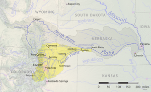 South Platte River watershed including Bayou Gulch | |
| Physical characteristics | |
| Source | |
| • location | Ponderosa Park, Colorado |
| Mouth | |
• location | Confluence with Cherry Creek |
• elevation | 6,000 ft (1,800 m) |
| Length | 8 mi (13 km)[2] |
| Basin features | |
| Progression | Cherry Creek-South Platte-Platte—Missouri—Mississippi |
Bayou Gulch | |
U.S. National Register of Historic Places | |
| NRHP reference No. | 100005167 |
| Added to NRHP | April 13, 2020 |
Description
The gulch is formed in Elbert County, Colorado, southeast of Denver and approximately 1 mile (1.6 km) southeast of Ponderosa Park.
The gulch flows west through Eastern Douglas County and into Cherry Creek. Bayou Gulch Road follows the streambed, which is generally dry.
Recreational opportunities
There is a park that is next to the gulch with a playground basketball hoops, football field, baseball field, and hiking trails.
See also
References
- U.S. Geological Survey Geographic Names Information System: Bayou Gulch
- U.S. Geological Survey. National Hydrography Dataset high-resolution flowline data. The National Map Archived 2012-03-29 at the Wayback Machine, accessed March 25, 2011
- "Weekly List 20200417B - National Register of Historic Places (U.S. National Park Service)".
External links
- Antero Reservoir
- Chatfield Reservoir
- Cheesman Reservoir
- USGS: South Platte River Basin
- University of Colorado: GIS Hydro Data for the South Platte
- City of Denver: South Platte Initiative
- Eleven Mile Reservoir
- The Greenway Foundation
- Spinney Mountain Reservoir
- Strontia Springs Reservoir and Waterton Canyon
Текст в блоке "Читать" взят с сайта "Википедия" и доступен по лицензии Creative Commons Attribution-ShareAlike; в отдельных случаях могут действовать дополнительные условия.
Другой контент может иметь иную лицензию. Перед использованием материалов сайта WikiSort.org внимательно изучите правила лицензирования конкретных элементов наполнения сайта.
Другой контент может иметь иную лицензию. Перед использованием материалов сайта WikiSort.org внимательно изучите правила лицензирования конкретных элементов наполнения сайта.
2019-2026
WikiSort.org - проект по пересортировке и дополнению контента Википедии
WikiSort.org - проект по пересортировке и дополнению контента Википедии