geo.wikisort.org - River
The Atuel River is a river located mainly in the south of the Argentine province of Mendoza, with its last part in La Pampa. It is a tributary of the Desaguadero River.
The Atuel is the longest river in Mendoza. It is born in the Andes range, at 3,250 metres (10,660 ft) above mean sea level, from the glacial Atuel Lake. It has a mean flow of 31.8 cubic metres per second (1,120 cu ft/s), and its drainage basin covers 13,000 square kilometres (5,000 sq mi). Its volume increases from November to March (around the summer).
Canyon

As it approaches the city of San Rafael, Mendoza, from the southwest, the Atuel is turned into a reservoir with an area of 96 square kilometres (37 sq mi) by the El Nihuil Dam. Immediately after El Nihuil, the river becomes entrenched along a canyon and forms rapids. The canyon is about 60 kilometres (37 mi) long, and during its course the river falls from 1,250 to 700 metres (4,100 to 2,300 ft) above sea level. This level difference is taken advantage of by four hydroelectric power stations (Nihuil I, II, III and IV). Most of the Atuel's flow at this point has been redirected through a system of tunnels inside the mountains, connecting the chain of reservoirs.
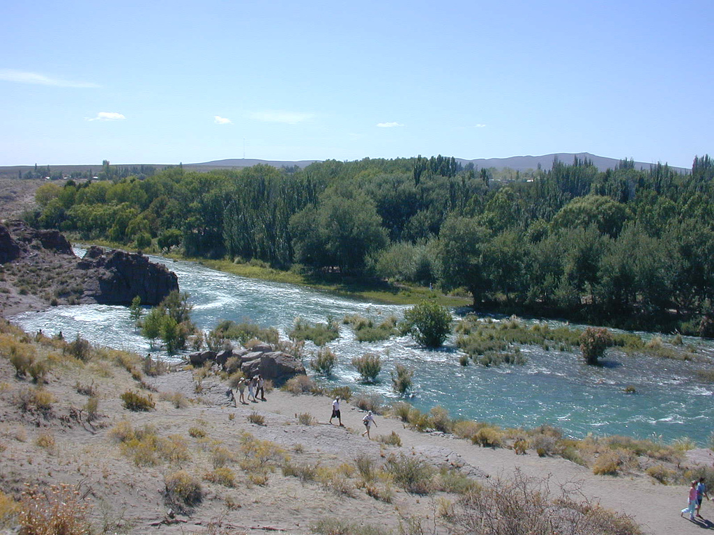
The Atuel Canyon area is a major tourist attraction, featuring hotels, camping sites, country clubs and other lodging facilities. The rapids are employed for rafting and canoeing; they are classified between class II (novice) and IV (advanced) in the International Scale of River Difficulty.
The canyon ends at Rincón del Atuel. From there on the river flows along a plain, becoming wider and meandering until reaching the Desaguadero River.
References
- El Baqueano, San Rafael, Río Atuel.
- WelcomeArgentina. Adrenaline Guaranteed.
Authority control | |
|---|---|
| General |
|
| National libraries | |
This article about a place in Mendoza Province, Argentina is a stub. You can help Wikipedia by expanding it. |
This article related to a river in Argentina is a stub. You can help Wikipedia by expanding it. |
На других языках
[de] Río Atuel
Der Río Atuel ist ein etwa 600 km langer Fluss in Argentinien. Er fließt durch die beiden Provinzen Mendoza und La Pampa.- [en] Atuel River
[es] Río Atuel
El río Atuel es un río de Argentina, un afluente del río Desaguadero que discurre principalmente por el sur de la provincia de Mendoza y llega en menos medida hasta el noroeste de la provincia de La Pampa. Atuel, proviene de un vocablo puelche «Latuel» que significa «Alma de la tierra». La cuenca ocupa el sector más meridional de las que integran el sistema del Desaguadero y drena una superficie aproximada de 39 404 km². El Atuel tiene una longitud aproximada de 790 km (otras fuentes hablan de más de 600 km[1]).[ru] Атуэль
Атуэ́ль (исп. Atuel) — река в Аргентине, левый приток Рио-Саладо[1][2].Другой контент может иметь иную лицензию. Перед использованием материалов сайта WikiSort.org внимательно изучите правила лицензирования конкретных элементов наполнения сайта.
WikiSort.org - проект по пересортировке и дополнению контента Википедии