geo.wikisort.org - River
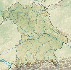
Attel is a river of Bavaria, Germany. It flows into the Inn near Ramerberg.
This article may be expanded with text translated from the corresponding article in German. (September 2011) Click [show] for important translation instructions.
|
| Attel | |
|---|---|
 | |
| Location | |
| Country | Germany |
| State | Bavaria |
| Physical characteristics | |
| Mouth | |
• location | Inn |
• coordinates | 48.0221°N 12.1774°E |
| Length | 39.6 km (24.6 mi) [1] |
| Basin size | 331 km2 (128 sq mi) [1] |
| Basin features | |
| Progression | Inn→ Danube→ Black Sea |
See also
References
- Complete table of the Bavarian Waterbody Register by the Bavarian State Office for the Environment (xls, 10.3 MB)
На других языках
[de] Attel
Die Attel ist ein auf dem Hauptstrang fast 40 km langer linker und westlicher Zufluss des Inns in den Landkreisen Ebersberg und dann Rosenheim in Oberbayern, der nahe dem Pfarrdorf Attel von Wasserburg am Inn mündet.- [en] Attel
Текст в блоке "Читать" взят с сайта "Википедия" и доступен по лицензии Creative Commons Attribution-ShareAlike; в отдельных случаях могут действовать дополнительные условия.
Другой контент может иметь иную лицензию. Перед использованием материалов сайта WikiSort.org внимательно изучите правила лицензирования конкретных элементов наполнения сайта.
Другой контент может иметь иную лицензию. Перед использованием материалов сайта WikiSort.org внимательно изучите правила лицензирования конкретных элементов наполнения сайта.
2019-2025
WikiSort.org - проект по пересортировке и дополнению контента Википедии
WikiSort.org - проект по пересортировке и дополнению контента Википедии
