geo.wikisort.org - River
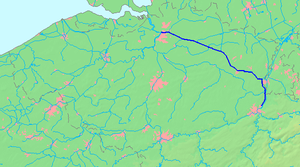
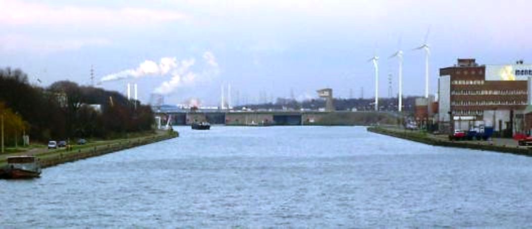
The Albert Canal (Dutch: Albertkanaal, French: Canal Albert) is a canal located in northeastern Belgium, which was named for King Albert I of Belgium. The Albert Canal connects Antwerp with Liège, and also the Meuse river with the Scheldt river. It also connects with the Dessel–Turnhout–Schoten Canal, and its total length is 129.5 kilometres (80.5 mi).
This article needs additional citations for verification. (December 2009) |
| Albert Canal | |
|---|---|
 | |
| Specifications | |
| Length | 80.5 miles (129.6 km) |
| Locks | 6 |
| History | |
| Construction began | 1930 |
| Date of first use | 1939 |
| Geography | |
| Start point | Liège |
| End point | Antwerp |
Size and geography
The Albert Canal has a standard depth of 3.4 metres (11 ft) and an overhead clearance of 6.7 metres (22 ft). To allow four-stacked container traffic, bridges over the canal are currently being heightened to allow for a 9.1 metres (30 ft) overhead.
Between Antwerp and Liège, there is a difference in elevation of 56 metres (184 ft), and six sets of canal locks were needed to overcome this difference. Five canal locks each have a lift of 10 metres (33 ft), and these are located in Genk, Diepenbeek, Hasselt, Kwaadmechelen, and Olen, Belgium. The sixth lock at Wijnegem has a lift of 5.45 metres (17.9 ft).
During most of the 1930s, before the completion of the Albert Canal, it took about seven days to travel from Antwerp to Liège by water. In the 21st century, that same distance can be covered in about 18 hours.
History


The Albert Canal was constructed from 1930 through 1939. The German construction company Hochtief AG worked on the canal between 1930 and 1934, but it was completed by Belgian companies. The Albert Canal was used for the first time in 1940 but, because of World War II and the German occupation, intensive use only began later, in 1946.
During World War II, the Albert Canal functioned as a defence line. The crossing of the canal by the German forces and the destruction of Fort Eben-Emael on 11 May 1940 was a milestone in the German invasion of Belgium.
During the Liberation of Belgium by the Allies in September 1944, the Second Canadian Division was the first Allied unit to cross the Albert Canal.[citation needed] The British Army also crossed the Albert Canal on its way north across Belgium and into the Netherlands and the U.S. Army entered Belgium further to the east on its way to liberate the rest of Belgium, and Luxembourg, and then proceed east to invade Nazi Germany.[citation needed] Hence, Belgium was liberated from the south by three different armies, two of which needed to cross the Albert Canal.[citation needed]
Today
In 2002, the canal carried a record 43 million tons of goods of various kinds, amounting to more than half the Belgian waterway total.[1]
The canal is also a popular leisure and cycling destination, with well paved service roads on both sides traversing picturesque farm land, particularly around Smeermaas, Lanaken and Maasmechelen.[1]
Notes
- "Cycling Belgium's Waterways: Albert Canal", Gamber.net, archived from the original on 2016-03-04, retrieved 10 October 2015
Authority control | |
|---|---|
| General |
|
| National libraries | |
| Other |
|
На других языках
[de] Albert-Kanal
Der Albert-Kanal, flämisch Albertkanaal, französisch Canal Albert, verbindet als künstliche Wasserstraße die beiden belgischen Städte Lüttich und Antwerpen. Der Bau dieses Kanals sollte den Anliegern an der Maas einen Zugang zur Nordsee ermöglichen, ohne dabei durch das Gebiet der Niederlande fahren zu müssen.- [en] Albert Canal
[es] Canal Alberto
El canal Alberto (en neerlandés, Albertkanaal; en francés, Canal Albert) es un canal de navegación ubicado en el noreste de Bélgica, llamado así por el rey Alberto I de Bélgica. Fue inaugurado con gran pompa el 30 de julio de 1939 en ocasión de la Exposition internationale de l'Eau que se celebró en Lieja desde el 20 de mayo al 31 de agosto de 1939. Conecta las grandes ciudades de Lieja y Amberes, el puerto de Lieja en el río Mosa con el puerto de Amberes en el estuario del Escalda. Tiene una profundidad de 3,4 m, una altura libre de 6,7 metros y una longitud total de 129,5 km. La capacidad máxima es Clase CEMT VI.[it] Canale Alberto
Il canale Alberto è un corso d'acqua artificiale scavato nel 1939, di rilevante interesse storico, navigabile dai battelli fino a 2000 tonnellate di peso, che attraversa il territorio del Belgio per 129,6 km dal fiume Mosa al fiume Schelda.[ru] Альберт-канал
Альберт-канал (нем. Albert-Kanal, фр. Canal Albert, нидерл. Albertkanaal) — канал в Бельгии, соединяющий реки Маас близ города Льеж и Шельду, протекающую рядом с Антверпеном. Длина канала около 130 км[1].Другой контент может иметь иную лицензию. Перед использованием материалов сайта WikiSort.org внимательно изучите правила лицензирования конкретных элементов наполнения сайта.
WikiSort.org - проект по пересортировке и дополнению контента Википедии