geo.wikisort.org - River
Aitrach is a river of Baden-Württemberg, Germany. It is formed at the confluence of the Wurzacher Ach and the Eschach near Leutkirch im Allgäu. It is a left tributary of the Iller, which it joins near the village Aitrach. Including the Wurzacher Ach, it is 39.6 km long.
This article may be expanded with text translated from the corresponding article in German. (September 2011) Click [show] for important translation instructions.
|
| Aitrach | |
|---|---|
 | |
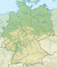 Location of mouth | |
| Location | |
| Country | Germany |
| State | Baden-Württemberg |
| Physical characteristics | |
| Mouth | |
• location | Iller |
• coordinates | 47.9622°N 10.0847°E |
| Length | 39.6 km (24.6 mi) [1] |
| Basin size | 357 km2 (138 sq mi) [1] |
| Basin features | |
| Progression | Iller→ Danube→ Black Sea |
See also
References
- Complete table of the Bavarian Waterbody Register by the Bavarian State Office for the Environment (xls, 10.3 MB)
На других языках
[de] Aitrach (Iller)
Die Aitrach ist der wasserreichste linke Zufluss der Iller im baden-württembergischen Landkreis Ravensburg gegen Ende von deren Mittellauf. Sie mündet nach einem ungefähr nördlichem Lauf von etwa 15 km Länge im Gemeindegebiet von Aitrach. Zusammen mit ihrem längeren Oberlauf kommt sie auf eine Gesamtlänge von etwa 50 km.- [en] Aitrach (Iller)
[ru] Айтрах (река)
Айтрах (нем. Aitrach) — река в Германии, протекает по земле Баден-Вюртемберг, левый приток Иллера.Текст в блоке "Читать" взят с сайта "Википедия" и доступен по лицензии Creative Commons Attribution-ShareAlike; в отдельных случаях могут действовать дополнительные условия.
Другой контент может иметь иную лицензию. Перед использованием материалов сайта WikiSort.org внимательно изучите правила лицензирования конкретных элементов наполнения сайта.
Другой контент может иметь иную лицензию. Перед использованием материалов сайта WikiSort.org внимательно изучите правила лицензирования конкретных элементов наполнения сайта.
2019-2026
WikiSort.org - проект по пересортировке и дополнению контента Википедии
WikiSort.org - проект по пересортировке и дополнению контента Википедии