geo.wikisort.org - River
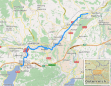
The Ager (German pronunciation: [ˈaːɡɐ] (![]() listen)) is a river in Upper Austria; it is the discharge of the Attersee between Schörfling am Attersee and Seewalchen, and by Lambach it flows into the Traun.
listen)) is a river in Upper Austria; it is the discharge of the Attersee between Schörfling am Attersee and Seewalchen, and by Lambach it flows into the Traun.
| Ager | |
|---|---|
 The Ager (right, coming from the west) flowing into the Traun (middle, coming from the south). | |
 | |
| Location | |
| Country | Austria |
| Physical characteristics | |
| Source | |
| • location | Attersee |
| • coordinates | 47.9489°N 13.5934°E |
| Mouth | |
• location | Traun |
• coordinates | 48°05′16″N 13°51′32″E |
| Length | 33.8 km (21.0 mi) [1] |
| Basin features | |
| Progression | Traun→ Danube→ Black Sea |
The Ager emerged towards the end of the Würm glaciation, when the mighty glaciers began to melt.
Influx into the Ager:
- The Fornacher Redlbach flows into the Ager west of Vöcklamarkt
- The Vöckla flows into the Ager by Vöcklabruck
- The Aurach flows into the Ager by Wankham
Over the Attersee the Ager also receives water from the Mondsee, the Irrsee (also called Zeller See), and the Fuschlsee, that are all connected by relatively short streams.
In the postwar period, the Ager was strongly polluted by various nearby factories. Today this is less the case because several sewage treatment plants have been created.
References
- DORIS Atlas (Upper Austria)
External links
 Media related to Ager at Wikimedia Commons
| Authority control |
|
|---|
This Upper Austria location article is a stub. You can help Wikipedia by expanding it. |
На других языках
[de] Ager
Die Ager ist ein Fluss in Oberösterreich; sie ist der Abfluss des Attersees und mündet nach rund 34 km zwischen Lambach und Stadl-Paura in die Traun. Die Ager entwässert das ganze nordwestliche Salzkammergut. Ihr Einzugsgebiet beträgt rund 1260 km².- [en] Ager (river)
Текст в блоке "Читать" взят с сайта "Википедия" и доступен по лицензии Creative Commons Attribution-ShareAlike; в отдельных случаях могут действовать дополнительные условия.
Другой контент может иметь иную лицензию. Перед использованием материалов сайта WikiSort.org внимательно изучите правила лицензирования конкретных элементов наполнения сайта.
Другой контент может иметь иную лицензию. Перед использованием материалов сайта WikiSort.org внимательно изучите правила лицензирования конкретных элементов наполнения сайта.
2019-2026
WikiSort.org - проект по пересортировке и дополнению контента Википедии
WikiSort.org - проект по пересортировке и дополнению контента Википедии