geo.wikisort.org - River
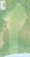
The Agbado River is a river of Benin.[1] It flows through Maxi territory to the north of Abomey.[2] It flows south from its source in northern Collines Department, passes the town of Savalou, and discharges into the Zou River at the Atchérigbé Classified Forest near Setto.[3]
 Ouémé River system with the Zou and the Agbado river (south west) | |
 Location of mouth | |
| Location | |
|---|---|
| Country | Benin |
| Physical characteristics | |
| Mouth | |
• coordinates | 7.565°N 2.129°E |
References
- Rand McNally, The New International Atlas, 1993.
- Herskovits, Melville Jean; Herskovits, Frances Shapiro (1964). An outline of Dahomean religious belief. Kraus. p. 63. Retrieved 30 April 2012.
- Sheet 17: Lagos (Map). 1:2,000,000. Series 2201. Defense Mapping Agency Topographic Center. April 1973.
Текст в блоке "Читать" взят с сайта "Википедия" и доступен по лицензии Creative Commons Attribution-ShareAlike; в отдельных случаях могут действовать дополнительные условия.
Другой контент может иметь иную лицензию. Перед использованием материалов сайта WikiSort.org внимательно изучите правила лицензирования конкретных элементов наполнения сайта.
Другой контент может иметь иную лицензию. Перед использованием материалов сайта WikiSort.org внимательно изучите правила лицензирования конкретных элементов наполнения сайта.
2019-2026
WikiSort.org - проект по пересортировке и дополнению контента Википедии
WikiSort.org - проект по пересортировке и дополнению контента Википедии