geo.wikisort.org - River
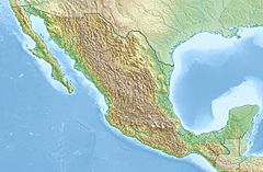
The Acaponeta River originates in the State of Durango, México and drains into the Pacific Ocean.[1]
This article needs additional citations for verification. (January 2021) |
| Acaponeta River | |
|---|---|
 | |
| Location | |
| Country | Mexico |
| State | Durango, Nayarit |
| Physical characteristics | |
| Mouth | |
• location | Pacific Ocean |
• coordinates | 22°22′36″N 105°38′11″W |
| Length | 233 km (145 mi) |
| Basin size | 5,603.9 km2 (2,163.7 sq mi) |
| Discharge | |
| • average | 5,000 L/s (180 cu ft/s) |
The river basin covers 5,399.68 square kilometres (2,084.83 sq mi).[2] From its beginning in Durango to where it crosses into Nayarit, the river is called Quebrada de San Bartolo; farther downstream it's referred to as the Acaponeta.[3]
Crossing the municipalities of Pueblo Nuevo, Durango; and Huajicori and Acaponeta, in Nayarit; it passes by the regions of Mineral de Cucharas, Quiviquinta, Huajicori, Acaponeta, San Felipe Aztatán, Tecuala, Milpas Viejas, El Filo and Quimichis; with its mouth in Estero de Teacapán, in a place called Puerta del Río (River's gate).
The river has a total length of 233 kilometres (145 mi) until Barra del Novillero; in the last 40 kilometres (25 mi), given its gentle slope, it is navagable by canoe, even in the dry seasons.[4]
See also
References
На других языках
- [en] Acaponeta River
[es] Río Acaponeta
El río Acaponeta es un corto río costero de la vertiente del océano Pacífico de México. Tiene una longitud de 233 km (hasta barra del Novillero) y drena una pequeña región de 5.092 km².[1]Другой контент может иметь иную лицензию. Перед использованием материалов сайта WikiSort.org внимательно изучите правила лицензирования конкретных элементов наполнения сайта.
WikiSort.org - проект по пересортировке и дополнению контента Википедии
