geo.wikisort.org - River
The Aar is a river in the administrative district of Bas-Rhin which crosses the municipalities of Strasbourg and Schiltigheim. It is an arm which separates from the Ill at the University bridge to rejoin it at lock no 51 in Schiltigheim. Together the Aar and the Ill form the island of Saint-Hélène.
| Aar | |
|---|---|
 Pont Abraham Deutsch | |
  | |
| Location | |
| Country | France |
| Region | Grand Est |
| Department | Bas-Rhin, Haut-Rhin |
| Physical characteristics | |
| Source | Ill |
| • location | Strasbourg |
| • coordinates | 48°35′07″N 7°45′32″E |
| Mouth | Ill |
• location | Schiltigheim |
• coordinates | 48°36′10″N 7°45′55″E |
| Length | 3 kilometres (1.9 mi) |
| Basin features | |
| River system | Rhine |
Geography
The Aar is 3 kilometres (1.9 mi) long.[1] It separates from the Ill at the southern tip of Île Sainte-Hélène, near St. Paul's Church, Strasbourg, and crosses the Contades and Wacken neighborhoods. It rejoins the Ill at Schiltigheim after having crossed the Marne–Rhine Canal thanks to a dam with several gates.
Environment
There is a walking route, the "two rivers route", and sports equipment along the banks of the river. The river borders the Aar Park, which has allotment gardens and the sports complex.[2] The river flows through a calm, green landscape, and is used by coypus and birds such as kingfishers, herons, cormorants, swans, coots and moorhens. There are old wash-houses along the bank. The river is used for canoeing and kayaking.[3]
Gallery
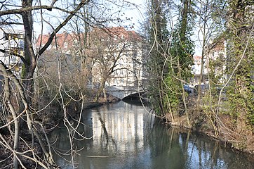 Pont de la Protestation
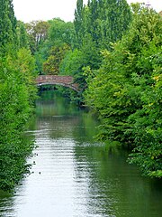 The Aar and the Vosges Bridge in Strasbourg
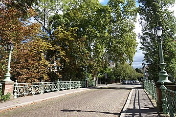 Pont Abraham Deutsch


Notes
Sources
- Cours d'eau - L'Aar, Sandre; Service d'administration nationale des données et référentiels sur l'eau, retrieved 2021-11-20
- Rives de l'Aar (in French), Schiltigheim, retrieved 2021-11-20
- "Strasbourg, Circular Tour of the River Aar", strasbourgeauxvives.org, retrieved 2021-11-20
Другой контент может иметь иную лицензию. Перед использованием материалов сайта WikiSort.org внимательно изучите правила лицензирования конкретных элементов наполнения сайта.
WikiSort.org - проект по пересортировке и дополнению контента Википедии