geo.wikisort.org - River
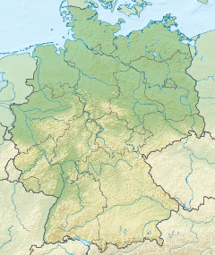
The Aal is a small river in the town of Aalen in Baden-Württemberg, Germany. It originates in the Dürrwiesen near the road bridge of the K 3326 at the western end of the street Gartenstraße through the confluence of the left Rombach and the right Sauerbach, that slightly exceeds the Rombach in length and area of basin. From here, the Aal first flows eastern, later northeastern direction. After 1.6 km, it flows on the left side of the Reichstädter Markt into the Kocher.
This article does not cite any sources. (September 2020) |
| Aal | |
|---|---|
 | |
 Mouth | |
| Location | |
| Country | Germany |
| State | Baden-Württemberg |
| Physical characteristics | |
| Mouth | |
• location | Kocher |
• coordinates | 48.8377°N 10.0906°E |
| Basin features | |
| Progression | Kocher→ Neckar→ Rhine→ North Sea |
For the Ancient Romans, the Aal was the reason to erect the Aalen Castle somewhat north of it, its largest equestrian fort north of the Alps. They extracted up to 30,000 liters of water daily for their approximately 1,000 horses.
At the confluence of Rombach and Sauerbach, the Aal was recultivated for 5 million euros, and on September 10, 2010 the newly constructed Dürrwiesen flood retention basin was inaugurated.
Tributaries
- Rombach, left headwater, 5.8 km from the mouth most distant source, and 12.1 km².
It is considered as the main headwater, the name officially used also for the total course of the Aal.
- Sauerbach right headwaters, 6.5 km from muzzle most distant source and 12.9 km².
- Heuchelbach, from the right near the street Fackelbrückenstraße, 1.5 km and 1.1 km².
See also
На других языках
[de] Aal (Kocher)
Die Aal, auch Aalbach genannt, ist ein kleiner Fluss in der Stadt Aalen in Baden-Württemberg in Deutschland. Er entsteht in den Dürrwiesen nahe bei der Straßenbrücke der K 3326 am Westende der Gartenstraße durch den Zusammenfluss von linkem Rombach und rechtem Sauerbach, welcher den Rombach in Länge wie Teileinzugsgebiet leicht übertrifft. Von hier aus fließt die Aal in östliche, später in nordöstliche Richtung und mündet nach 1,6 km langem Lauf linksseitig beim Reichstädter Markt in den Kocher.[3]- [en] Aal (Kocher)
Другой контент может иметь иную лицензию. Перед использованием материалов сайта WikiSort.org внимательно изучите правила лицензирования конкретных элементов наполнения сайта.
WikiSort.org - проект по пересортировке и дополнению контента Википедии