geo.wikisort.org - Fluss
Der Adobe Creek ist ein 22,9 Kilometer langer Zufluss der San Francisco Bay. Er verläuft durch die Städte Los Altos Hills, Los Altos und Palo Alto. Sein Name leitet sich vom spanischen und englischen Wort Adobe ab, was Lehmziegel bedeutet. Der Adobe Creek ist Namensgeber von Adobe Inc.[2]
| Adobe Creek San Antonio Creek, Yeguas Creek | ||
 Abgebrochener Mammutbaum im Adobe Creek, Los Altos, Kalifornien | ||
| Daten | ||
| Gewässerkennzahl | US: 217989 | |
| Lage | Vereinigte Staaten Kalifornien | |
| Flusssystem | Adobe Creek | |
| Abfluss über | Palo Alto Überschwemmungsbecken → Bucht von San Francisco | |
| Quellgebiet | Black Mountain (nahe Los Altos, Kalifornien) in den Santa Cruz Mountains 37° 19′ 12″ N, 122° 9′ 19″ W | |
| Quellhöhe | 792 m[1] | |
| Mündung | Palo Alto Überschwemmungsbecken in der südwestlichen San Francisco Bay 37° 27′ 10″ N, 122° 5′ 29″ W | |
| Mündungshöhe | 0 m[1] | |
| Höhenunterschied | 792 m | |
| Sohlgefälle | 35 ‰ | |
| Länge | 22,9 km | |
| Linke Nebenflüsse | Middle, West und North Fork Adobe Creek, Moody Creek, Purisima Creek, Robleda Creek, Barron Creek | |
| Mittelstädte | Palo Alto | |
| Kleinstädte | Los Altos Hills, Los Altos | |
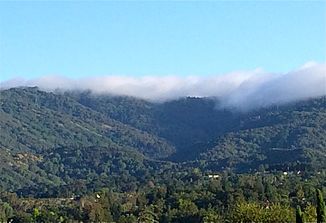
 Nebel auf dem Black Mountain, dem Quellgebiet des Adobe Creeks. | ||
Einzelnachweise
- U.S. Geological Survey. National Hydrography Dataset high-resolution flowline data. The National Map, besucht am 15. März 2011
- Frank Heiniger: Adobe will kräftig wachsen. In: Finanz und Wirtschaft. 31. Juli 2010, abgerufen am 26. Juni 2017.
На других языках
- [de] Adobe Creek (San Francisco Bay)
[en] Adobe Creek (Santa Clara County)
Adobe Creek, historically San Antonio Creek, is a 14.2-mile-long (22.9 km)[5] northward-flowing stream originating on Black Mountain in the Santa Cruz Mountains. It courses through the cities of Los Altos Hills, Los Altos, and Palo Alto on its way to the Palo Alto Flood Basin and thence to southwestern San Francisco Bay in Santa Clara County, California, United States. Historically, Adobe Creek was a perennial stream and hosted runs of steelhead trout entering from the Bay, but these salmonids are now blocked by numerous flood control structures, including a tidal gate at the creek's mouth and a long concretized rectangular channel culminating in an impassable drop structure at El Camino Real. The co-founders of Adobe Systems both lived on Adobe Creek.Текст в блоке "Читать" взят с сайта "Википедия" и доступен по лицензии Creative Commons Attribution-ShareAlike; в отдельных случаях могут действовать дополнительные условия.
Другой контент может иметь иную лицензию. Перед использованием материалов сайта WikiSort.org внимательно изучите правила лицензирования конкретных элементов наполнения сайта.
Другой контент может иметь иную лицензию. Перед использованием материалов сайта WikiSort.org внимательно изучите правила лицензирования конкретных элементов наполнения сайта.
2019-2025
WikiSort.org - проект по пересортировке и дополнению контента Википедии
WikiSort.org - проект по пересортировке и дополнению контента Википедии