geo.wikisort.org - Bacino
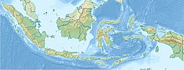
Il lago Matano (in indonesiano: Danau Matano) è un lago naturale dell'Indonesia, nella provincia del Sulawesi Meridionale.
| Lago Matano | |
|---|---|
 | |
| Stato | |
| Provincia | Sulawesi Meridionale |
| Coordinate | 2°29′07″S 121°20′00″E |
| Altitudine | 382 m s.l.m. |
| Dimensioni | |
| Superficie | 164 km² |
| Lunghezza | 28 km |
| Larghezza | 8 km |
| Profondità massima | 590 m |
| Volume | 98 km³ |
| Idrografia | |
| Origine | tettonica |
Con una profondità di 590 metri, è il lago più profondo dell'Indonesia, il 10° più profondo del mondo ed il lago più profondo situato su un'isola (Sulawesi). Si trova ad una quota di 382 m s.l.m., per cui il fondo del lago è 208 metri sotto il livello del mare. La parte inferiore del lago si trova quindi in una criptodepressione.
Il lago ospita molte specie endemiche di fauna acquatica (tra cui gamberetti del genere Caridina, granchi del genere Parathelphusid, gasteropodi del genere Tylomelania) e vari tipi di piante acquatiche.
Per far conoscere ai turisti stranieri la bellezza del lago Matano e dei suoi dintorni, dal maggio 2015 viene organizzato il "Lake Matano Festival", con varie attrazioni e competizioni amatoriali di corsa campestre, ciclismo e nuoto.[1]
Note
- (EN) Lake Matano Festival, su en.tempo.co. URL consultato il 23 agosto 2019.
Altri progetti
 Wikimedia Commons contiene immagini o altri file su Lago Matano
| Controllo di autorità | VIAF (EN) 315169497 |
|---|
На других языках
[de] Matanosee
Der Matanosee (indones. Danau Matano) ist ein großer See im Osten der indonesischen Insel Sulawesi. Er gehört zum Malili-Seen-System und liegt als Grabenbruchsee in einer Kryptodepression tektonischen Ursprungs. Der Seeboden liegt bis zu 203 Meter unter dem Meeresspiegel.[2] Das Alter des Sees wird auf eine bis vier Millionen Jahre geschätzt wurde jedoch nie mit wissenschaftlichen Methoden überprüft. Aufgrund seiner Schichtung gilt der See als Meromiktisches Gewässer.[3] Mit einer Maximaltiefe von über 590 Metern ist er der tiefste See Indonesiens und gehört zu den zehn tiefsten Seen der Erde. Das Wasser des Sees ist extrem nährstoffarm (ultraoligotroph).[1] Der Matanosee ist ein bedeutender Biodiversitäts-Hotspot.[4][en] Lake Matano
Lake Matano (Indonesian: Danau Matano), also known as Matana, is a natural lake in East Luwu Regency, South Sulawesi province, Indonesia. With a depth of 590 m (1,940 ft), it is the deepest lake in Indonesia (ranked by maximum depth), the 10th deepest lake in the world and the deepest lake on an island by maximum depth. The surface elevation from mean sea level is only 382 m (1,253 ft), which means that the deepest portion of the lake is below sea level (cryptodepression). It is one of the two major lakes (the other being Lake Towuti) in the Malili Lake system.[fr] Lac Matano
Le lac Matano (en indonésien Danau Matano) est un lac dans le kabupaten de Luwu oriental, dans la province de Sulawesi du Sud, dans l'île indonésienne de Sulawesi. C'est l'un des cinq lacs du système de lacs de Malili. C'est le plus profond d'Indonésie, et le 8e le plus profond du monde.- [it] Lago Matano
[ru] Матана
Мата́на[1][4][3] (Матано[5]; индон. Matana[4], Danau Matano[6]) — озеро в восточной части индонезийской провинции Южный Сулавеси, на юго-востоке центральной части острова Сулавеси в округе Восточный Луву[en][6][7].Другой контент может иметь иную лицензию. Перед использованием материалов сайта WikiSort.org внимательно изучите правила лицензирования конкретных элементов наполнения сайта.
WikiSort.org - проект по пересортировке и дополнению контента Википедии
