geo.wikisort.org - Réservoir
Le Lough Tay est un petit lac glaciaire du comté de Wicklow en Irlande, situé au sud-ouest de Djouce dans les montagnes de Wicklow.
Cet article est une ébauche concernant l’Irlande et un lac.
Vous pouvez partager vos connaissances en l’améliorant (comment ?) selon les recommandations des projets correspondants.
| Lough Tay | ||
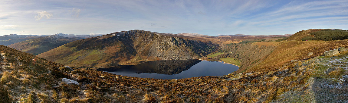 Vue du Lough Tay. | ||
| Administration | ||
|---|---|---|
| Pays | ||
| Province | Leinster | |
| Comté | Wicklow | |
| Géographie | ||
| Coordonnées | 53° 06′ 22″ N, 6° 16′ 00″ O | |
| Type | Lac glaciaire | |
| Hydrographie | ||
| Alimentation | Rivière Cloghoge | |
| Émissaire(s) | Rivière Cloghoge | |
| Géolocalisation sur la carte : Irlande
| ||
| modifier |
||

C'est le lieu de tournage de la série canado-irlandaise Vikings pour le village de Kattegat (bien qu'une partie se fasse en studio)[1].
Notes et références
 Portail de l’Irlande
  Portail des lacs et cours d'eau
На других языках
[en] Lough Tay
Lough Tay (Irish: Loch Té), is a small but scenic lake set on private property in the Wicklow Mountains in Ireland. The lake lies between the mountains of Djouce 725 metres (2,379 ft), and Luggala 595 metres (1,952 ft), and is dominated by Luggala's east-facing granite cliffs.[1] The lough is fed by the Cloghoge River, which then drains into Lough Dan to the south. Lough Tay forms part of the Guinness Estate at Luggala, and has limited public access.[2][3]- [fr] Lough Tay
Текст в блоке "Читать" взят с сайта "Википедия" и доступен по лицензии Creative Commons Attribution-ShareAlike; в отдельных случаях могут действовать дополнительные условия.
Другой контент может иметь иную лицензию. Перед использованием материалов сайта WikiSort.org внимательно изучите правила лицензирования конкретных элементов наполнения сайта.
Другой контент может иметь иную лицензию. Перед использованием материалов сайта WikiSort.org внимательно изучите правила лицензирования конкретных элементов наполнения сайта.
2019-2026
WikiSort.org - проект по пересортировке и дополнению контента Википедии
WikiSort.org - проект по пересортировке и дополнению контента Википедии