geo.wikisort.org - Réservoir
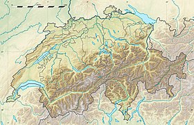
Le lac de Palpuogna est un lac alpin, situé sur le col de l'Albula, dans le canton des Grisons, en Suisse.
| Lac de Palpuogna | |
 Le lac de Palpuogna | |
| Administration | |
|---|---|
| Pays | |
| Canton | |
| Géographie | |
| Coordonnées | 46° 34′ 51″ N, 9° 47′ 07″ E |
| Type | alpin |
| Montagne | Alpes |
| Altitude | 1 918 m |
| Hydrographie | |
| Alimentation | Albula |
| Émissaire(s) | Albula |
| modifier |
|
Géographie
Il donne naissance à la rivière Albula.
Notes et références
- Portail de la géographie de la Suisse
- Portail des Alpes
- Portail des lacs et cours d'eau
- Portail du canton des Grisons
На других языках
[de] Palpuognasee
Der Palpuognasee (rätoromanisch Lai da Palpuogna) liegt in den Albula-Alpen auf 1918 m ü. M. oberhalb von Preda im Schweizer Kanton Graubünden.[en] Lai da Palpuogna
Lai da Palpuogna (Romansh; German: Palpuognasee) is a mountain lake at Albula Pass in the municipality of Bergün, in the Grisons, Switzerland. In a 2007 television program of the Swiss channel SF 1, the lake was voted the most beautiful place in Switzerland.- [fr] Lac de Palpuogna
Текст в блоке "Читать" взят с сайта "Википедия" и доступен по лицензии Creative Commons Attribution-ShareAlike; в отдельных случаях могут действовать дополнительные условия.
Другой контент может иметь иную лицензию. Перед использованием материалов сайта WikiSort.org внимательно изучите правила лицензирования конкретных элементов наполнения сайта.
Другой контент может иметь иную лицензию. Перед использованием материалов сайта WikiSort.org внимательно изучите правила лицензирования конкретных элементов наполнения сайта.
2019-2025
WikiSort.org - проект по пересортировке и дополнению контента Википедии
WikiSort.org - проект по пересортировке и дополнению контента Википедии
