geo.wikisort.org - Réservoir
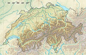
Le lac de Hallwil (en allemand: Hallwilersee) se trouve sur les territoires du canton d'Argovie et du canton de Lucerne en Suisse. Son nom provient de la famille de Hallwyl et du village proche de Hallwil.
Présentation

Il a une superficie moyenne de 10,3 km2 dont 5/6 sur le district de Lenzbourg et le reste sur le district de Hochdorf. Il se trouve à une altitude de 449 mètres et sa profondeur maximale est de 48 mètres. Sa largeur est d'environ 1 500 mètres.
Notes et références
Voir aussi
Articles connexes
- Hydrologie de la Suisse
- Liste des lacs de Suisse
- Liste des lacs de barrage de Suisse
- Liste des lacs de Suisse par canton
- Géographie de la Suisse
Bibliographie
- [PDF] L'état des lacs en Suisse, Office fédéral de l'environnement, des forêts et du paysage, Berne, 1994.
Liens externes
- Article Lac de Hallwil dans le Dictionnaire historique de la Suisse en ligne.
- (de) Webcam
- (fr) Le tour du lac de Hallwil jusqu'au château entouré d'eau
- Portail des lacs et cours d'eau
- Portail de la géographie de la Suisse
- Portail de la Suisse centrale
- Portail de la Suisse du Nord-Ouest
На других языках
[de] Hallwilersee
Der Hallwilersee ist ein See im Schweizer Mittelland und liegt wie der etwas weiter südlich gelegene Baldeggersee im Seetal. Er ist 8,4 Kilometer lang, an der breitesten Stelle 1,5 Kilometer breit und maximal 47 Meter tief bei einer mittleren Tiefe von 28 Metern. Seine Fläche beträgt 10,3 Quadratkilometer, davon liegen fünf Sechstel in den Bezirken Lenzburg und Kulm des Kantons Aargau und ein Sechstel in den Wahlkreisen Hochdorf und Sursee des Kantons Luzern. Nach der Grösse ist er an 16. Stelle der Schweizer Seen. Das Volumen des Sees beträgt 0,215 Kubikkilometer, sein Einzugsgebiet 128 Quadratkilometer. Der Hauptzufluss bzw. -abfluss ist der Aabach, der bei Möriken-Wildegg in die Aare mündet. Daneben münden zahlreiche kleine Bäche in den See.[2][en] Lake Hallwil
Lake Hallwil (German: Hallwilersee) is a lake largely in the Canton of Aargau, Switzerland, located at 47°17′N 8°12′E. It is the largest lake in Aargau and lies mostly in the districts of Lenzburg and Kulm on the southern edge of the canton. The southern tip of the lake reaches into the canton of Lucerne. The main river leading to this lake is the Aabach, which is coming from the Lake Baldegg.- [fr] Lac de Hallwil
[it] Lago di Hallwil
Il lago di Hallwil (in tedesco Hallwilersee) è un lago in Argovia, Svizzera, situato a 47°17′N 8°12′E. La sua superficie è di circa 10,3 km² e la sua profondità massima è di 48 metri. È una nota meta turistica.[ru] Хальвильское озеро
Хальвильское[1][3][4] (Хальвилэр-Зе[5], Хальвил-Зе[6];нем. Hallwilersee, англ. Hallwill или Halwyl, фр. Lac de Hallwil) — горное озеро ледникового происхождения в Швейцарии[2], расположенное на территории кантонов Аргау и Люцерн[1].Текст в блоке "Читать" взят с сайта "Википедия" и доступен по лицензии Creative Commons Attribution-ShareAlike; в отдельных случаях могут действовать дополнительные условия.
Другой контент может иметь иную лицензию. Перед использованием материалов сайта WikiSort.org внимательно изучите правила лицензирования конкретных элементов наполнения сайта.
Другой контент может иметь иную лицензию. Перед использованием материалов сайта WikiSort.org внимательно изучите правила лицензирования конкретных элементов наполнения сайта.
2019-2025
WikiSort.org - проект по пересортировке и дополнению контента Википедии
WikiSort.org - проект по пересортировке и дополнению контента Википедии

