geo.wikisort.org - Réservoir
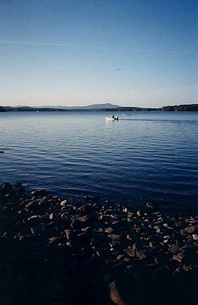
Le lac Umbagog est un lac américain constituant frontière entre les États du New Hampshire (comté de comté de Coös) et du Maine (comté d'Oxford).
Géographie
Il s'étend sur un axe nord-sud sur 18 km et a une superficie de 31,8 km2 Peu profond, sa profondeur maximale est de 14 mètres pour une profondeur moyenne de trois[1]. Son nom en langue Abénaqui signifie d'ailleurs peu profond.
Il est alimenté par les rivières Magalloway, Rapid River et Dead Cambridge River. Il donne naissance à la rivière Androscoggin.
Le lac est inclus dans le refuge faunique national Umbagog. La région présente une faune diversifiée, y compris coyote, dindon sauvage, aigle chauve, balbuzard pêcheur, lynx roux, orignal, lapin, ours, et bien d'autres espèces indigènes.
Notes et références
Annexes
Articles connexes
- La rivière Androscoggin
- La Kennebec
Liens externes
- Portail du New Hampshire
- Portail du Maine
- Portail des lacs et cours d'eau
На других языках
[de] Umbagog Lake
Der Umbagog Lake ist ein 31,8 km² großer See an der Grenze zwischen den US-Bundesstaaten New Hampshire und Maine. Er befindet sich demzufolge im Coös County und im Oxford County. Im See entspringt der 287 km lange Androscoggin River, in den See münden der Magalloway, der Rapid und der Dead Cambridge River. Im See befindet sich eine Reihe von Inseln, nämlich Big Island, Blake Island, Bear, Metallak, Blueberry Island, dann „C“ Island, schließlich Pine, Mosquito, Absalom und Black Island. Auf der New-Hampshire-Seite befindet sich das 300 Einwohner zählende Errol, auf der Maine-Seite Upton,[1] das etwas mehr als 100 Einwohner hat.[en] Umbagog Lake
Umbagog Lake is a wilderness lake located in Coös County, New Hampshire, and Oxford County, Maine. It is one of the most pristine lakes in the state of New Hampshire. It lies in the towns of Errol, New Hampshire, and Upton, Maine, as well as the townships of Cambridge, New Hampshire, and Magalloway Plantation, Maine. The name Umbagog is properly pronounced with the stress on the second syllable (um-BAY-gog) and is said to come from the Abenaki word for "shallow water". Both "Lake Umbagog" and "Umbagog Lake" are commonly used and accepted when referring to the body of water.- [fr] Lac Umbagog
[ru] Амбейгог
Амбейгог[2] (Умбагог[3]; англ. Umbagog Lake, Wambighe) — озеро, расположенное в округах Коос штата Нью-Гэмпшир и Оксфорд штата Мэн[1]. Озеро считается одним из чистейших в Новой Англии.Текст в блоке "Читать" взят с сайта "Википедия" и доступен по лицензии Creative Commons Attribution-ShareAlike; в отдельных случаях могут действовать дополнительные условия.
Другой контент может иметь иную лицензию. Перед использованием материалов сайта WikiSort.org внимательно изучите правила лицензирования конкретных элементов наполнения сайта.
Другой контент может иметь иную лицензию. Перед использованием материалов сайта WikiSort.org внимательно изучите правила лицензирования конкретных элементов наполнения сайта.
2019-2025
WikiSort.org - проект по пересортировке и дополнению контента Википедии
WikiSort.org - проект по пересортировке и дополнению контента Википедии

