geo.wikisort.org - Réservoir
Le lac Tuggerah (en anglais : Tuggerah Lake) est une grande lagune sur la "Central Coast" de la Nouvelle-Galles du Sud à environ 90 km au nord de Sydney. Il est relié à la mer par un chenal, appelé "The Entrance" et à deux autres lacs plus petits : Budgewoi Lake et Munmorah Lake.
| Lac Tuggerah | |||
 plan du lac Tuggrah en Nouvelles-Galles du Sud | |||
| Administration | |||
|---|---|---|---|
| Pays | |||
| Subdivision | Nouvelles-Galles du Sud | ||
| Géographie | |||
| Coordonnées | 33° 19′ 00″ S, 151° 29′ 00″ E | ||
| Type | lagune estuaire | ||
| Superficie | 80,8 km2 |
||
| Altitude | 0 m | ||
| Profondeur · Moyenne |
2,4 m |
||
| Volume | 193 231 m3 | ||
| Hydrographie | |||
| Bassin versant | 714,5 km2 | ||
| Alimentation | Wyong River (en) et Ourimbah Creek (en) | ||
| Géolocalisation sur la carte : Nouvelle-Galles du Sud
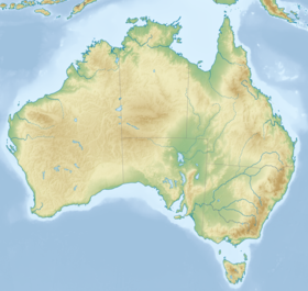
Géolocalisation sur la carte : Australie
| |||
| modifier |
|||
C'est un lac peu profond qui reçoit les eaux de la rivière Wyong. Le Parc national Wyrrabalong, situé entre le lac et la mer, la zone résidentielle de "Toukley" et "The Entrance", abrite la dernière forêt humide du littoral de la "Central Coast". Au bord de la mer sur la péninsule de "Norah Head" se trouve son célèbre phare.
Lien externe
Notes et références
- Portail des lacs et cours d'eau
- Portail de la Nouvelle-Galles du Sud
На других языках
[en] Tuggerah Lake
Tuggerah Lake, an intermittently open intermediate wave dominated barrier estuary[1] that is part of the Tuggerah Lakes, is located within the Central Coast Council local government area in the Central Coast region of New South Wales, Australia. The lake is located near Wyong and is situated about 90 kilometres (56 mi) north of Sydney.- [fr] Lac Tuggerah
Текст в блоке "Читать" взят с сайта "Википедия" и доступен по лицензии Creative Commons Attribution-ShareAlike; в отдельных случаях могут действовать дополнительные условия.
Другой контент может иметь иную лицензию. Перед использованием материалов сайта WikiSort.org внимательно изучите правила лицензирования конкретных элементов наполнения сайта.
Другой контент может иметь иную лицензию. Перед использованием материалов сайта WikiSort.org внимательно изучите правила лицензирования конкретных элементов наполнения сайта.
2019-2025
WikiSort.org - проект по пересортировке и дополнению контента Википедии
WikiSort.org - проект по пересортировке и дополнению контента Википедии

