geo.wikisort.org - Réservoir
Le lac Rupa (en népalais : रुपा ताल) est un lac du Népal situé dans le district de Kaski.
 Portail des lacs et cours d'eau
  Portail du Népal
Cet article est une ébauche concernant un lac et le Népal.
Vous pouvez partager vos connaissances en l’améliorant (comment ?) selon les recommandations des projets correspondants.
| Lac Rupa | ||

| ||
| Administration | ||
|---|---|---|
| Pays | ||
| District | Kaski | |
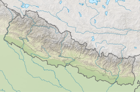
| Coordonnées | 28° 08′ 55″ N, 84° 06′ 40″ E | |
| Géolocalisation sur la carte : Népal
| ||
| modifier |
||
На других языках
[en] Rupa Lake
Rupa Lake or Rupa Tal is a freshwater lake in Nepal located in the border of Pokhara Metropolitan and Rupa Rural Municipality of Kaski District.[1] It is the third biggest lake in Pokhara valley of Nepal and at an altitude of 600 m (1,969 ft) covering area about 1.35 km2 (0.5 sq mi)[2] with an average water depth 3 m and maximum depth 6 m.[3] The lake is elongated north to south and is fed by perennial streams. Its watershed area is 30 km2,[4] where The main inflow of water is from Talbesi stream, whereas Dhovan khola is the feeder stream with its outlet Tal khola at Sistani ghat.[5] It supports a number of floral and faunal species. A total of 36 species of waterbirds have been recorded in the lake which represents about 19 percent of the total 193 wetland-dependent birds found in Nepal.[6]- [fr] Lac Rupa
[ru] Рупа (озеро)
Рупа (непальск. रुपा ताल) — озеро в центральной части Непала. В административном отношении расположено в муниципалитете Лехнатх района Каски зоны Гандаки[1].Текст в блоке "Читать" взят с сайта "Википедия" и доступен по лицензии Creative Commons Attribution-ShareAlike; в отдельных случаях могут действовать дополнительные условия.
Другой контент может иметь иную лицензию. Перед использованием материалов сайта WikiSort.org внимательно изучите правила лицензирования конкретных элементов наполнения сайта.
Другой контент может иметь иную лицензию. Перед использованием материалов сайта WikiSort.org внимательно изучите правила лицензирования конкретных элементов наполнения сайта.
2019-2026
WikiSort.org - проект по пересортировке и дополнению контента Википедии
WikiSort.org - проект по пересортировке и дополнению контента Википедии