geo.wikisort.org - Réservoir
Le lac Profile est un plan d'eau de 13 acres (53,000 m²), situé à Franconia Notch dans les montagnes Blanches, au pied du mont Cannon (en).
| Lac Profile | |||
 Vue du lac Profile regardant vers le sud et Franconia Notch. | |||
| Administration | |||
|---|---|---|---|
| Pays | |||
| Subdivision | |||
| Géographie | |||
| Coordonnées | 44° 09′ 49″ N, 71° 40′ 41″ O | ||
| Superficie | 5,3 ha |
||
| Hydrographie | |||
| Émissaire(s) | Pemigewasset River | ||
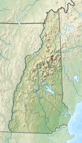
| Géolocalisation sur la carte : New Hampshire
Géolocalisation sur la carte : États-Unis
| |||
| modifier |
|||

Géographie
Le lac a été ainsi nommé à cause de son emplacement directement sous le vieil homme de la montagne, une formation rocheuse célèbre qui s'est effondré en 2003. Le lac se trouve à proximité de la ligne de crête dans le Parc d'État de Franconia Notch. La décharge du lac est la rivière Pemigewasset, qui coule vers le sud jusqu'àu fleuve Merrimack et finalement le golfe du Maine (océan Atlantique) à Newburyport, Massachusetts.
Articles connexes
- Merrimack (fleuve)
- Old Man of the Mountain
 Portail du New Hampshire
  Portail des lacs et cours d'eau
На других языках
[en] Profile Lake
Profile Lake is a 13-acre (53,000 m2) water body located in Franconia Notch in the White Mountains of New Hampshire, at the foot of Cannon Mountain.[1] The lake was given its name due to its location directly beneath the Old Man of the Mountain, a famous rock formation which collapsed in 2003. The lake is near the height of land in Franconia Notch; the lake's outlet is the Pemigewasset River, which flows south to the Merrimack River and ultimately the Gulf of Maine (Atlantic Ocean) at Newburyport, Massachusetts.- [fr] Lac Profile
Текст в блоке "Читать" взят с сайта "Википедия" и доступен по лицензии Creative Commons Attribution-ShareAlike; в отдельных случаях могут действовать дополнительные условия.
Другой контент может иметь иную лицензию. Перед использованием материалов сайта WikiSort.org внимательно изучите правила лицензирования конкретных элементов наполнения сайта.
Другой контент может иметь иную лицензию. Перед использованием материалов сайта WikiSort.org внимательно изучите правила лицензирования конкретных элементов наполнения сайта.
2019-2026
WikiSort.org - проект по пересортировке и дополнению контента Википедии
WikiSort.org - проект по пересортировке и дополнению контента Википедии