geo.wikisort.org - Réservoir
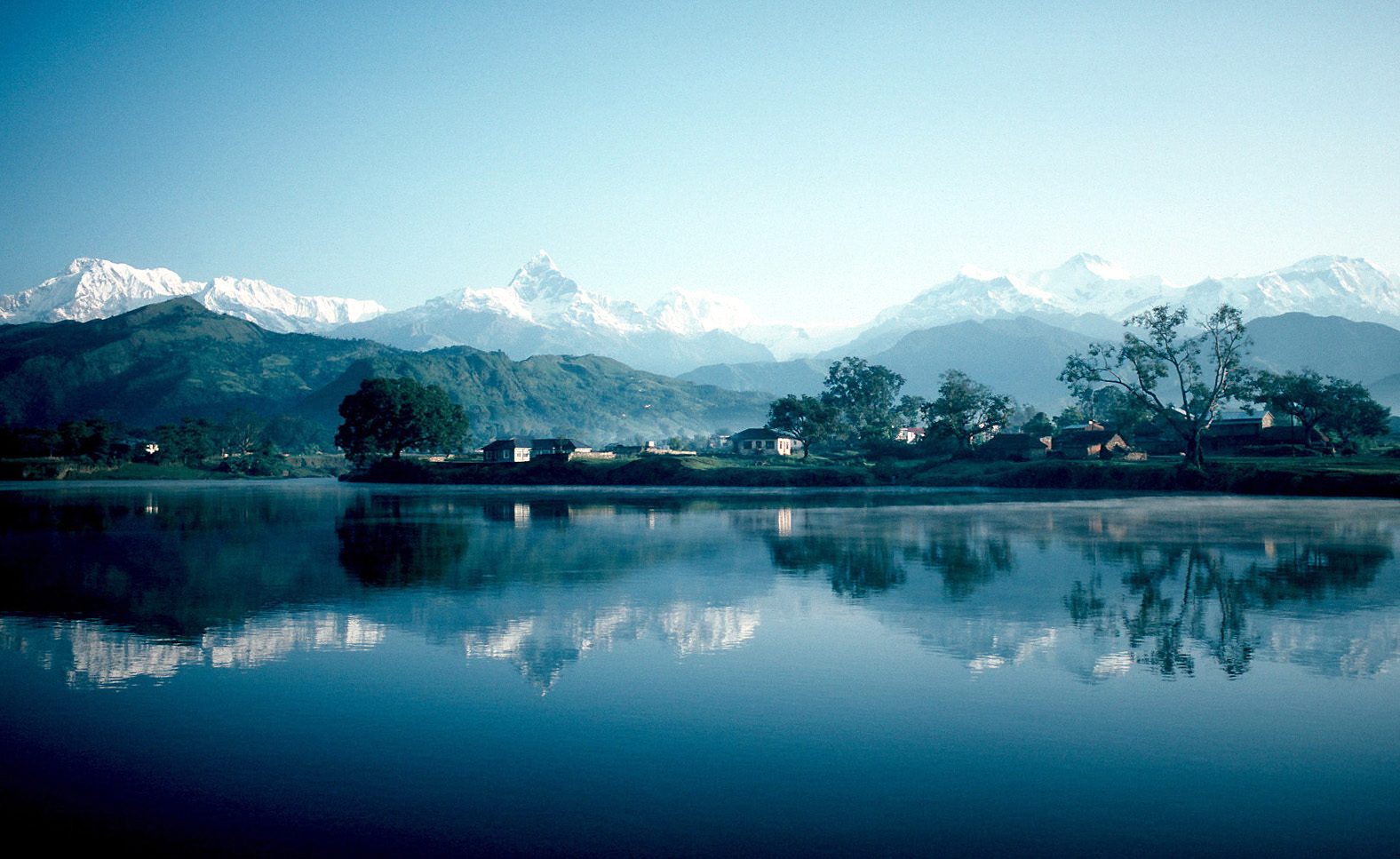
Le lac Phéwa, aussi connu sous les noms de Phéwa Tal ou lac Féwa, est un lac népalais situé à Pokhara et Sarankot. C’est le second plus grand lac du Népal. Son altitude est de 915 m, sa superficie est d’environ 4,43 km2 avec une profondeur moyenne d’environ 8,6 m et de 19 m au maximum[1].
Cet article est une ébauche concernant le Népal et un lac.
Vous pouvez partager vos connaissances en l’améliorant (comment ?) selon les recommandations des projets correspondants.
| Lac Phéwa | ||
| ||
| Administration | ||
|---|---|---|
| Pays | ||
| District | District de Kaski (Pokhara) | |
| Géographie | ||
| Coordonnées | 28° 13′ 00″ N, 83° 57′ 00″ E | |
| Superficie | 4,43 km2 |
|
| Longueur | 4,6 km | |
| Altitude | 915 m | |
| Profondeur · Maximale · Moyenne |
19 m 8,6 m |
|
| Volume | 46 millions de m3 | |
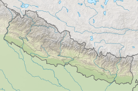
| Géolocalisation sur la carte : Népal
| ||
| modifier |
||
Images
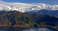


 Le Lac Phéwa pendant le coucher du soleil
 Même lac, même soleil, même barque, même moment.


Notes et références
- (en) « www.phewalake.org.np »(Archive.org • Wikiwix • Archive.is • Google • Que faire ?) (consulté le )
 Portail des lacs et cours d'eau
  Portail du Népal
На других языках
[de] Phewa-See
Der Phewa-See ( Nepali .mw-parser-output .Deva{font-size:120%}@media all and (min-width:800px){.mw-parser-output .Deva{font-size:calc(120% - ((100vw - 800px)/80))}}@media all and (min-width:1000px){.mw-parser-output .Deva{font-size:100%}}फेवा ताल ) ist ein Süßwassersee im Distrikt Kaski in Nepal. Er ist der zweitgrößte See des Landes.[2][en] Phewa Lake
Phewa Lake, Phewa Tal or Fewa Lake (Nepali: फेवा ताल, [ˈpʰewa tal]) is a freshwater lake in Nepal formerly called Baidam Tal located in the south of the Pokhara Valley that includes Pokhara city; parts of Sarangkot and Kaskikot. The lake is stream-fed but a dam regulates the water reserves, therefore, the lake is classified as semi-natural freshwater lake.[1] It is the second largest lake in Nepal; the largest in Gandaki Province after the Rara lake in the comparison to Nepal's water bodies.[2] It is the most popular and most visited lake of Nepal. Phewa lake is located at an altitude of 742 m (2,434 ft) and covers an area of about 4.43 km2 (1.7 sq mi).[3] It has an average depth of about 8.6 m (28 ft) and a maximum depth of 24 m (79 ft).[4] Maximum water capacity of the lake is approximately 43,000,000 cubic metres (35,000 acre⋅ft).[5] The Annapurna range on the north is only about 28 km (linear distance) away[6] from the lake. The lake is also famous for the reflection of mount Machhapuchhre and other mountain peaks of the Annapurna and Dhaulagiri ranges on its surface.[7] The Tal Barahi Temple is situated on an island in the lake.[8] It is located 4 km from the city's centre Chipledhunga.[es] Phewa
El lago Phewa es el segundo lago más largo de Nepal, situado en el distrito de Kaski, en el valle de Pokhara. Junto a él se encuentra la ciudad de Pokhara. En una isla del lago se encuentra la pagoda de Barahi. Debido a la gran afluencia de turistas el lago se encuentra bastante contaminado.- [fr] Lac Phewa
[it] Lago Phewa
Il Lago Phewa, Phewa Tal o Lago Fewa è un lago d'acqua dolce in Nepal situato nella zona sud della valle di Pokhara che include città di Pokhara; parti di Sarangkot e Kaskikot. Il lago è alimentato, ma una diga regola la riserva d'acqua, di conseguenza, il lago è classificato come lago d'acqua dolce semi-naturale.[1] È il secondo lago più grande del Nepal, il più grande della zona di Gaṇḍakī seguito dal Lago Begnas.[2] Il lago Phewa è a un'altezza di 742 m e copre un'area di circa 5.23 km2.[3] Ha una profondità media di circa 8,6 m ed una profondità massima di 24 m.[4] La massima capacità del lago è approssimativamente di 43 milioni di metri cubi.[5] L'Annapurna a nord è solo a circa 28 km (in linea d'aria) di distanza [6] dal lago. Il lago è famoso anche per la riflessione del Monte Machhapuchhre e altre cime dell'Annapurna e del Dhaulagiri sulla sua superficie .[7] Il tempio Taal Barahi è situato in un'isola del lago.[8][ru] Пхева (озеро)
Пхева или Фева — второе по величине озеро в Непале, расположенное в долине Покхара рядом с городом Покхара и горой Сарангкот. Озеро находится на высоте 784 м над уровнем моря. Площадь озера составляет примерно 4,43 км². Средняя глубина — 8,6 м, максимальная глубина — 22,8 м. Максимальный объём воды в озере — 46000000 м³.Текст в блоке "Читать" взят с сайта "Википедия" и доступен по лицензии Creative Commons Attribution-ShareAlike; в отдельных случаях могут действовать дополнительные условия.
Другой контент может иметь иную лицензию. Перед использованием материалов сайта WikiSort.org внимательно изучите правила лицензирования конкретных элементов наполнения сайта.
Другой контент может иметь иную лицензию. Перед использованием материалов сайта WikiSort.org внимательно изучите правила лицензирования конкретных элементов наполнения сайта.
2019-2026
WikiSort.org - проект по пересортировке и дополнению контента Википедии
WikiSort.org - проект по пересортировке и дополнению контента Википедии