geo.wikisort.org - Réservoir
Le lac Pend Oreille (Lake Pend Oreille) est un lac de l'Idaho Panhandle, dans l'Idaho aux États-Unis.

Cet article est une ébauche concernant un lac.
Vous pouvez partager vos connaissances en l’améliorant (comment ?) selon les recommandations des projets correspondants.
| Lac Pend Oreille | ||
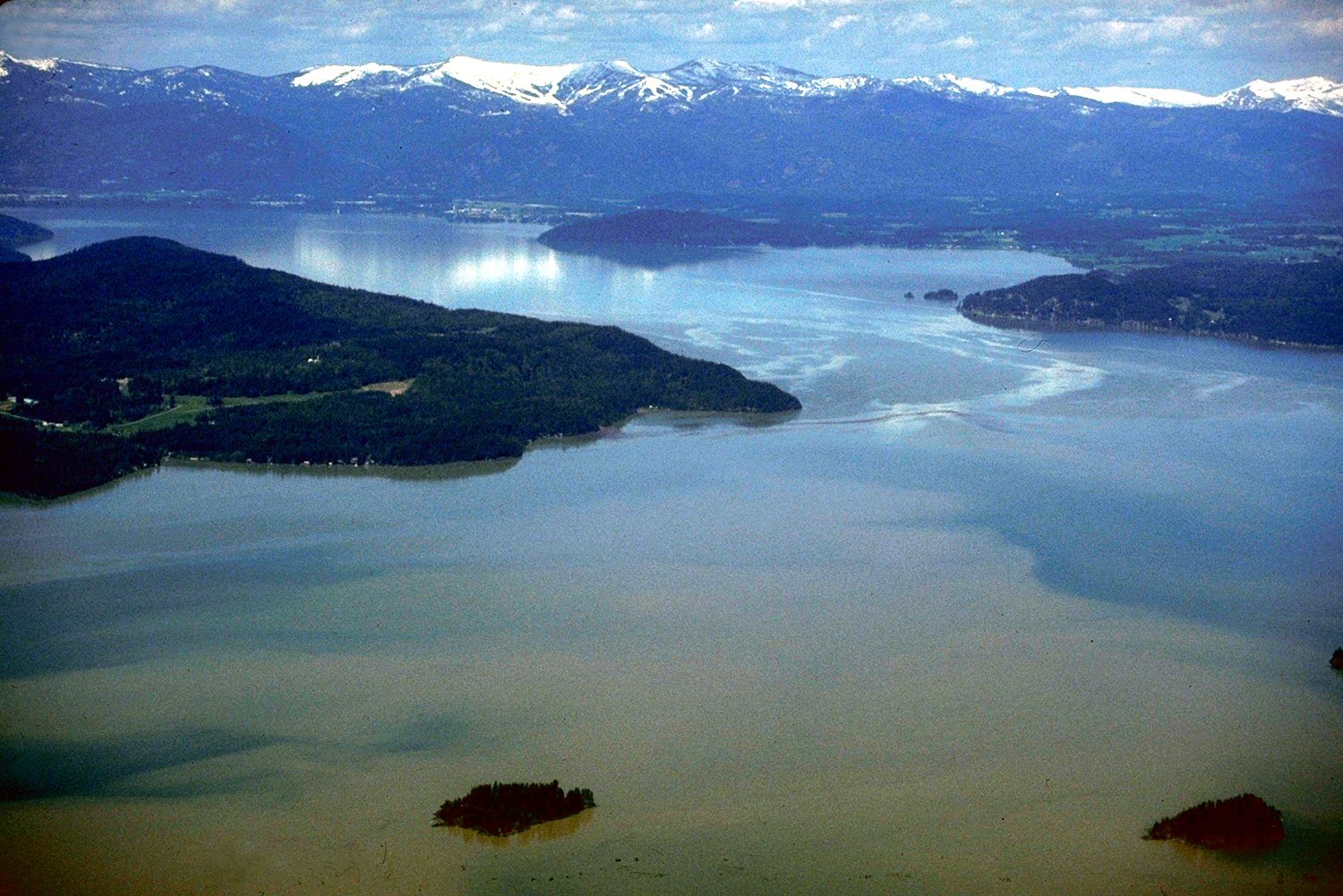 Lac Pend Oreille. | ||
| Administration | ||
|---|---|---|
| Pays | États-Unis | |
| Subdivision | Idaho | |
| Géographie | ||
| Coordonnées | 48° 10′ 00″ N, 116° 20′ 00″ O | |
| Superficie | 383 km2 |
|
| Longueur | 105 km | |
| Altitude | 630 m | |
| Profondeur | 351 m |
|
| Hydrographie | ||
| Alimentation | Clark Fork, Pack, rivière des Prêtres | |
| Émissaire(s) | Pend Oreille | |
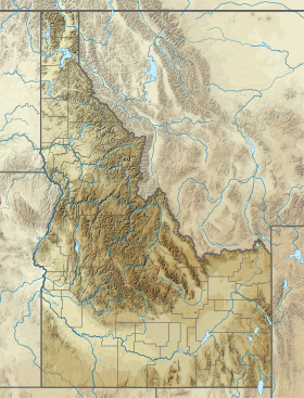
| Géolocalisation sur la carte : Idaho
| ||
| modifier |
||
Alimenté par la Clark Fork et la Pack, il donne naissance à la Pend Oreille.
Voir aussi
Articles connexes
Liens externes
- Ressource relative à la géographie :
 Portail des lacs et cours d'eau
  Portail de l’Idaho
На других языках
[de] Lake Pend Oreille
Der Lake Pend Oreille ist ein See im Norden des Idaho Panhandle. Er hat eine Länge von 105 km und eine Wasserfläche von 383 km².[en] Lake Pend Oreille
Lake Pend Oreille (/ˌpɒndəˈreɪ/ POND-ə-RAY)[2] in the northern Idaho Panhandle is the largest lake in the U.S. state of Idaho and the 38th-largest lake by area in the United States, with a surface area of 148 square miles (380 km2). It is 43 miles (69 km) long, and 1,150 feet (350 m) deep in some regions, making it the fifth-deepest in the nation and having a volume of 43,939,940 acre feet = 54 km3. The lake is fed by the Clark Fork River and the Pack River, and drains into the Pend Oreille River, as well as subsurfacely into the Spokane Valley–Rathdrum Prairie Aquifer.[1] It is surrounded by national forests and a few small towns, with the largest population on the lake at Sandpoint. The majority of the shoreline is non-populated and all but the southern tip of the lake is in Bonner County. The southern tip is in Kootenai County and is home to Farragut State Park, formerly the Farragut Naval Training Station during World War II, of which a small part is still active and conducts U.S. Navy acoustic underwater submarine research.[3][4]- [fr] Lac Pend Oreille
[it] Lago Pend Oreille
Il Pend d'Oreille è un lago degli Stati Uniti d'America di origine glaciale che si trova nell'Idaho, nella zona nota come Idaho Panhandle. Il lago ricopre una superficie di circa 380 chilometri quadrati per una lunghezza di circa 100 chilometri, fra gli affluenti si ricorda il fiume Clark Fork. Sulle rive si trovano vari centri abitati, tra cui la cittadina di Sandpoint.[ru] Панд-Орей (озеро)
Панд-Орей[1] (Пенд-Ореил[2], англ. Pend Oreille) — озеро в США, расположенное на севере штата Айдахо, в так называемом Айдахском выступе. Площадь поверхности составляет 383 км². Длина озера — 105 км. Глубина достигает местами 350 м, что делает его пятым по глубине озером в США. Озеро подпитывается реками Кларк-Форк и Пак и является истоком реки Панд-Орей. Оно окружено национальными лесами; в окрестностях расположено несколько небольших городов, среди них самый крупный — Сэндпойнт[en] (Sandpoint).Текст в блоке "Читать" взят с сайта "Википедия" и доступен по лицензии Creative Commons Attribution-ShareAlike; в отдельных случаях могут действовать дополнительные условия.
Другой контент может иметь иную лицензию. Перед использованием материалов сайта WikiSort.org внимательно изучите правила лицензирования конкретных элементов наполнения сайта.
Другой контент может иметь иную лицензию. Перед использованием материалов сайта WikiSort.org внимательно изучите правила лицензирования конкретных элементов наполнения сайта.
2019-2026
WikiSort.org - проект по пересортировке и дополнению контента Википедии
WikiSort.org - проект по пересортировке и дополнению контента Википедии