geo.wikisort.org - Réservoir
Le lac Monger (en anglais : Lake Monger et en nyungar : Keiermulu) est une zone humide d'Australie-Occidentale, au nord-ouest de Perth.
 Portail des lacs et cours d'eau
  Portail de Perth
Cet article est une ébauche concernant un lac.
Vous pouvez partager vos connaissances en l’améliorant (comment ?) selon les recommandations des projets correspondants.
| Lac Monger | ||||
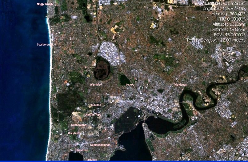 Le lac Monger (croix) vu sur une photographie satellite. | ||||
| Administration | ||||
|---|---|---|---|---|
| Pays | ||||
| État | Australie-Occidentale | |||
| Géographie | ||||
| Coordonnées | 31° 55′ 46″ S, 115° 49′ 35″ E | |||
| Superficie | 70 ha |
|||
| Altitude | 11 m | |||
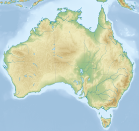
| Géolocalisation sur la carte : Australie
Géolocalisation sur la carte : Australie-Occidentale
Géolocalisation sur la carte : Perth
| ||||
| modifier |
||||


На других языках
[en] Lake Monger
Lake Monger (Nyungar: Keiermulu[1]) is a large urban wetland on the Swan Coastal Plain in suburban Perth, Western Australia nestled between the suburbs of Leederville, Wembley and Glendalough.- [fr] Lac Monger
Текст в блоке "Читать" взят с сайта "Википедия" и доступен по лицензии Creative Commons Attribution-ShareAlike; в отдельных случаях могут действовать дополнительные условия.
Другой контент может иметь иную лицензию. Перед использованием материалов сайта WikiSort.org внимательно изучите правила лицензирования конкретных элементов наполнения сайта.
Другой контент может иметь иную лицензию. Перед использованием материалов сайта WikiSort.org внимательно изучите правила лицензирования конкретных элементов наполнения сайта.
2019-2025
WikiSort.org - проект по пересортировке и дополнению контента Википедии
WikiSort.org - проект по пересортировке и дополнению контента Википедии