geo.wikisort.org - Réservoir
Le barrage de Bonneville est un barrage sur le fleuve Columbia, entre les États américains de l'Oregon et de Washington.
Cet article est une ébauche concernant l’eau, l’État de Washington et l’Oregon.
Vous pouvez partager vos connaissances en l’améliorant (comment ?) selon les recommandations des projets correspondants.
Barrage de Bonneville

| Localisation | |
|---|---|
| Coordonnées |
45° 38′ 32″ N, 121° 56′ 41″ O |
| Cours d'eau |
Columbia |
| Vocation |
Énergie et irrigation |
|---|---|
| Date de mise en service |
1937 (Première centrale hydroélectrique) 1981 (Seconde centrale hydroélectrique) |
| Classement |
National Historic Landmark |
| Type |
Barrage poids |
|---|---|
| Hauteur (lit de rivière) |
60 m |
| Longueur |
820 m |
| Nom |
|---|
| Nombre de turbines |
20 |
|---|---|
| Puissance installée |
1 189 MW MW |
Localisation sur la carte de l’État de Washington
 |
Localisation sur la carte de l’Oregon
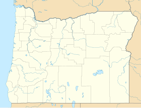 |
Localisation sur la carte des États-Unis
 |
Galerie d'images
 Générateurs dans la seconde centrale hydroélectrique
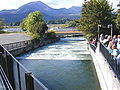 Échelle à poisson au barrage de Bonneville
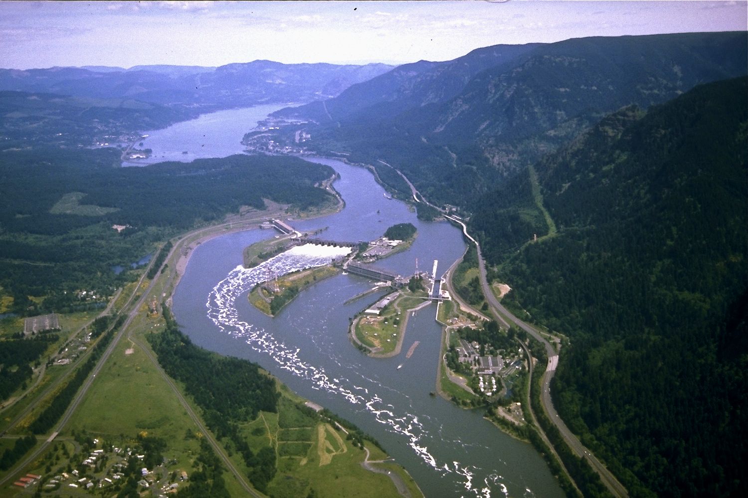
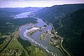 Vue aérienne du barrage de Bonneville et du Lac de Bonneville


Voir aussi
Articles connexes
Liens externes
- Ressources relatives à l'architecture :
 Portail de l’État de Washington
  Portail de l’Oregon
  Portail des énergies renouvelables
  Portail des lacs et cours d'eau
  Portail sur les barrages
На других языках
[de] Bonneville Dam
Der Bonneville Dam ist eine Staumauer mit großer Schleusenanlage, die den Columbia River aufstaut. Da der Fluss die Grenze zwischen den US-Bundesstaaten Oregon und Washington bildet, gehört das Bauwerk zu beiden Bundesstaaten. Es befindet sich etwa 60 km östlich von Portland, die nächstgelegene Stadt ist Hood River in 30 km Entfernung im Osten. Der Komplex wurde vom United States Army Corps of Engineers gebaut und wird von diesem unterhalten. In der Nähe der Staumauer liegt der John B. Yeon State Scenic Corridor.[en] Bonneville Dam
Bonneville Lock and Dam /ˈbɒnəvɪl/ consists of several run-of-the-river dam structures that together complete a span of the Columbia River between the U.S. states of Oregon and Washington at River Mile 146.1.[6] The dam is located 40 miles (64 km) east of Portland, Oregon, in the Columbia River Gorge. The primary functions of Bonneville Lock and Dam are electrical power generation and river navigation. The dam was built and is managed by the United States Army Corps of Engineers. At the time of its construction in the 1930s it was the largest water impoundment project of its type in the nation, able to withstand flooding on an unprecedented scale.[7] Electrical power generated at Bonneville is distributed by the Bonneville Power Administration. Bonneville Lock and Dam is named for Army Capt. Benjamin Bonneville, an early explorer credited with charting much of the Oregon Trail. The Bonneville Dam Historic District was designated a National Historic Landmark District in 1987.[5]- [fr] Barrage de Bonneville
Текст в блоке "Читать" взят с сайта "Википедия" и доступен по лицензии Creative Commons Attribution-ShareAlike; в отдельных случаях могут действовать дополнительные условия.
Другой контент может иметь иную лицензию. Перед использованием материалов сайта WikiSort.org внимательно изучите правила лицензирования конкретных элементов наполнения сайта.
Другой контент может иметь иную лицензию. Перед использованием материалов сайта WikiSort.org внимательно изучите правила лицензирования конкретных элементов наполнения сайта.
2019-2025
WikiSort.org - проект по пересортировке и дополнению контента Википедии
WikiSort.org - проект по пересортировке и дополнению контента Википедии