geo.wikisort.org - Réservoir
Le Totensee (en allemand : Totensee) est un lac situé au col du Grimsel en Suisse.
| Totensee | ||

| ||
| Administration | ||
|---|---|---|
| Pays | ||
| Canton | ||
| Géographie | ||
| Coordonnées | 46° 33′ 39,3″ N, 8° 20′ 24,9″ E | |
| Type | lac de retenue | |
| Superficie | 18 ha |
|
| Altitude | 2 160 m | |
| Profondeur | 34 m |
|
| Volume | 2,5 millions de m3 | |
| Hydrographie | ||
| Émissaire(s) | vers le Grimselsee | |
| Géolocalisation sur la carte : Suisse
| ||
| modifier |
||

Géographie
Le Totensee, d'une superficie de 18 ha, est situé au col du Grimsel, sur la ligne de partage des eaux entre le Rhin et le Rhône. Le col du Grimsel marque la frontière entre les cantons de Berne et du Valais.
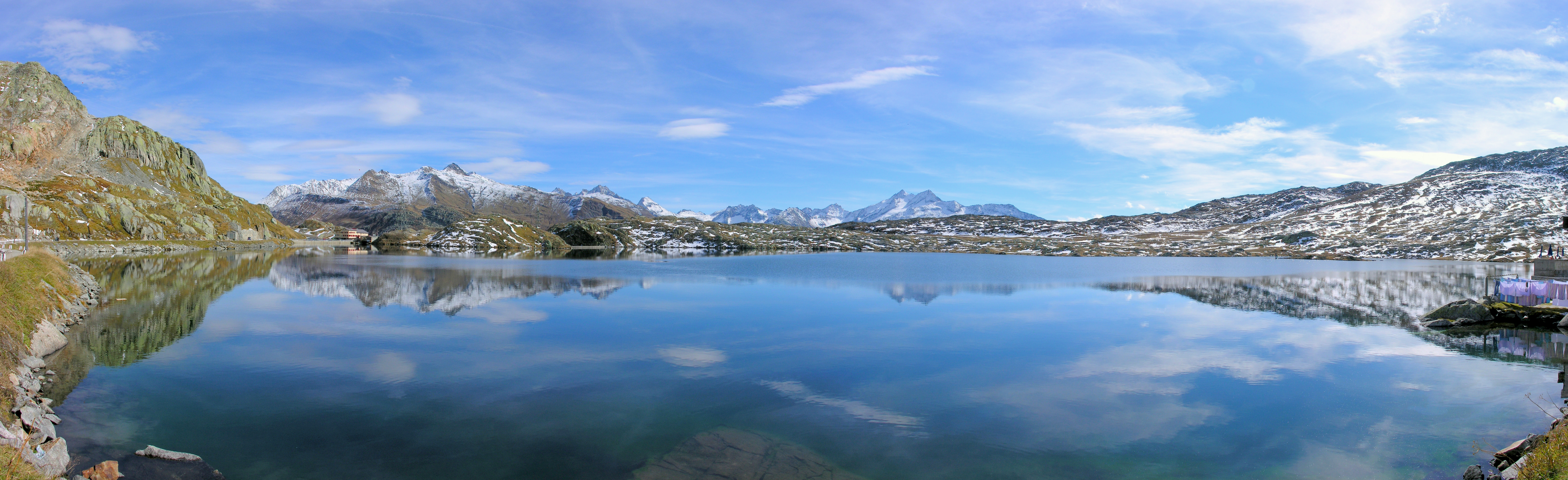
Son émissaire évacue les eaux vers le Grimselsee, sur le bassin hydrographique de l'Aar, donc du Rhin.
Étymologie et histoire
Le nom du lac fait référence à la mort, töten signifiant tuer en allemand. En effet, en 1211 après la bataille d'Ulrichen 800 soldats de l'armée du duc Berthold V de Zähringen poursuivis par les Valaisans victorieux et tentant de se regrouper auprès du col du Grimsel furent rattrapés, à nouveau battus et se noyèrent dans le lac.
Sources
- (de) Cet article est partiellement ou en totalité issu de l’article de Wikipédia en allemand intitulé « Totensee » (voir la liste des auteurs).
Notes et références
 Portail des lacs et cours d'eau
  Portail de la géographie de la Suisse
  Portail des Alpes
  Portail du Valais
На других языках
[de] Totesee
Der Totesee (Bezeichnung auf der Landeskarte der Schweiz), häufiger Totensee, ist ein 0,27 km² grosser[1] Stausee im Kanton Wallis am Grimselpass an der Grenze zum Kanton Bern. Der See liegt auf 2160 m ü. M. direkt an der Wasserscheide zwischen Nordsee und Mittelmeer. Er hat bei einer maximalen Tiefe von 34 m einen Inhalt von rund 2,6 Mio. m³.[en] Totesee
Totesee (Germanized: Totensee) is a small natural lake (18 ha or 44 acres) at the Grimsel Pass in Switzerland. The lake lies immediately to the south of the natural watershed and cantonal boundary at the pass. It is therefore in the canton of Valais, and it would naturally drain into the river Rhône in the valley below. However a dam has been constructed to enable its use as a reservoir, increasing its size and raising its level by 16 metres (52 ft). As part of this work, an aqueduct supplies water to the Grimselsee, which drains into the river Aare and thus forms part of the Rhine catchment.[1][2]- [fr] Totensee
Текст в блоке "Читать" взят с сайта "Википедия" и доступен по лицензии Creative Commons Attribution-ShareAlike; в отдельных случаях могут действовать дополнительные условия.
Другой контент может иметь иную лицензию. Перед использованием материалов сайта WikiSort.org внимательно изучите правила лицензирования конкретных элементов наполнения сайта.
Другой контент может иметь иную лицензию. Перед использованием материалов сайта WikiSort.org внимательно изучите правила лицензирования конкретных элементов наполнения сайта.
2019-2026
WikiSort.org - проект по пересортировке и дополнению контента Википедии
WikiSort.org - проект по пересортировке и дополнению контента Википедии