geo.wikisort.org - Réservoir
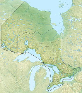
Le lac Wabatongushi est une étendue d'eau située dans le nord de l'Ontario au Canada.
| Lac Wabatongushi | |

| |
| Administration | |
|---|---|
| Pays | |
| Province | Ontario |
| Géographie | |
| Coordonnées | 48° 26′ N, 84° 12′ O |
| Type | Naturel |
| Altitude | 351 m |
| Hydrographie | |
| Émissaire(s) | Rivière Lochalsh |
| modifier |
|
Géographie
C'est un lac tout en longueur qui mesure 27 kilomètres de long. Il forme deux parties en raison d'un rétrécissement au milieu qui pourrait presque constituer deux lacs séparés.
La rivière Lochalsh alimente ce lac qui se déverse à son tour vers la rivière Michipicoten qui lui sert d'émissaire jusqu'au Grands Lacs.
Le lac Wabatongushi est entièrement situé à l'intérieur de la Réserve de chasse de la Couronne de Chapleau.
Notes et références
- Portail de l’Ontario
- Portail des lacs et cours d'eau
На других языках
[en] Wabatongushi Lake
Wabatongushi Lake is a lake in Northern Ontario, Canada, fully within the Chapleau Crown Game Preserve. The lake is highly diversified in its topography. The north end of Wabatongushi is shallow with many low, swampy areas. This is perfect habitat for northern pike and hungry moose. The south half of the lake is much deeper, with a maximum depth of 175' located right off of Loch Island Lodge. This set up is ideal for large game fish such as walleye and northern pike. The shoreline on the south end is much higher, with exposed Pre-Cambrian shield plummeting straight into the tea-stained water. Large schools of bait fish congregate off of these shorelines which attract the game fish. Fishing is excellent in these locations on the south end near Loch Island Lodge. Wabatongushi is the top lake in a chain that stretches almost 100 miles, eventually draining into lake Superior. It sits on the crest of the northern watershed. Wabatongushi Lake was a traditional transportation route from Hudson Bay to Lake Superior for both First Nations and Voyageurs. Wabatongushi in the Ojibwa language approximately means "White Sand Lake".- [fr] Lac Wabatongushi
Текст в блоке "Читать" взят с сайта "Википедия" и доступен по лицензии Creative Commons Attribution-ShareAlike; в отдельных случаях могут действовать дополнительные условия.
Другой контент может иметь иную лицензию. Перед использованием материалов сайта WikiSort.org внимательно изучите правила лицензирования конкретных элементов наполнения сайта.
Другой контент может иметь иную лицензию. Перед использованием материалов сайта WikiSort.org внимательно изучите правила лицензирования конкретных элементов наполнения сайта.
2019-2025
WikiSort.org - проект по пересортировке и дополнению контента Википедии
WikiSort.org - проект по пересортировке и дополнению контента Википедии


