geo.wikisort.org - Réservoir
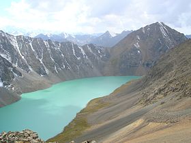
L'Ala Kul parfois transcrit Ala Köl est un lac situé au Kirghizistan.
| Ala Kul | ||

| ||
| Administration | ||
|---|---|---|
| Pays | ||
| Subdivision | Issyk-Koul | |
| Géographie | ||
| Coordonnées | 42° 19′ 03″ N, 78° 32′ 08″ E | |
| Type | Lac glaciaire | |
| Montagne | Terskey Alatau (en) | |
| Superficie | 9,46 km2 |
|
| Longueur | 2,3 km | |
| Largeur | 700 m | |
| Altitude | 3 560 m | |
| Hydrographie | ||
| Bassin versant | 9,46 km2 | |
| Géolocalisation sur la carte : Kirghizistan
| ||
| modifier |
||
Histoire
Guillaume de Rubrouck, le voyageur du Moyen-Âge, semble avoir vu le lac lors de son voyage d'allée jusqu'au Karakorum, mais il pense toujours qu'il s'agit d'une mer intérieure, la partie orientale du Lac Balkhach. Il donne une description de l'aire, et du "vent presque continu qui vient par cette vallée [qui] est si fort qu'on ne la traverse pas [la mer] qu'à grand peril, au risque d'être précipité dans la mer. [1]
Putimtsoff, un voyageur russe, semble croire être le premier occidental à atteindre le lac, en 1811. Sa description mentionne des rochers de différentes couleurs et des vents furieux. Trente ans plus tard, Alexander Schrenk explore le lac et ses environs[2].
Littéralement, le nom Ala-Köl peut signifier « lac panaché », mais il tire probablement son nom des monts Alataou qui s'élèvent plus au nord[3].
Références
- Rubruquis, G. (1255), Voyage dans l'Empire Mongol, p. 188, Petit Biblio Payot Voyageurs
- Bretschneider, E. (1910), Mediæval researches from eastern Asiatic sources: Fragments towards the knowledge of the geography and history of central and western Asia from the 13th to the 17th century, p. 126, Michigan University
- Taylor, Issac (1898), Names and their histories: a handbook of historical geography and topographical nomenclature, p. 317, Rivingtons
- Portail des lacs et cours d'eau
- Portail du Kirghizistan
На других языках
[de] Alaköl
Der Alaköl (kirgisisch Алакөл; russisch Ала-Куль Ala-Kul) ist ein Bergsee im Terskej-Alatau im Osten von Kirgisistan (Zentralasien).[en] Ala-Köl
Ala-Köl (Kyrgyz: Ала-Көл,[1] also Алакөл, Russian: Ала-Куль, romanized: Ala-Kul) is a rock-dammed lake in the Terskey Alatau mountain range in the Ak-Suu District of the Issyk-Kul Region in Kyrgyzstan. It lies at an altitude of 3,532 m (11,588 ft). It is 2.8 km (1.7 mi) long and 600–700 m (2,000–2,300 ft) wide. Its area is 1.5 km2 (0.58 sq mi).[2]- [fr] Ala Kul
[ru] Ала-Куль
Ала-Куль (Ала-Кёль, Алакуль, Алакёль, кирг. Ала-Көл) — озеро в районе Терскей-Ала-Тоо, в Центральном Тянь-Шане, Киргизия. Означает по-киргизски «Пёстрое озеро».Другой контент может иметь иную лицензию. Перед использованием материалов сайта WikiSort.org внимательно изучите правила лицензирования конкретных элементов наполнения сайта.
WikiSort.org - проект по пересортировке и дополнению контента Википедии
