geo.wikisort.org - Reservoir
Zyuratkul (Russian: Зюраткуль; Bashkir: Йөрәккүл) is a freshwater lake in Satkinsky District, Chelyabinsk Oblast, Russia.[2]
| Zyuratkul | |
|---|---|
| Зюраткуль / Йөрәккүл | |
 View of the Zyuratkul ridge from the shore of lake Zyuratkul | |
 Zyuratkul Location in Chelyabinsk Oblast, Russia  Zyuratkul Zyuratkul (Russia) | |
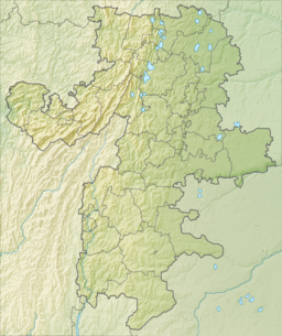
| Location | Southern Urals |
| Coordinates | 54°55′0″N 59°12′0″E[1] |
| Primary inflows | Bolshoy Kyl |
| Primary outflows | Bolshaya Satka |
| Catchment area | 179 km2 (69 sq mi) |
| Basin countries | Russia |
| Max. length | 10 km (6.2 mi) |
| Max. width | 2 km (1.2 mi) |
| Surface area | 178 km2 (69 sq mi) |
| Average depth | 3.4 m (11 ft) |
| Max. depth | 12 m (39 ft) |
| Surface elevation | 724 m (2,375 ft) |
| Frozen | October to May |
| Islands | none |
The name "Zyuratkul" comes from the Bashkir "yöräk/kul" (йөрәк/күл), meaning "heart/lake".[3]
In 1993 the Zyuratkul National Park, a protected area, was established in the lake and its surroundings.[4]
Geography
The lake lies at 724 m (2,375 ft) above mean sea level, being one of the highest lakes of the Southern Urals. It is located about 5 km (3.1 mi) to the south of the small mountain range named after it. Its southern shore stretches at the feet of the northern slopes of the larger Nurgush range.[5] Previously, in its natural state, the lake was smaller and surrounded by swamps. After WWII a dam was built and the new reservoir doubled the surface area of the ancient lake.[6]
The water of Zyuratkul is not as clear as is normal in high-altitude lakes. The reason is that the inflowing watercourses originate in swamps. The Bolshaya Satka, a left hand tributary of the Ay, is the outflow of the lake.[2]
 |
 |
See also
- List of lakes of Russia
- Zyuratkul Geoglyph
References
- Google Earth
- State Water Register - Озеро Зюрат-Куль
- Энциклопедия «От Парижа до Берлина по карте Челябинской области» (топонимика Челябинской области) Зюрат-Куль.
- Zyuratkul National Park official site
- Челябинская область: Энциклопедия / гл.ред. К. Н. Бочкарёв. Ч.: Каменный пояс, 2008
- Nash-Ural - Озеро Зюраткуль
External links
 Media related to Zyuratkul Lake at Wikimedia Commons
- Lake Zyuratkul pictures (in Russian)
- Путешествия по России 35 самых красивых мест, которые должен увидеть каждый (35 most beautiful spots in Russia)
This Chelyabinsk Oblast location article is a stub. You can help Wikipedia by expanding it. |
На других языках
- [en] Zyuratkul
[fr] Lac Ziouratkoul
Le lac Ziouratkoul (en russe : озеро Зюра́ткуль, ozero ziouratkoul) est un lac de Russie, situé au sud-est de l'Oural, dans l'oblast de Tcheliabinsk. Le lac est à la fois une étendue d'eau naturelle et une retenue de barrage. Sa superficie naturelle de 6 km², le lac a doublé depuis l'installation hydroélectrique dans les années 1940.[ru] Зюраткуль (озеро)
Зюра́ткуль[3][4][5] (устар. Зюрат-Куль)[1] — озеро[4][5][3] в Саткинском районе Челябинской области России[6]. Исток реки Большая Сатка[4]. Подпружено плотиной на северном берегу в месте истока Большой Сатки у посёлка Зюраткуль[5]. Площадь поверхности — 13,2 км². Площадь водосборного бассейна — 178 км²[1].Другой контент может иметь иную лицензию. Перед использованием материалов сайта WikiSort.org внимательно изучите правила лицензирования конкретных элементов наполнения сайта.
WikiSort.org - проект по пересортировке и дополнению контента Википедии