geo.wikisort.org - Reservoir
Wollaston Lake[7] is a lake in north-eastern Saskatchewan, Canada. It is 550 kilometres (340 mi) northeast of Prince Albert. With a surface area of 2,286 square kilometres (883 sq mi) (excluding islands; 2,681 square kilometres (1,035 sq mi) if islands are included),[6] it is the largest bifurcation lake in the world – that is, a lake that drains naturally in two directions.[8]
| Wollaston Lake | |
|---|---|
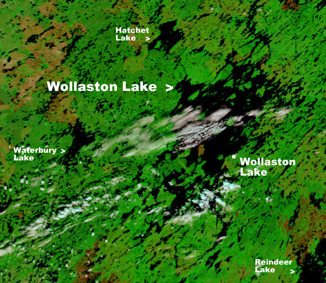 NASA image of Wollaston Lake | |
 Wollaston Lake Location of Wollaston Lake in Saskatchewan | |
| Location | north-eastern Saskatchewan |
| Coordinates | 58°15′N 103°20′W |
| Type | Glacial lake |
| Primary inflows | Geikie River |
| Primary outflows | Fond du Lac River (10%) Cochrane River (90%)[1] |
| Catchment area | 20,000 km2 (7,700 sq mi) |
| Basin countries | Canada |
| Surface area | 2,681 km2 (1,035 sq mi) |
| Average depth | 20.6 m (68 ft) |
| Max. depth | 97 m (318 ft) |
| Water volume | 39.8 km3 (32,300,000 acre⋅ft) |
| Shore length1 | 1,475 km (917 mi) |
| Surface elevation | 398 m (1,306 ft) |
| Settlements | Wollaston Lake, Saskatchewan |
| References | [2][3][4][5][6] |
| 1 Shore length is not a well-defined measure. | |
About 10% of the lake's water drains into the Fond du Lac River, which flows out of the lake to the north-west, where it drains into Lake Athabasca, which ultimately drains into the Arctic Ocean via the Mackenzie River system. The rest of the water drains into the Cochrane River, which flows out of the north-eastern side of the lake and into Reindeer Lake, which drains via the Churchill River system into Hudson Bay.[1]
Wollaston Lake's main inflow is the Geikie River which flows from the south-west into the south-west section of the lake. If Hudson Bay is considered an arm of the Atlantic Ocean, then the Geikie is the largest river in the world to flow naturally into two oceans.
Wollaston Lake is also the largest lake entirely within Saskatchewan, although the Saskatchewanian portions of Lake Athabasca and Reindeer Lake are both larger.
Samuel Hearne learned of the lake in 1770 and David Thompson noted in 1796 the dual outlets as "perhaps without parallel in the world."[9] In 1807, Peter Fidler named the lake after William Hyde Wollaston.
The only settlement on its shores is also named Wollaston Lake. The settlement includes the northern hamlet of Wollaston Lake with a population of 129[10] and the adjacent village of Wollaston Post of the Hatchet Lake Dene Nation with a population of 1251.[11][12][13]
Access
Access to the lake is provided by the community airstrip (Wollaston Lake Airport) and an all-weather road (Highway 905) to La Ronge.[13] This road passes by the western side of the lake, while the community of Wollaston Lake is located on the eastern side, but the lake can be crossed by a winter road when the lake is frozen (November through June)[5] and by the Wollaston barge when it is not.[13] Air service is also provided to Points North Landing, a service centre for nearby uranium mines. This industry provides jobs for local residents, but has raised concerns over possible contamination of the lake.
On the west side of the lake at Collins Bay,[14] near Collins Creek,[15] is Collins Bay Airport. Also on the west side of the lake, near Hidden Bay, is an abandoned airport called Hidden Bay Airport.[16]
Wollaston Lake (Hidden Bay) Recreation Site
Wollaston Recreation Site (58°6′2″N, 103°47′25″W),[17] also known as Hidden Bay Campground, is a provincially run park located on the north bank of Umpherville River[18] near its mouth where it empties into Hidden Bay of Wollaston Lake. The campground features 12 campsites, a boat launch, a fish cleaning station, and a picnic area.
Wild fires completely burned the campground and it is closed until further notice.[19]
The park is located on kilometre 240[20] of Highway 905, 260 km north of the community of Southend. [21][22]
Fish species
Fish species found in the lake include walleye, yellow perch, northern pike, lake trout, Arctic grayling, lake whitefish, cisco, burbot, white sucker, and longnose sucker.
Treated effluent from the Rabbit Lake uranium mine is released into Hidden Bay on the south-western side of the lake.[23]
See also
- List of lakes in Saskatchewan
References
- Mitchell, Patricia; Prepas, Ellie E. (1990). Atlas of Alberta Lakes. ISBN 9780888642158.
- "Principal lakes, elevation and area, by province and territory". Statistics Canada. 2 February 2005. Retrieved 11 March 2015.
- "World Lake Database (Wollaston Lake)". Retrieved 21 February 2015.
- LakeNet
- Data Summary Archived March 13, 2007, at the Wayback Machine
- Natural Resources Canada
- Government of Canada, Natural Resources Canada. "Place names - Wollaston Lake". www4.rncan.gc.ca.
- The Atlas of Canada – Parks and Environment
- The Encyclopedia of Saskatchewan | Details
- "Ministry of Municipal Affairs-Northern Settlement of WOLLASTON LAKE". Retrieved 28 October 2012.
- "Statistics Canada. 2012. Lac La Hache 220, Saskatchewan". 8 February 2012. Retrieved 28 October 2012.
- Saskatchewan wildfire forces emergency airlift – Saskatchewan – CBC News
- Wollaston Lake Archived October 11, 2006, at the Wayback Machine
- Government of Canada, Natural Resources Canada. "Place names - Collins Bay". www4.rncan.gc.ca.
- Government of Canada, Natural Resources Canada. "Place names - Collins Creek". www4.rncan.gc.ca.
- Canada Flight Supplement. Effective 0901Z 16 July 2020 to 0901Z 10 September 2020.
- Government of Canada, Natural Resources Canada. "Place names - Wollaston Lake (Hidden Bay) Recreation Site". www4.rncan.gc.ca.
- Government of Canada, Natural Resources Canada. "Place names - Umpherville River". www4.rncan.gc.ca.
- "Lac la Ronge Provincial Park | Tourism Saskatchewan".
- "Hidden Bay Campground | Tourism Saskatchewan".
- https://www.brmbmaps.com/explore/canada/saskatchewan/saskatchewan/wollaston-lake-[hidden-bay]-recreation-site/59323
- "Wollaston Lake, Saskatchewan, Canada Vacation Info".
- Wollaston Lake
External links
- Fish Species of Saskatchewan
- Encyclopedia of Saskatchewan
 Canada portal
На других языках
[de] Wollaston Lake
Der Wollaston Lake ist ein glazial entstandener See im Nordosten von Saskatchewan in Kanada.- [en] Wollaston Lake
[fr] Lac Wollaston
Le lac Wollaston est situé en Saskatchewan au Canada à 550 km au nord-est de Prince Albert.[it] Lago Wollaston
Il lago Wollaston è un lago situato nelle regioni nord-orientali della provincia canadese del Saskatchewan. Il lago ha una superficie di 2.286 km² e una profondità massima delle sue acque che raggiunge i 71 metri.[ru] Вулластон (озеро)
Ву́лластон (англ. Wollaston Lake) — озеро в провинции Саскачеван в Канаде. Расположено на северо-востоке провинции. Одно из больших озёр Канады — площадь водной поверхности 2286 км², общая площадь — 2681 км², третье по величине озеро в провинции Саскачеван[1]. Длина озера составляет 70 миль (112 км), максимальная ширина — 25 миль (40 км)[2]. Высота над уровнем моря 398 метров. Ледостав с ноября по июнь[3]. Озеро Вулластон было открыто Питером Фидлером примерно в 1800 году и позднее использовалось торговцами мехом как транспортный коридор через водораздел между двумя речными системами. Названо в честь английского химика Уильяма Хайда Волластона полярным исследователем Джоном Франклином в 1821 году.Другой контент может иметь иную лицензию. Перед использованием материалов сайта WikiSort.org внимательно изучите правила лицензирования конкретных элементов наполнения сайта.
WikiSort.org - проект по пересортировке и дополнению контента Википедии