geo.wikisort.org - Reservoir
Viedma Lake (Spanish: Lago Viedma, Spanish pronunciation: [laɣo ˈβjeðma]) is a Patagonian lake in the province of Santa Cruz, Argentina, situated near its border with Chile. Measuring approximately 50 miles (80 kilometers) in length, it is a major elongated trough lake formed from melting glacial ice. Viedma Lake is the second largest perennial lake located entirely within Argentina.[1]

This article needs additional citations for verification. (December 2009) |
| Viedma Lake | |
|---|---|
 from space, October 1994 | |
 Viedma Lake  Viedma Lake 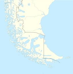 Viedma Lake | |
| Location | Lago Argentino Department, Santa Cruz Province (Argentina) |
| Coordinates | 49°35′S 72°30′W |
| Type | periglacial lake |
| Native name | Lago Viedma (Spanish) |
| Primary outflows | Santa Cruz River |
| Basin countries | Argentina |
| Max. length | 80 km (50 mi) |
| Max. width | 15 km (9.3 mi) |
| Surface area | ca. 1,088 km2 (420 sq mi) |
| Surface elevation | 250 m (820 ft) |
The name of the lake comes from the Spanish explorer Antonio de Viedma, who in 1783 reached its shores, being the first European to do so.
The town of El Chaltén and the Andes peaks Cerro Torre and Fitz-Roy lie in the proximity of Lake Viedma.
Lake Viedma is fed primarily by the Viedma Glacier at its western end. The Viedma Glacier measures 3 miles (5 kilometers) wide at its terminus at Lake Viedma. The brown landscape is a result of ice scouring, which left virtually no vegetation on the steep-walled valleys.
Water from lake Viedma flows into Lake Argentino through the La Leona River, and eventually from there into the Atlantic Ocean through the Santa Cruz River.
Although the lake lies in Argentine territory, the western shores of the lake reach the Southern Patagonian Ice Field in an area where the border remains undefined.
See also
- Lake San Martín
- Lake Argentino
References
- "Principal Lagos de la Republica Argentina", http://www.ign.gob.ar/NuestrasActividades/Geografia/DatosArgentina/Lagos, accessed 20 Jul 2018. Note that this list does not include an area figure for the large but seasonal Mar Chiquita.
Authority control | |
|---|---|
| General |
|
| National libraries | |
This article about a place in Santa Cruz Province, Argentina is a stub. You can help Wikipedia by expanding it. |
На других языках
[de] Lago Viedma
Der Lago Viedma (Viedma-See) ist ein 80 km langer und 15 km breiter Gletschersee in der argentinischen Provinz Santa Cruz nahe der Grenze zu Chile im Nationalpark Los Glaciares in den Anden. Seine Oberfläche beträgt 1.088 bis 1.600 km² und sein Abfluss geht zum Atlantik via Rio Santa Cruz.- [en] Viedma Lake
[es] Lago Viedma
El lago Viedma, de aproximadamente 80 km de longitud,[1] y una anchura promedio de 15 km en el extremo sudoeste de la Argentina; es el más largo de los lagos argentinos formados por abrasión glacial. La extensión de su espejo de agua es de 1088 km².[fr] Lac Viedma
Le lac Viedma (en espagnol : Lago Viedma) est un lac de Patagonie argentine, situé dans la province de Santa Cruz, et inclus partiellement dans le parc national Los Glaciares, tout comme son « jumeau » le lac Argentino.[it] Lago Viedma
Il lago Viedma è un lago della Patagonia argentina, situato nella provincia di Santa Cruz, e in parte incluso nel Parco nazionale di Los Glaciares.[ru] Вьедма (озеро)
Вье́дма (исп. Viedma)[1] — ледниковое озеро в Патагонии на юге Аргентине около границы с Чили. Располагается у одноимённого ледника[en], спускающегося в озеро с восточных склонов Патагонских Анд. Вьедма представляет приледниковый моренно-подпрудный водоём площадью 1100 км², находящийся на высоте 254 м над уровнем моря. Озеро названо в честь исследователя Патагонии Франсиско де Вьедма[2][1][3].Другой контент может иметь иную лицензию. Перед использованием материалов сайта WikiSort.org внимательно изучите правила лицензирования конкретных элементов наполнения сайта.
WikiSort.org - проект по пересортировке и дополнению контента Википедии