geo.wikisort.org - Reservoir
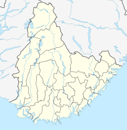
Venneslafjorden is a lake in the municipality of Vennesla in Agder county, Norway. The 1.56-square-kilometre (390-acre) lake is locate along the river Otra. There are several islands and islets located in the northern part of the lake, the largest of which is Drivenesøya. The village of Vennesla is located along the southern end and there are also settlements that extend along the east side of the lake. The lake is dammed as a reservoir for the Hunsfos hydropower plants.[3]
| Venneslafjorden | |
|---|---|
 Venneslafjorden  Venneslafjorden | |
| Location | Vennesla, Agder |
| Coordinates | 58°16′52″N 07°57′51″E |
| Primary inflows | Otra river |
| Primary outflows | Otra river |
| Catchment area | 3,679 km2 (1,420 sq mi)[1] |
| Basin countries | Norway |
| Surface area | 1.56 km2 (0.60 sq mi)[2] |
| Surface elevation | 41 metres (135 ft)[2] |
| References | NVE[3] |
References
- "NVE-Atlas Search: Nedbørsfelt, Venneslafjorden" (in Norwegian). Norwegian Water Resources and Energy Directorate.
- "NVE-atlas Search:Venneslafjorden" (in Norwegian). Norwegian Water Resources and Energy Directorate.
- "Venneslafjorden" (in Norwegian). Vann fra fjord til fjell, Vannett.
Текст в блоке "Читать" взят с сайта "Википедия" и доступен по лицензии Creative Commons Attribution-ShareAlike; в отдельных случаях могут действовать дополнительные условия.
Другой контент может иметь иную лицензию. Перед использованием материалов сайта WikiSort.org внимательно изучите правила лицензирования конкретных элементов наполнения сайта.
Другой контент может иметь иную лицензию. Перед использованием материалов сайта WikiSort.org внимательно изучите правила лицензирования конкретных элементов наполнения сайта.
2019-2025
WikiSort.org - проект по пересортировке и дополнению контента Википедии
WikiSort.org - проект по пересортировке и дополнению контента Википедии