geo.wikisort.org - Reservoir
Soluntakh (Russian: Солунтах; Yakut: Солунтах) is a freshwater lake in the Sakha Republic (Yakutia), Russia.[1][2] It is one of the largest lakes in the Allaikhovsky District. The region where Soluntakh lies is uninhabited.[3]
| Soluntakh | |
|---|---|
| Солунтах | |
 Course of the Kyuyol-Yuryakh with lake Soluntakh at the center of the basin | |
 Soluntakh Location in the Sakha Republic, Russian Far East | |
| Location | Yana-Indigirka Lowland |
| Coordinates | 71°42′41″N 143°15′19″E |
| Primary inflows | Kyuyol-Yuryakh |
| Primary outflows | Kyuyol-Yuryakh |
| Catchment area | 1,930 square kilometres (750 sq mi) |
| Basin countries | Russia |
| Max. length | 19 km (12 mi) |
| Max. width | 11 km (6.8 mi) |
| Surface area | 131 square kilometres (51 sq mi) |
| Frozen | September to June |
| Settlements | None |
Like most bodies of water in the area in has not been studied enough.[4] A sector of the lake is a protected area.[5]
Geography
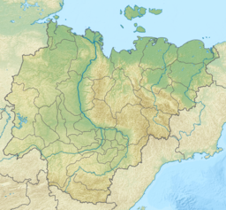
Soluntakh lake is located north of the Arctic circle, in the central part of the Yana-Indigirka Lowland. It is crossed from west to east by the 247 km (153 mi) long Kyuyol-Yuryakh river, which enters its western shore roughly in the middle. All other inflowing rivers are small. There are many smaller lakes in the vicinity. The lake begins to freeze in mid September and stays under ice until early June.[6][3][7]
Fauna
The greater white-fronted goose and bean goose are some of the bird species known to nest in the lake.[8] Soluntakh has also been explored as one of the probable sites providing a habitat for the Siberian crane, a critically endangered species.[9] Lake Soluntakh is rich in fish.[10][6]
See also
References
- "Озеро Солунтаах in the State Water Register of Russia". textual.ru (in Russian).
- Солунтах - Water of Russia
- "R-55_56 Topographic Chart (in Russian)". Retrieved 30 May 2022.
- АНАЛИТИЧЕСКИЙ ОБЗОР БИОГЕОГРАФИИ КОНТИНЕНТАЛЬНЫХ ВОДОЁМОВ СЕВЕРНОЙ И ЮЖНОЙ АЗИИ - Научное обозрение. Биологические науки (научный журнал)
- Янские мамонты - ООПТ России
- nature.ykt - Солунтах
- Google Earth
- ТУНДРЫ ВОСТОЧНОЙ ЯКУТИИ
- Map showing survey route followed during the current study of Siberian cranes
- Рыбы северо-востока Яно-Индигирской низменности (на примере бассейна р. Хромы как северной экосистемы в условиях антропогенного воздействия)
External links
This Sakha Republic location article is a stub. You can help Wikipedia by expanding it. |
На других языках
- [en] Soluntakh
[it] Lago Soluntach
Il lago Soluntach (in russo: озеро Солунтах?) è un lago d'acqua dolce della Russia siberiana orientale nel bacino del fiume Chroma. Situato all'interno del Circolo polare artico, appartiene al bacino del mare della Siberia Orientale. Si trova nell'Allaichovskij ulus della Repubblica Autonoma della Sacha-Jacuzia.[ru] Солунтах
Солунтах (якут. Солунтах) — крупное озеро на севере Якутии, в Аллаиховском улусе, Россия. Расположено на севере Яно-Индигирской низменности. Площадь поверхности 131 км²[2]. Площадь водосборного бассейна — 1930 км²[2]. Через озеро протекает река Кюёль-Юрях[3].Другой контент может иметь иную лицензию. Перед использованием материалов сайта WikiSort.org внимательно изучите правила лицензирования конкретных элементов наполнения сайта.
WikiSort.org - проект по пересортировке и дополнению контента Википедии