geo.wikisort.org - Reservoir
Shatt al Gharsah, Chott el Gharsa (Arabic language شط الغرسة) is sedimentary basin and also intermittent salt lake in Tunisia. It has width of 20 kilometres and length of 50 kilometres. At 17 metres under sea level it is at the lowest point of the country.[1]
| Shatt al Gharsah | |
|---|---|
 | |
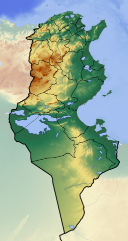 Shatt al Gharsah Shatt al Gharsah in Tunisia | |
| Coordinates | 34.07°N 7.52°E |
| Type | Salt lake, sedimentary basin |
| Primary inflows | rain |
| Primary outflows | terminal Evaporation |
| Basin countries | Tunisia |
| Max. length | 50 km (31 mi) |
| Max. width | 20 km (12 mi) |
| Surface area | 1,000 km2 (390 sq mi) |
| Surface elevation | −17 m (−56 ft) |
Wikimedia Commons has media related to Chott el Gharsa.
References
- "Chott El-Jarid lake, Tunisia". Encyclopedia Britannica. Retrieved 20 February 2018.
Authority control | |
|---|---|
| General | |
| National libraries | |
На других языках
[de] Chott el Gharsa
Das Chott el Gharsa (arabisch شط الغرسة, DMG Šaṭṭ al-Ġarsa), auch Schott el Rharsa, ist ein Sedimentbecken mit Salzsee im Südwesten von Tunesien, genauer im Gouvernement Tozeur. Das Schott, eine Salztonebene, liegt in einer Depression und hat im nördlichen Bereich seinen tiefsten Punkt mit 17 Metern unter dem Meeresspiegel.- [en] Shatt al Gharsah
[fr] Chott el-Gharsa
Le Chott el-Gharsa ou Chott el-Rharsa (arabe : شط الغرسة soit Šaṭṭ al-Ġarsa) est un chott situé au sud-ouest de la Tunisie, plus particulièrement dans le gouvernorat de Tozeur, à la frontière entre l'Algérie et la Tunisie. Il se trouve dans une dépression et atteint dans sa partie septentrionale son point le plus profond, soit 17 mètres en dessous du niveau de la mer, altitude la plus basse du territoire tunisien.[ru] Эль-Гарса
Эль-Га́рса[2], Шотт-эль-Гарса (араб. شط الغرسة) — шотт, пересыхающее бессточное соляное озеро, расположенное преимущественно на территории Туниса.Текст в блоке "Читать" взят с сайта "Википедия" и доступен по лицензии Creative Commons Attribution-ShareAlike; в отдельных случаях могут действовать дополнительные условия.
Другой контент может иметь иную лицензию. Перед использованием материалов сайта WikiSort.org внимательно изучите правила лицензирования конкретных элементов наполнения сайта.
Другой контент может иметь иную лицензию. Перед использованием материалов сайта WikiSort.org внимательно изучите правила лицензирования конкретных элементов наполнения сайта.
2019-2026
WikiSort.org - проект по пересортировке и дополнению контента Википедии
WikiSort.org - проект по пересортировке и дополнению контента Википедии