geo.wikisort.org - Reservoir
The Sarygamysh Lake, also Sarykamysh or Sary-Kamysh (Turkmen: Sarygamyş köli, Uzbek: Sariqamish ko‘li, Russian: Сарыкамы́шское озеро), is a lake in Central Asia. It is about midway between the Caspian Sea and the Aral Sea. It is the largest lake in Turkmenistan,[2] in which three quarters of the entire lake's area is located (a quarter of the area falls on Uzbekistan[3]). The Sarykamysh basin and the Sarykamysh delta of the Amu Darya river are physical and geographical nature regions of the Dashoguz Region of Turkmenistan.[4]
| Sarygamysh Lake | |
|---|---|
 December 2001 | |
 Sarygamysh Lake 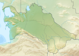 Sarygamysh Lake | |
| Coordinates | 42°00′N 57°20′E |
| Basin countries | Turkmenistan and Uzbekistan |
| Max. length | 125 km (78 mi) |
| Max. width | 90 km (56 mi) |
| Surface area | 3,955 km2 (1,527 sq mi)[1] |
| Average depth | 8 m (26 ft) |
| Max. depth | 40 m (130 ft) |
| Water volume | 68.56 km3 (55,580,000 acre⋅ft)[1] |
| Surface elevation | 5 m (16 ft) |
Up until the 17th century, the lake was fed by the Uzboy River, a distributary of the Amu Darya River, which continued on to the Caspian Sea. Today, its main source of water is a canal from the Amu Darya but also the runoff water from surrounding irrigated lands, containing high levels of pesticides, herbicides and heavy metals.
Contribution to the drying up of the Aral Sea
This and many other "unintended" lakes, such as Aydar Lake on the Syr Darya deny the Aral Sea about 150 cubic kilometres (36 cu mi) of annual inflow of water, directly contributing to, if not actually causing, the latter's drying up.
Etymology
The name of the lake comes from the Turkic words sari (yellow) and qamish (depression), a reference to the yellow color of silt and salt in the old dried up basin before its flooding by the Soviets. The modern Turkmen authorities wish to "Turkmenize" the name by contending that the name is Turkmen sarykamysh 'yellow reed'.[5]
The Turkmen section of the lake and the land around it is protected by the Sarygamyş Sanctuary.
History
Throughout its history, the lake has disappeared several times and re-emerged, depending on the arrival of the Amudarya waters. The drying out periods of the Sarygamysh lake were associated with the confluence of the river into the Aral Sea. The lake existed at the end of the Neogene period, in the upper anthropogene[6] (at 58 m above sea level), when its area covered, including the modern Assake-Audan basin,[7] and then in the 14th - 16th centuries AD (at the level of 50–62 metres above sea level).[6] It was first discovered and charted by the Russian geographer, Nikolai Petrusevich, in 1876.[8] The last time the waters of the Amu Darya directly entered the basin was during the flood of 1878.[6][9]
Since the beginning of the 1960s, the Sarykamysh lake has been filled with collector-drainage waters,[10] feeding was carried out through the Daryalyk collector, while water from the farmland of the left bank of the Amu Darya was used.[10][11]
Fauna
The ichthyofauna of Lake Sarykamysh was formed by species that penetrated from the Amu Darya and water bodies of the adventitious drainage network. For the most part, the lake is inhabited by native species of the Aral-Amu Darya basin and immigrant species, both spontaneously penetrated and purposefully transferred to the reservoir for fish breeding purposes in 1969–1974. In 1980–1987, 27 species lived here, and in 2018 there were already 32, of which 34.4% are immigrant species. In total, during the existence of the lake, 36 species of various representatives of ichthyofauna were recorded in it,[12] including carp, catfish and snakehead.[13] At the end of 2020, two tons of carp, silver carp and grass carp fry were released into the Sarykamysh lake in the territory of the Dashoguz velayat of Turkmenistan.[14]
Sarygamysh lake is also inhabited by such bird species as white swans, pink and curly pelicans, cormorants.[15]
Gallery
 Sarykamysh Lake at lower left, Oxus delta and what is left of the Aral Sea
 Sarygamysh Lake, from Uzbekistan
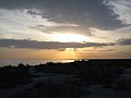 Sunset at Sarygamysh Lake
 Political Map of the southern Aral Sea and surroundings.


References
- Orlovsky, Leah; Matsrafi, Offir; Orlovsky, Nikolai; Kouznetsov, Michael (2014). "Sarykamysh Lake: Collector of Drainage Water – the Past, the Present, and the Future". The Turkmen Lake Altyn Asyr and Water Resources in Turkmenistan. The Handbook of Environmental Chemistry. Vol. 28. Berlin/Heidelberg: Springer-Verlag. pp. 107–140. doi:10.1007/698_2012_191. ISBN 978-3-642-38606-0.
- "Озеро Сарыкамышское: описание, исторические факты, интересные факты". autogear.ru. Retrieved 2022-06-06.
- "Сарыкамышское озеро". www.advantour.com. Retrieved 2022-06-06.
- "Велаяты Туркменистана/Академия наук Туркменистана". science.gov.tm. Retrieved 2022-06-18.
- E.M. Pospelov, Geograficheskiye nazvaniya mira (Moscow, 1998), p. 369.
- Сариқамиш сойлиги — Национальная энциклопедия Узбекистана на узбекском языке. — Ташкент, 2000—2005.
- http://bse.sci-lib.com/article076978.html Ассаке-Аудан
- Igor S. Zonn; Michael H. Glantz; Andrey G. Kostianoy; Aleksey N. Kosarev (2009). The Aral Sea Encyclopedia. Springer Science & Business Media. p. 251. doi:10.1007/978-3-540-85088-5. ISBN 978-3-540-85088-5.
- Шнитников А. В. (1969). "Внутривековая изменчивость компонентов общей увлажненности". Ленинград: Издательство «Наука». Ленинградское отделение: 130.
{{cite journal}}: Cite journal requires|journal=(help) - Григорович Н. (1977). "Солнце и вода, земля и соль" (8) (Наука и жизнь ed.): 68–69.
{{cite journal}}: Cite journal requires|journal=(help) - "Сары-Камыш" (Словарь современных географических названий ed.). Екатеринбург: У-Фактория. Под общей редакцией акад. В. М. Котлякова. 2006.
{{cite journal}}: Cite journal requires|journal=(help) - Ф.М.Шакирова «Биоразнообразие ихтиофауны водоемов Туркменистана». Международный научно-практический журнал «Проблемы освоения пустынь», 2018 г., № 3-4. г. Ашхабад, Туркменистан
- "Там, где жили гепарды | Turkmen.ru". Turkmen.ru. Retrieved 2022-06-19.
- "Восполняются природные ресурсы". uae.tmembassy.gov.tm. Retrieved 2022-06-08.
- "Там, где жили гепарды | Turkmen.ru". Turkmen.ru. Retrieved 2022-06-19.
External links
 Media related to Sarygamysh Lake at Wikimedia Commons
На других языках
[de] Sarykamyschsee
Der Sarykamyschsee (turkmenisch Sarygamyş köli, usbek. Sariqamish ko‘li, russ. Сарыкамышское озеро - Sarykamyschskoje osero) ist ein leicht salziger, in seiner heutigen Form anthropogen entstandener Binnensee, der in Zentralasien südwestlich des Aralsees an der Grenze zwischen Usbekistan und Turkmenistan liegt. Der Name leitet sich ab von „Sarı“ (Gelb) und „qamış“ (Schilf).[1]- [en] Sarygamysh Lake
[es] Lago Sariqamish
El lago Sariqamish (en turkmeno Sarygamyş köli, en uzbeko Sariqamish ko‘li y en ruso, Сарыкамышское озеро, Sarykamyshskoe ozero) es un lago endorreico de escasa profundidad situado en Asia Central, al norte de Turkmenistán. La mayor parte de su superficie pertenece políticamente a Turkmenistán, mientras que su cuarta parte septentrional pertenece a Uzbekistán.[fr] Lac Sary Kamysh
Le lac Sary Kamysh, également appelé Sarygamysh ou Sarykamysh (en turkmène Sarygamyş köli, qui signifie «roseau», en ouzbek Sariqamish ko‘li, et en russe Сарыкамы́шское озеро) est un lac légèrement salé situé dans le nord du Turkménistan et l'ouest de l'Ouzbékistan, entre la mer Caspienne et la mer d'Aral. Le lac a actuellement une superficie de près de 5 000 km2 avec une longueur de 89 km, une largeur de 69 km et une profondeur maximale de 40 m.[it] Sarygamysh
Il lago Sarygamysh (in turkmeno: Sarygamyş köli, in uzbeco: Sariqamish ko‘li, in russo: Сарыкамышское озеро), dal turkmeno "depressione gialla", è un lago salmastro situato in Asia centrale, geopoliticamente si estende per un quarto nel territorio dell'Uzbekistan, il resto in quello del Turkmenistan.[ru] Сарыкамышское озеро
Сарыкамы́шское озеро (Сарыкамы́ш; туркм. Sarygamyş köli, каракалп. Sariqamis kóli, узб. Sariqamish ko‘li) — бессточное горько-солёное озеро в центральной части Сарыкамышской котловины[1], в Туркменистане и Узбекистане, примерно посередине между Каспийским и Аральским морями-озёрами. Большая часть территории озера находится на территории Туркменистана, остальная — в Узбекистане.Другой контент может иметь иную лицензию. Перед использованием материалов сайта WikiSort.org внимательно изучите правила лицензирования конкретных элементов наполнения сайта.
WikiSort.org - проект по пересортировке и дополнению контента Википедии