geo.wikisort.org - Reservoir
Raja Rani lake (Nepali: ne:राजा रानी) is a lake and orchid sanctuary located at Letang Municipality, the North of the Morang District, Province No. 1. The area is a wetland, surrounded by Sal (Shorea robusta) forest and lake is stream-fed but a dam regulates the water reserves,[1] therefore, the lake is classified as semi-natural freshwater lake. Of the three ponds, Raja Pokhari, Rani Pokhari, and Rajkumari Pokhari, Rani Pokhari has 1 sq mi (2.6 km2) of dense forest growing up from the water, and its orchid-rich habitat is a center of attraction.[2][3]
| Raja Rani | |
|---|---|
 Range on Rani Lake | |
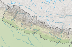 Raja Rani Location in Nepal | |
| Location | Morang |
| Coordinates | 26.883°N 87.435°E |
| Lake type | Freshwater |
| Native name | राजा रानी (Nepali) |
| Primary inflows | Raja Rani Temple & Dhimal Temple |
| Basin countries | Nepal |
| Max. length | 0.8 km (0.50 mi) |
| Max. width | 2 km (1.2 mi) |
| Surface area | 0.32 km2 (0.1 sq mi) |
| Average depth | 3.6 m (12 ft) |
| Max. depth | 3.6 m (12 ft) |
| Water volume | 0.046 km3 (0.011 cu mi) |
| Surface elevation | 453 m (1,486 ft) |
| Frozen | Does not freeze |
| Settlements | Letang, Bhogateni, Pathari-Sanischare Municipality, Belbari |
 | |
This places occupies two temples; Raja Rani Temple and Dhimal's Temple.
References
- "संक्षिप्त परिचय : मोरङ जि.स.स". ddcmorang.gov.np. Retrieved 2019-04-18.
- "Orchid Sanctuary Raja Rani (Morang District), East Nepal: An Effort Toward Habitat Conservation". ResearchGate. Retrieved 2019-04-18.
- "Rajarani in Morang popular among domestic tourists". The Himalayan Times. 2016-05-30. Retrieved 2019-04-18.
Текст в блоке "Читать" взят с сайта "Википедия" и доступен по лицензии Creative Commons Attribution-ShareAlike; в отдельных случаях могут действовать дополнительные условия.
Другой контент может иметь иную лицензию. Перед использованием материалов сайта WikiSort.org внимательно изучите правила лицензирования конкретных элементов наполнения сайта.
Другой контент может иметь иную лицензию. Перед использованием материалов сайта WikiSort.org внимательно изучите правила лицензирования конкретных элементов наполнения сайта.
2019-2025
WikiSort.org - проект по пересортировке и дополнению контента Википедии
WikiSort.org - проект по пересортировке и дополнению контента Википедии