geo.wikisort.org - Reservoir
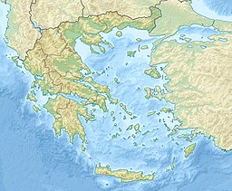
Lake Ozeros (Greek: Οζερός, Λίμνη Οζερού) is a lake located west of the Greek city of Agrinio. The lake has its own catchment area but is sometimes connected to the waters of the Acheloos river, flowing from the northwest, when the river overflows. The lake has a surface of ca. 10 km2 and an average depth of 8–10 m, but this varies greatly with the season. The road GR-5/E55 (Antirrio - Agrinio - Ioannina) runs to the northeastern side.
| Ozeros | |
|---|---|
 View of Ozeros lake | |
| Location | Aetolia-Acarnania |
| Coordinates | 38°39′21″N 21°13′27″E |
| Type | natural |
| Basin countries | Greece |
| Max. length | 5 km (3.1 mi) |
| Max. width | 3 km (1.9 mi) |
| Surface area | 10 km2 (3.9 sq mi) |
| Max. depth | 10 m (33 ft) |
| Settlements | Agios Konstantinos |
Nearest places
- Agios Konstantinos, southeast
- Kalyvia, south
- Bampini, west
- Fyteies, northwest
На других языках
- [en] Ozeros
[ru] Озерос
Озерос (греч. Οζερός) — озеро в Греции.Текст в блоке "Читать" взят с сайта "Википедия" и доступен по лицензии Creative Commons Attribution-ShareAlike; в отдельных случаях могут действовать дополнительные условия.
Другой контент может иметь иную лицензию. Перед использованием материалов сайта WikiSort.org внимательно изучите правила лицензирования конкретных элементов наполнения сайта.
Другой контент может иметь иную лицензию. Перед использованием материалов сайта WikiSort.org внимательно изучите правила лицензирования конкретных элементов наполнения сайта.
2019-2025
WikiSort.org - проект по пересортировке и дополнению контента Википедии
WikiSort.org - проект по пересортировке и дополнению контента Википедии
