geo.wikisort.org - Reservoir
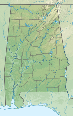
Neely Henry Lake is located on the Coosa River near Gadsden, Alabama. The lake was formed by the Neely Henry Dam (57 ft high), built in 1966 by Alabama Power Company for hydroelectric power and recreation.
| Neely Henry Lake | |
|---|---|
 Neely Henry Lake  Neely Henry Lake | |
| Location | Calhoun / Etowah / St. Clair counties, Alabama, US |
| Coordinates | 33.84°N 86.06°W |
| Type | reservoir |
| Primary inflows | Coosa River |
| Primary outflows | Coosa River |
| Basin countries | United States |
| Surface area | 11,200 acres (45 km2) |
| Surface elevation | 508 ft (155 m) |
| Settlements | Gadsden, Southside, Rainbow City |
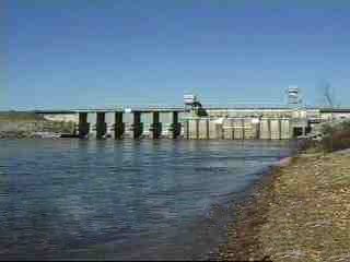
Completed on June 2, 1966, the dam and reservoir were named for H. Neely Henry, a senior executive vice-president of Alabama Power. The dam has a 72,900 kilowatt generating capacity; the lake covers 11,200 surface acres (45.3 km2) with a total capacity of 129,800 acre-feet and about 339 miles of shoreline. The nearest town is Ohatchee, Alabama to the East of the dam, and Ragland, Alabama to the West. It is an excellent recreational lake with fishing opportunities for largemouth bass, spotted bass, bluegill and other sunfish, crappie, catfish, striped bass, hybrid and white bass. Alabama Power maintains three public access sites on the lake.[1]
References
- "Alabama Power Website, Facts About Dams". southerncompany.com. Archived from the original on 2016-02-24. Retrieved 2012-07-30.
External links
- www.neelyhenry.com Information about Lake Neely Henry
- lakes.alabamapower.com Alabama Power Lake Information
Authority control | |
|---|---|
| General |
|
| National libraries | |
This Calhoun County, Alabama state location article is a stub. You can help Wikipedia by expanding it. |
This Etowah County, Alabama state location article is a stub. You can help Wikipedia by expanding it. |
This St. Clair County, Alabama state location article is a stub. You can help Wikipedia by expanding it. |
Другой контент может иметь иную лицензию. Перед использованием материалов сайта WikiSort.org внимательно изучите правила лицензирования конкретных элементов наполнения сайта.
WikiSort.org - проект по пересортировке и дополнению контента Википедии