geo.wikisort.org - Reservoir
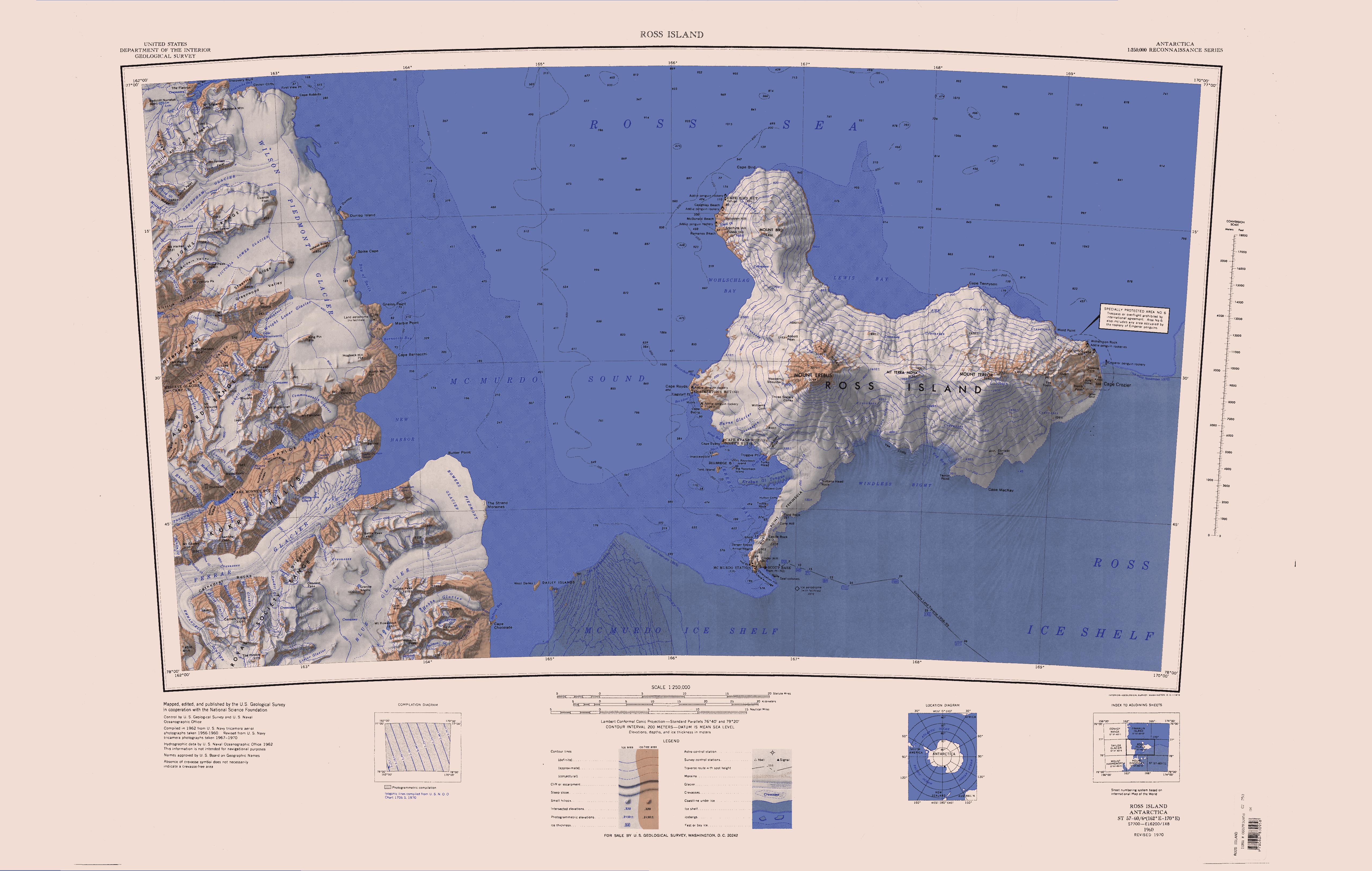
Mummy Pond (77°40′S 162°39′E) is a pond between Suess and Lacroix Glaciers in Taylor Valley, Victoria Land. So named by T.L. Pewe, U.S. geologist who visited the area in December 1957, because of the mummified seals found around the pond.
Further reading
- Gunter Faure, Teresa M. Mensing, The Transantarctic Mountains: Rocks, Ice, Meteorites and Water, P 715
- Galen Rowell, Poles Apart: Parallel Visions of the Arctic and Antarctic, P 172
- Sara Wheeler, Terra Incognita: Travels in Antarctica
- Lucy Jane Bledsoe, The Big Bang Symphony: A Novel of Antarctica, P 210
- Ana María Alonso-Zarza, Lawrence H. Tanner, editors, Paleoenvironmental Record and Applications of Calcretes and Palustrine Carbonates, P 99
![]() This article incorporates public domain material from the United States Geological Survey document: "Mummy Pond". (content from the Geographic Names Information System)
This article incorporates public domain material from the United States Geological Survey document: "Mummy Pond". (content from the Geographic Names Information System)
This McMurdo Dry Valleys location article is a stub. You can help Wikipedia by expanding it. |
На других языках
[de] Mumienteich
Der Mumienteich (englisch Mummy Pond) ist ein kleiner See im ostantarktischen Viktorialand. Im Taylor Valley liegt er zwischen dem Suess- und dem Lacroix-Gletscher.- [en] Mummy Pond
Текст в блоке "Читать" взят с сайта "Википедия" и доступен по лицензии Creative Commons Attribution-ShareAlike; в отдельных случаях могут действовать дополнительные условия.
Другой контент может иметь иную лицензию. Перед использованием материалов сайта WikiSort.org внимательно изучите правила лицензирования конкретных элементов наполнения сайта.
Другой контент может иметь иную лицензию. Перед использованием материалов сайта WikiSort.org внимательно изучите правила лицензирования конкретных элементов наполнения сайта.
2019-2026
WikiSort.org - проект по пересортировке и дополнению контента Википедии
WikiSort.org - проект по пересортировке и дополнению контента Википедии