geo.wikisort.org - Reservoir
Lower Otay Reservoir is a reservoir in San Diego County, Southern California. It is flanked by Otay Mountain to the southeast, the Jamul Mountains to the east, Otay Lakes Road and Upper Otay Reservoir to the north, and the city of Chula Vista to the west.
| Lower Otay Reservoir | |
|---|---|
 | |
 Lower Otay Reservoir  Lower Otay Reservoir  Lower Otay Reservoir | |
| Location | San Diego County, California |
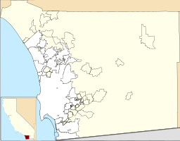
| Coordinates | 32.6372°N 116.9249°W |
| Type | Reservoir |
| Part of | Otay and Proctor Valleys[1] |
| Primary inflows | Otay River San Diego Aqueduct |
| Primary outflows | Otay River |
| Basin countries | United States |
| Surface area | 1,100 acres (450 ha)[2] |
| Average depth | 124 ft (38 m) (August 2009)[3] |
| Max. depth | 137.5 ft (41.9 m)[2] |
| Water volume | 49,500 acre⋅ft (61.1×10⁶ m3) |
| Shore length1 | 25 mi (40 km)[2] |
| Surface elevation | 381 ft (116 m) |
| References | U.S. Geological Survey Geographic Names Information System: Lower Otay Reservoir |
 | |
| 1 Shore length is not a well-defined measure. | |
The reservoir is formed by impounding the waters of the Otay River, behind Savage Dam, completed in 1918, and is also the terminus for the second San Diego Aqueduct,[4] which transports imported water from the Colorado River.[5] The dam and reservoir are owned by the City of San Diego.
History

The area where the Reservoir is located was part of Rancho Janal, and was purchased by E. S. Babcock.[6] Lower Otay Reservoir was originally created in 1897 after the construction of the Lower Otay Dam by the Southern California Mountain Water Company.[7] The original dam was a rock fill type of 125 feet (38 m) high.[8] In 1900, John D. Spreckels purchased the land around the reservoir, and the reservoir was later acquired by a company owned by Spreckels.[9] At the lake was a hunting lodge that was utilized by guests of Hotel del Coronado.[6][10]
The original dam gave way in January 1916 following heavy rains which affected most of Southern California flooding the Otay Valley with a wall of water ranging from 20 to 100 feet (6.1 to 30.5 m) in height during the event, killing more than 14 people.[8] The flood swept away entire farms and buildings, including the Montgomery residence at Fruitland near the mouth of the river, where John J. Montgomery had built his initial series of manned glider designs.[11] The rains were ostensibly the work of the "rainmaker" Charles Hatfield, who had been hired by the City of San Diego to assist in increasing rainfall to fill nearby Morena Reservoir. He was never charged with any crimes. Following this the present Arch-gravity dam was built.[8] In 1934, it was named in honor of Hiram Newton Savage, the city engineer who supervised its construction.[12]

In 1936, Stephen Birch purchased the land around the reservoir, which had been Rancho Otay. His daughter Mary inherited the land and, marrying a former Royal Air Force commander, moved into the former hunting lodge on Upper Otay Lake, Rancho del Otay.[7]
A Curtiss SB2C Helldiver plane was spotted in the lake in February 2009 by a bass fisherman. On May 28, 1945, it had been on a practice bombing run from a nearby aircraft carrier when a stalled engine forced an emergency landing in the reservoir.[13] Divers examined the plane on July 23, 2009, to see if it could be salvaged for museum display, and it was raised on August 20, 2010.[14]
See also
- List of dams and reservoirs in California
- List of lakes in California
References
- Common Grounds Project (2006). "The Otay Watershed (HU 910.00)". San Diego Bay Watersheds. San Diego State University. Retrieved 2009-03-22.
- "Lower Otay Reservoir". Water department. City of San Diego. Retrieved 17 August 2009.
- "Water Levels". Water Department. City of San Diego. Retrieved 17 August 2009.
- Water Department (2005). "Watershed Sanitary Survey". City of San Diego: Volume 3.
{{cite journal}}: Cite journal requires|journal=(help) - Norman Durfor, Charles; Becker, Edith (1962). Public Water Supplies of the 100 Largest Cities in the United States, 1962, Issue 1812. Government Printing Office. p. 133. Retrieved 2 September 2014.
- Smith, Brian F.; Buysse, Johnna L.; Pierson, Larry; Tuma, Michal; Guerrero, Kyle (26 August 2014). Otay Ranch Resort Village Archaeological/Historical Study (PDF) (Report). County of San Diego. p. 3.0–8. Retrieved 12 May 2018.
- Schoenherr, Steven (29 October 2004). "Otay Valley". San Diego Local History. University of San Diego. Archived from the original on 9 May 2008. Retrieved 17 August 2009.
- Hill, Joseph (2002). "Dry Rivers, Dammed Rivers and Floods: An Early History of the Struggle Between Droughts and Floods in San Diego". The Journal of San Diego History. City of San Diego. 48 (1). Retrieved 2009-08-17.
- Otay Ranch General Development Plan (Report). City of Chula Vista. 26 May 2015. pp. 1–9. Retrieved 12 May 2018.
- Deegan, Joe (8 February 2007). "Turnstiles for Lake Murray". San Diego Reader. Retrieved 12 May 2018.
- Fogal, Gary B.; Harwood, Craig S. (11 October 2012). Quest for Flight: John J. Montgomery and the Dawn of Aviation in the West. University of Oklahoma Press. p. 172. ISBN 9780806187815. Retrieved 2 September 2014.
- Fetzer, Leland (2005). San Diego County Place Names A to Z. San Diego: Sunbelt Publications. pp. 131–132.
- Zieralski, Ed (21 July 2009). "Search for fish unearths history". San Diego Union Tribune. Retrieved 14 August 2009.
- Carlson, Chris (20 August 2011). "WWII warplane raised from California reservoir". San Diego Union Tribune. Retrieved 11 September 2017.
External links
- Lower Otay Reservoir - City of San Diego web site
Authority control | |
|---|---|
| General |
|
| Other |
|
На других языках
[de] Lower Otay und Sweetwater
32.627484-116.92583- [en] Lower Otay Reservoir
Другой контент может иметь иную лицензию. Перед использованием материалов сайта WikiSort.org внимательно изучите правила лицензирования конкретных элементов наполнения сайта.
WikiSort.org - проект по пересортировке и дополнению контента Википедии