geo.wikisort.org - Reservoir
Lower Granite Lake is a reservoir created by Lower Granite Dam. The dam is a concrete gravity run-of-the-river dam in the northwest United States. On the lower Snake River in southeastern Washington, it bridges Whitman and Garfield counties.[2] Opened 47 years ago in 1975,[1][3][4] the dam is located 22 miles (35 km) south of Colfax and 35 miles (56 km) north of Pomeroy.
| Lower Granite Lake | |
|---|---|
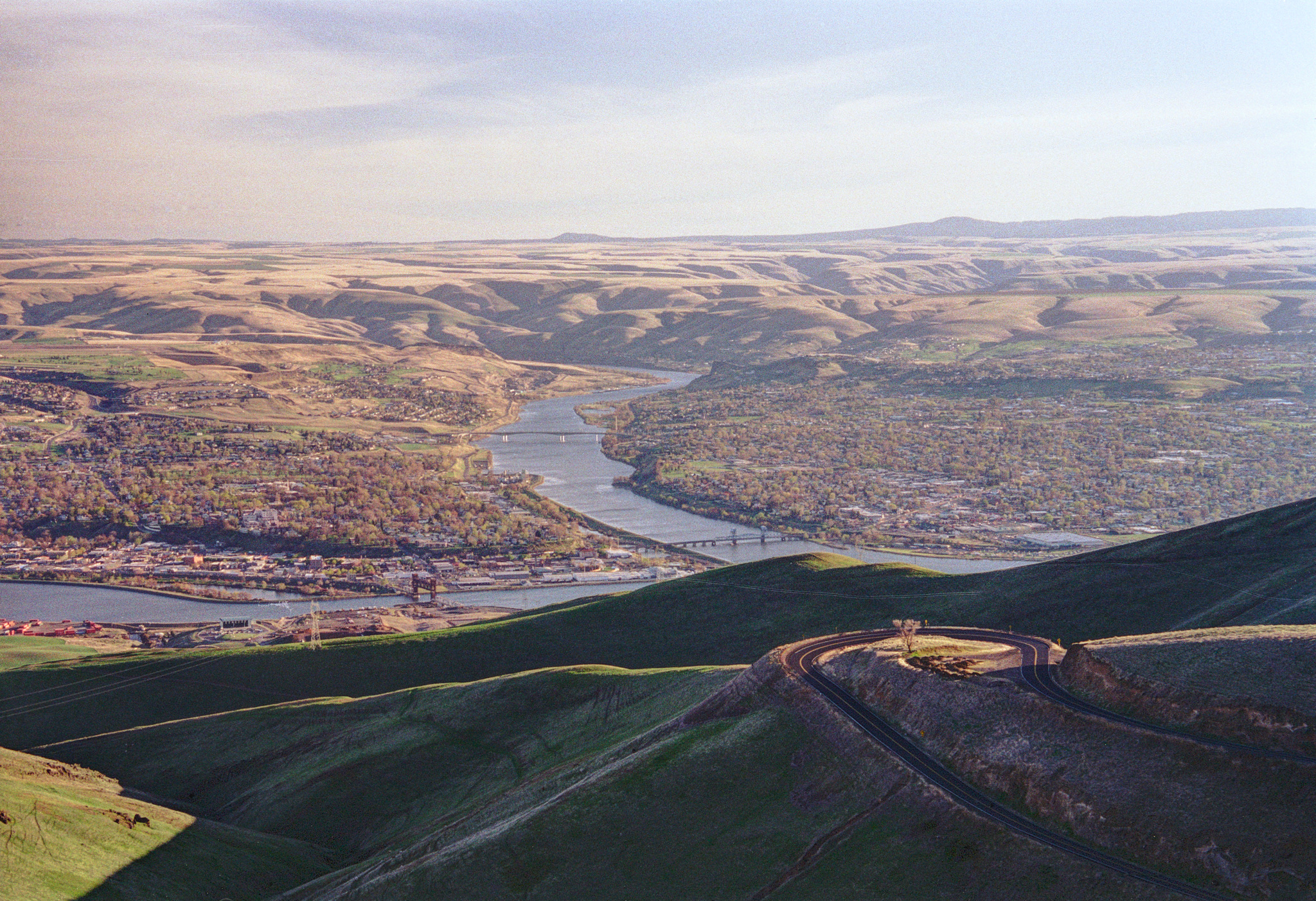
 A view of Lower Granite Lake/Snake River from Lewiston Hill. The city of Lewiston, Idaho is on the left with Clarkston, Washington on the right. The Interstate Highway Bridge is in the foreground and the Southway Bridge in the center of the photograph. | |
 Lower Granite Lake | |
| Coordinates | 46.426468°N 117.124779°W |
![The Lower Granite Lake was created in 1975. Since the Interstate Highway Bridge between Lewiston, Idaho and Clarkston, Washington was high enough, the new lake did not overwhelm the bridge.[1]](http://upload.wikimedia.org/wikipedia/commons/9/93/Snake_River_Bridge_between_Lewiston_and_Clarkston_%282010%29.jpg)
Lower Granite Dam is part of the Columbia River Basin system of dams, built and operated by the United States Army Corps of Engineers; power generated is distributed by the Bonneville Power Administration.
Behind the dam, Lower Granite Lake extends 39 miles (63 km) east to Lewiston, Idaho and Clarkston, Washington, and allowed the Lewiston–Clarkston metropolitan area to become a port.[1][5] The first barge to Portland on the 374-mile (602 km) navigation route was loaded with wheat and departed Lewiston on August 9, 1975.[6][7]'
Bridges
- Southway Bridge - crosses between Lewiston, Idaho and Clarkston, Washington
- Interstate Highway Bridge - also crosses between Lewiston and Clarkston, carrying U.S. Route 12 between the cities
Photos
References
- Harrell, Sylvia (June 20, 1975). "Dedication: Andrus brings a warning". Lewiston Morning Tribune. (Idaho). p. 1.
- "The Columbia River System Inside Story" (PDF). BPA.gov. pp. 14–15. Retrieved 17 July 2010.
- Bunning, Paul (June 20, 1975). "Andrus salutes dam project". Spokesman-Review. (Spokane, Washington). p. 6.
- Dullenty, Jim (June 19, 1975). "Idaho's link to the sea is acclaimed by Andrus". Spokane Daily Chronicle. (Washington). p. 1.
- "Snake River link to sea nearly complete". Ellensburg Daily Record. (Washington). UPI. March 6, 1975. p. 3.
- "First wheat heads downriver". Lewiston Morning Tribune. (Idaho). August 10, 1975. p. 10A.
- "Grain barge nears Portland". Ellensburg Daily Record. (Washington). UPI. August 11, 1975. p. 10.
This article about a location in the state of Washington is a stub. You can help Wikipedia by expanding it. |
This Idaho location article is a stub. You can help Wikipedia by expanding it. |
Другой контент может иметь иную лицензию. Перед использованием материалов сайта WikiSort.org внимательно изучите правила лицензирования конкретных элементов наполнения сайта.
WikiSort.org - проект по пересортировке и дополнению контента Википедии