geo.wikisort.org - Reservoir
Lough Corrib (/lɒx ˈkɒrɪb/ lokh KORR-ib; Irish: Loch Coirib[4]) is a lake in the west of Ireland. The River Corrib or Galway River connects the lake to the sea at Galway. It is the largest lake within the Republic of Ireland and the second largest on the island of Ireland (after Lough Neagh). It covers 176 km² and lies mostly in County Galway with a small area of its northeast corner in County Mayo.
| Lough Corrib | |
|---|---|
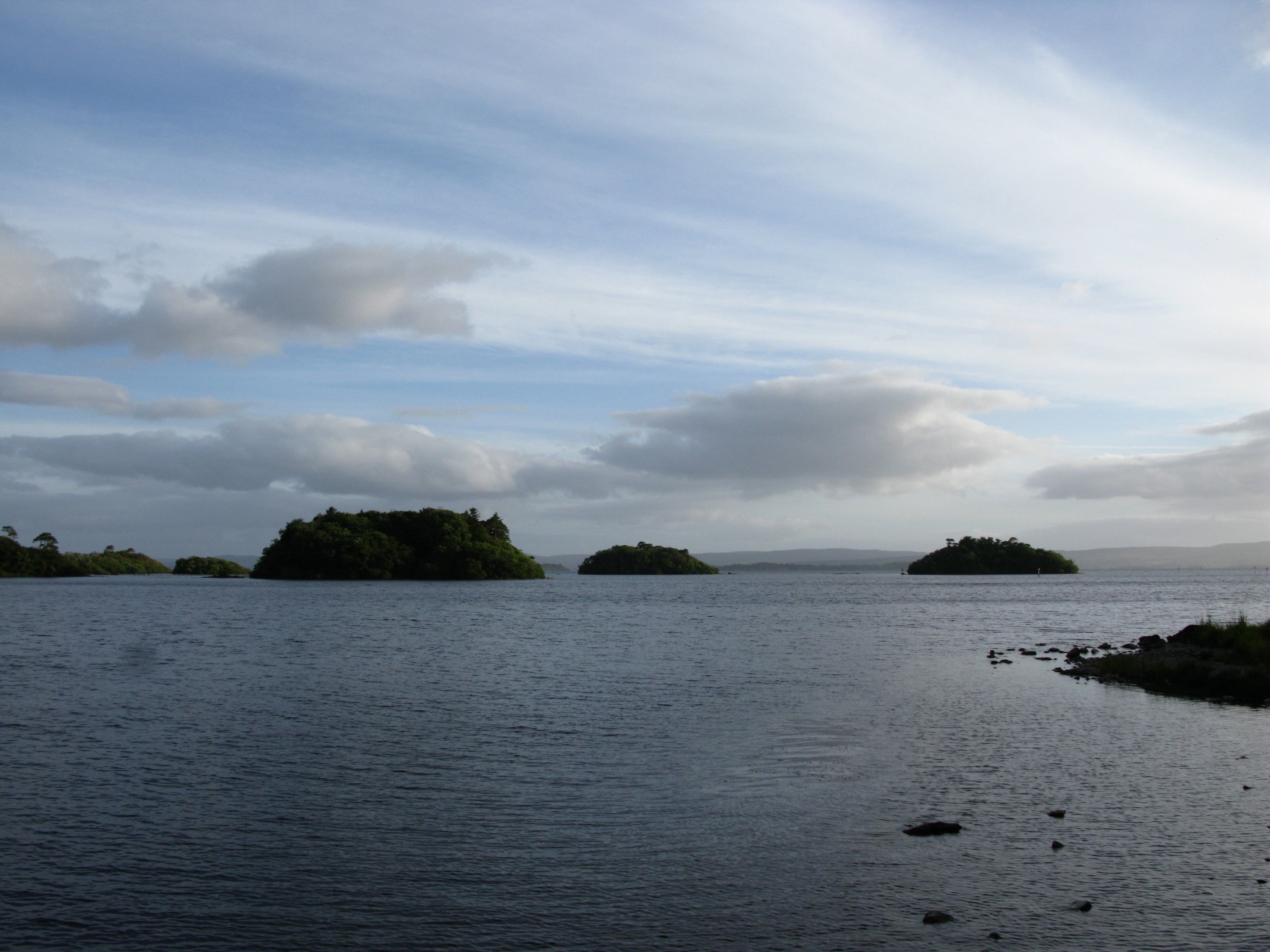
 View on Lough Corrib, south of Clonbur | |
 Lough Corrib Location of Lough Corrib in Ireland | |
| Location | Connacht |
| Coordinates | 53°26′N 9°14′W |
| Native name | Loch Coirib (Irish) |
| Primary inflows | Cregg River, River Clare, Black River |
| Primary outflows | River Corrib |
| Basin countries | Ireland |
| Max. length | 43.5 km (27.0 mi) |
| Max. width | 16.1 km (10.0 mi) |
| Surface area | 176 km2 (68 sq mi) |
| Average depth | 6.5 m (21 ft)[1] |
| Max. depth | 50.9 m (167 ft)[2] |
Ramsar Wetland | |
| Designated | 7 June 1996 |
| Reference no. | 846[3] |
The first canal on the island of Ireland was cut in the 12th century. Known as the Friar's Cut, it allowed boats to pass from Lough Corrib to the sea at Galway.[5]
Lough Corrib was designated a Ramsar site on 16 June 1996. It has also been designated a Special Area of Conservation.
Name
Loch Coirib is a corruption of Loch Oirbsean. According to placename lore, this refers to Oirbsen or Oirbsiu—another name for the Tuatha Dé Danann figure Manannán mac Lir—who is believed to have been a god of the sea. In Irish, the lough is also called An Choirib ("the Corrib").[citation needed]
Marine archaeology and charts
Surveys have been undertaken since 2007 by a local surveyor/cartographer to create up-to-date charts of Lough Corrib.[6] These have uncovered a number of objects of historical significance, which have been investigated by the Underwater Archaeology Unit of the National Monuments Service.[7] These include Bronze Age and Iron Age vessels (Dugout canoes), the "Annaghkeen Boat" being 40 ft in length and intricately carved,[8] the "Carrowmoreknock Boat", a well preserved 10th century vessel carrying three Viking battle axes,[9] and the wreck of a Victorian pleasure yacht. The lake is hence of international importance as a marine archaeological site.[citation needed] All historic wrecks in the lough are protected, and a licence to dive them is required from the National Monuments Service.[10]
Wildlife
The wildlife in Lough Corrib includes birds and hawks, otters, mink, stoat, frogs, and bats. Lough Corrib can be divided into two parts: a smaller shallower basin to the south and a larger deeper basin to the north. These two parts are connected by a narrow channel. In the southern and eastern parts of the lake, the lake bed is dominated by limestone bedrock covered by deposits of precipitated marl. The surrounding land is mostly pastoral farmland to the south and east and bog to the west and north. In addition to the lake basis, some areas of scientific interest adjoining the lake, e.g. woodland, callows grassland and raised bog, have been incorporated into the Special Area of Conservation.[citation needed]
Threats to ecology

In early 2007, large numbers of the protozoan parasite Cryptosporidium were detected in water from the lake, leading to contamination of the public water supply in Galway city and an outbreak of cryptosporidiosis. Another unwelcome visitor is the invasive species Lagarosiphon major (also known as 'curly-leaved waterweed' or 'South African pondweed') which is destroying fish habitat and the zebra mussel.[citation needed]
Cryptosporidium outbreak
On 21 March 2007, Cryptosporidium was confirmed to be present in the drinking water of Galway City, Moycullen, Oughterard and Headford, which had been instructed six days earlier to boil their water before drinking. The water taken from Lough Corrib was likely contaminated by migration of animal and human faeces. Controversy emerged when it was revealed that funds previously earmarked to improve Galway's water system had not been spent. Dick Roche, the Minister of the Environment, later announced allocation of additional funds to tackle the issue.[11] Measures included upgrading existing water treatment and filtration systems, as well as the projected importing of water from nearby Luimnagh, Tuam, County Galway. This plant at Luimnagh has facilities for Cryptosporidium eradication and filtration.[12]
The Community Care Organisation, Cope, delivered bottled water to their elderly clients from 30 March 2007.[13] A lobby group was formed in April 2007 to highlight the issue.[14]
Islands
While Lough Corrib is reputed to have 365 islands, a recent figure from the creator of the charts of the lake is 1,327.[15] These islands include Inchagoil Island, midway between Cong and Oughterard. It is one of the largest of the wooded islands along Lough Corrib. The island has views of the Maumturk range, Joyce Country and the mountains of Connemara. There are some beaches and woods with walks around the island. There is evidence of an early monastic settlement, and two churches - Saint Patrick's and the 12th century church known as the "saints" church. St. Brendan of Clonfert is also said to have spent some time on an island in this lake after returning from his travels in Britain. There are several paths around the island, an old cemetery and remains of four or five cottages which housed the few inhabitants.
Another lake island is Caislean-na-Circe, between Maam and Doon. This section of Lough Corrib is free from islands except for the rock on which the ancient Hen's Castle of the O'Connor's and the O'Flaherty's stands. The castle was home of the pirate Queen Gráinne O'Malley, who lived in the time of Queen Elizabeth I of England. In 1225, the Lord Justice caused Odo O'Flatherty to give up Kirk Castle to Odo O'Connor, King of Connaught; for assurance of his fidelity. Cruises on the lough depart from Cong, Ashford Castle, Galway City, and Oughterard.[16][17]
Influence on writers
Paul Féval's novel La Quittance de minuit (1846) is set in County Galway, near Lough Corrib.
William Wilde, father of Oscar Wilde, wrote a book about the lake, Lough Corrib, its Shores and Islands (1867).[18] He built a summerhouse on the banks of the lake, called Moytura House.[citation needed]
The Irish Times states that "the unspoilt countryside around Lough Corrib provided the inspiration" for The Hounds of the Morrigan, a children's novel by Pat O'Shea.[19]
Annalistic references
See Annals of Inisfallen (AI)
- AI1027.9 Muiredach Ua Flaithbertaig besieged Cathal, son of Ruaidrí, on Inis Crema in Loch Oirbsen, and divided his land despite him.
See also
- Lough Mask
- Lough Carra
- List of loughs of County Mayo
- List of loughs in Ireland
- Milwaukee Cryptosporidium outbreak
References
- Lagarosiphon major – An Aggressive Invasive Species in Lough Corrib
- "Traditional and GPS Fishing Maps of Lough Corrib and Lakes in the West of Ireland". anglingcharts.com.
- "Lough Corrib". Ramsar Sites Information Service. Retrieved 25 April 2018.
- "Loch Coirib/Lough Corrib". Placenames Database of Ireland (logainm.ie). Government of Ireland - Department of Arts, Heritage and the Gaeltacht and Dublin City University. Retrieved 7 March 2020.
- "Canals". BBC.co.uk. BBC Schools. Retrieved 6 January 2018.
- "AnglingCharts - up-to-date GPS and paper charts of Lough Corrib and other lakes".
- The Underwater Archeology Unit and Ireland’s Submerged Cultural Resource National Monuments Service
- "Massive late Neolithic / Early Bronze age Vessel". AnglingCharts.com. Retrieved 20 June 2020.
- "The Carrowmoreknock Boat".
- "Dive Survey Licence". Archived from the original on 16 June 2014. Retrieved 13 June 2014.
- "How the crisis unfold since March". The Irish Times. 21 August 2007. Retrieved 16 May 2019.
- Long, Angela. "Galway water crisis is no joke". Irish Health. Archived from the original on 17 May 2019. Retrieved 16 May 2019.
- "Community Catering and Galway Spring Water partner up to deliver clean water to Galway City's older people". Cope. Archived from the original on 19 November 2007. Retrieved 18 June 2007.
- "Galway Water Crisis". MySpace.
- "New Lough Corrib GPS Charts".
- Thomas, Sherry (2 March 2019). "Town and Castle". Country. JWC Media. Retrieved 16 May 2019.
- "Lough Corrib Ireland". County Galway Guide. Retrieved 16 May 2019.
- "William R. Wilde's "Lough Corrib"". Archived from the original on 7 February 2003 – via Galway.net.
- "Writer who created a novel for children to marvel". The Irish Times. 19 May 2007. Retrieved 19 October 2017.
External links
Authority control | |
|---|---|
| General |
|
| National libraries | |
На других языках
[de] Lough Corrib
Der Lough Corrib (irisch: Loch Coirib) ist mit 200 km² der größte See in der Republik Irland (und nach dem Lough Neagh der zweitgrößte auf der irischen Insel). Er liegt im County Galway und ist über den Fluss Corrib, der in Galway in den Atlantik mündet, mit dem Meer verbunden. Lough Corrib wurde am 16. Juni 1996 zum Ramsar-Schutzgebiet ernannt.- [en] Lough Corrib
[es] Lago Corrib
El lago Corrib (en inglés: Lough Corrib); en irlandés, Loch Coirib es un lago que se encuentra en el occidente de Irlanda. El río Corrib (también llamado río Galway) conecta el lago con el mar al desembocar cerca de Galway.[fr] Lough Corrib
Le Lough Corrib ((ga) Loch Coirib) est un lac situé dans le Comté de Galway à l'est du Connemara, dans l'ouest de l'Irlande.[it] Lough Corrib
Il Lough Corrib (gaelico irlandese: Loch Coiribe) è il lago più grande della Repubblica d'Irlanda, nonché il secondo in tutta l'isola d'Irlanda. È situato nella parte settentrionale della contea di Galway, in pieno Connemara, al confine con quella del Mayo che bagna in una piccolissima parte, oltre che collegato al Lough Mask tramite un piccolo fiume.[ru] Лох-Корриб
Лох-Корриб (ирл. Loch Coirib, англ. Lough Corrib) — озеро в Ирландии.Другой контент может иметь иную лицензию. Перед использованием материалов сайта WikiSort.org внимательно изучите правила лицензирования конкретных элементов наполнения сайта.
WikiSort.org - проект по пересортировке и дополнению контента Википедии