geo.wikisort.org - Reservoir
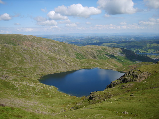
Levers Water is a small lake in the English Lake District. It is located at the head of the Coppermines Valley, above Coniston village. To its south-west is Raven Tor, a spur of Brim Fell, and to its north-west are Little How Crags and Great How Crags, on the eastern side of the north–south ridge leading to Swirl How.
| Levers Water | |
|---|---|
 | |
 Levers Water Location in the Lake District National Park  Levers Water Location in South Lakeland, Cumbria | |
| Location | Lake District |
| Coordinates | 54.384°N 3.111°W |
| Primary inflows | Swirl Hawse Beck, Cove Beck |
| Primary outflows | Levers Water Beck |
| Basin countries | United Kingdom |
| Surface area | 14 hectares (35 acres) |
| Average depth | 7.9 m (26 ft) |
| Water volume | 1,071,870 m3 (37,853,000 cu ft) |
| Surface elevation | 413 metres (1,355 ft) |
| References | [1] |
A dam built in 1717 enlarged the existing tarn to provide water for the mines and for the village below.[2]
A public footpath on its north-east side connects the Coppermines Valley to Swirl Hawse, while to its south-west, a path leads up Gill Cove to Levers Hawse on the main ridge of the Coniston Fells.
References
- "UK Lakes Detail - Levers Water". Centre for Ecology and Hydrology. Archived from the original on 11 June 2016. Retrieved 12 February 2017.
- "Levers Water". Retrieved 12 February 2017.
This Cumbria location article is a stub. You can help Wikipedia by expanding it. |
На других языках
[de] Levers Water
Levers Water ist ein See im Lake District, Cumbria, England.- [en] Levers Water
Текст в блоке "Читать" взят с сайта "Википедия" и доступен по лицензии Creative Commons Attribution-ShareAlike; в отдельных случаях могут действовать дополнительные условия.
Другой контент может иметь иную лицензию. Перед использованием материалов сайта WikiSort.org внимательно изучите правила лицензирования конкретных элементов наполнения сайта.
Другой контент может иметь иную лицензию. Перед использованием материалов сайта WikiSort.org внимательно изучите правила лицензирования конкретных элементов наполнения сайта.
2019-2026
WikiSort.org - проект по пересортировке и дополнению контента Википедии
WikiSort.org - проект по пересортировке и дополнению контента Википедии