geo.wikisort.org - Reservoir
The following is a list of naturally occurring lakes and other water bodies in Victoria, Australia; outside the Greater Melbourne area, in alphabetical order, for those lakes with a surface area greater than 70 hectares (170 acres):
| Lake name | Type | Region | Primary inflow | Primary outflow | Area | Image | Notes | |
|---|---|---|---|---|---|---|---|---|
| hectares | acres | |||||||
| Albacutya | Eutrophic | Wimmera | Outlet Creek | Evaporation | 5,500 | 14,000 | [1] | |
| Barracoota | Freshwater | East Gippsland | 240 | 590 | [2] | |||
| Beeac | Hypersaline | Western District Lakes | Evaporation | 560 | 1,400 | [3] | ||
| Boga | Freshwater water storage | The Mallee | outfall channel to the Little Murray River | 940 | 2,300 |  |
[4] | |
| Bookar | Barwon South West | Evaporation | 450 | 1,100 | [5] | |||
| Borrie | Coastal wetland | Greater Geelong | Little River | Port Phillip Bay | 70 | 170 |  |
[6] |
| Bullen Merri | Brackish crater | Barwon South West | Evaporation | 460 | 1,100 |  |
[7][8] | |
| Buloke | Eutrophic | Wimmera | Richardson River | Evaporation | 4,300 | 11,000 | [9] | |
| Burrumbeet | Eutrophic | Western Victoria | Burrumbeet Creek | Evaporation | 2,300 | 5,700 | [10] | |
| Colac | Freshwater | Barwon South West | Barongarook Creek | Evaporation | 2,800 | 6,900 |  |
[11] |
| Coleman | Freshwater | Gippsland | Latrobe River | Bass Strait | 1,300 | 3,200 | [12] | |
| Colungulac | Saline | Western District Lakes | Evaporation | 1,500 | 3,700 | [13] | ||
| Condah | Crater lake | Barwon South West | Darlot Creek | Evaporation | 250 | 620 | [14] | |
| Connewarre | Estuarine | Bellarine Peninsula | Barwon River | Barwon River | 880 | 2,200 |  |
[15] |
| Coorong | Eutrophic | Wimmera | Yarriambiack Creek | Evaporation | 100 | 250 | [16] | |
| Coradgil | Freshwater | Western District Lakes | Evaporation | 78 | 190 | [17] | ||
| Corangamite | Hypersaline, endorheic | Western District Lakes | Woady Yaloak River | Evaporation | 17,000 | 42,000 | [18] | |
| Cundare | Hypersaline | Western District Lakes | Evaporation | 280 | 690 | [19] | ||
| Deep | Freshwater | Western Victoria | Evaporation | 85 | 210 | [20] | ||
| Elingamite | Freshwater | Western District Lakes | Elingamite Creek | Evaporation | 300 | 740 | [21] | |
| Gnarpurt | Saline | Western District Lakes | Evaporation | 2,350 | 5,800 | |||
| Gnotuk | ||||||||
| Hindmarsh | Eutrophic | Wimmera | Wimmera River | Outlet Creek | 13,500 | 33,000 | [22] | |
| Hume | Reservoir | Hume | Murray River | Murray River | 20,190 | 49,900 |  |
[23][24] |
| Keilambete | ||||||||
| King | Freshwater | Gippsland | Tambo River; Mitchell River | to Bass Strait | 4,400 | 11,000 | [25] | |
| Learmonth | ||||||||
| Logan | ||||||||
| Marmal | Wimmera | Evaporation | 130 | 320 | [26] | |||
| Martin | Freshwater | Western District Lakes | Woady Yaloak River | Woady Yaloak River | 2,200 | 5,400 | [27] | |
| Milangil | Saline | Western District Lakes | 310 | |||||
| Mokoan | Reservoir | Hume | Broken River | Evaporation | 9,400 | 23,000 | 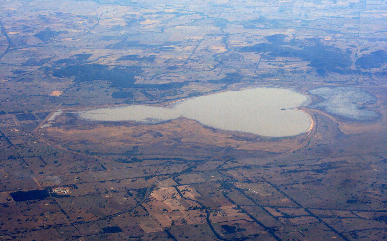 |
[28] |
| Monbeong | ||||||||
| Mulwala | Reservoir | Murray River | Murray River | 6,600 | 16,000 |  |
[29] | |
| Murdeduke | Saline | Western District Lakes | 3,800 | |||||
| Nagambie | Reservoir | Goldfields | Goulburn River | Goulburn River | 170 | 420 |  |
[30] |
| Narracan | Reservoir | West Gippsland | Latrobe River | Latrobe River | 281 | 690 | [31] | |
| Purrumbete | Crater lake | Western District Lakes | Evaporation | 552 | 1,360 | [32] | ||
| Reedy | Freshwater | Bellarine Peninsula | Barwon River | Barwon River | 550 | 1,400 |  |
|
| Reeve | Freshwater | Gippsland | Carr Creek | to Bass Strait | 5,200 | 13,000 | [33] | |
| Rosine | ||||||||
| Round | ||||||||
| Tali Karng | formed by a natural landslide | Alpine | Snowden Creek, Nigothoruk Creek | underground to Wellington River | 14 | 35 | [34] | |
| Terangoon | Freshwater | Western District Lakes | 208 | 510 | ||||
| Tutchewop | Freshwater | The Mallee | Evaporation | 760 | 1,900 | [35] | ||
| Tyrrell | Salt lake | Mallee | Tyrrell Creek | Evaporation | 20,860 | 51,500 | [36] | |
| Tyers | Freshwater | Gippsland | Boggy Creek; Stony Creek | to Bass Strait | 950 | 2,300 | [37] | |
| Victoria (Bellarine) | Saline | Bellarine Peninsula | to Bass Strait | 139 | 340 |  |
[38] | |
| Victoria (Gippsland) | Freshwater | Gippsland | Latrobe River; Mitchell River | to Bass Strait | 15,000 | 37,000 | [39] | |
| Weeranganuk | Freshwater | Barwon South West | Evaporation | 460 | 1,100 | [40] | ||
| Wellington | Freshwater | Gippsland | Latrobe River; Avon River | to Bass Strait | 15,000 | 37,000 | [41] | |
| Wendouree | Freshwater | Goldfields | Gong Gong Reservoir | Evaporation | 238 | 590 |  |
[42] |
| William Hovell | Reservoir | Alpine | King River | King River | 113 | 280 |  |
[43] |
See also
- Lakes and Reservoirs in Melbourne
References
- Ker, Peter (25 January 2011). "Parched lake may end 15-year dry". The Age. Retrieved 28 October 2014.
- "Map of Lake Barracoota, VIC". Bonzle Digital Atlas of Australia. Retrieved 6 January 2014.
- "Map of Lake Beeac, VIC". Bonzle Digital Atlas of Australia. Retrieved 27 October 2014.
- "Lake Boga: Recreational Guide" (PDF). Goulburn–Murray Water (PDF). October 2012. Archived from the original (PDF) on 21 March 2015. Retrieved 7 November 2014.
- "Map of Lake Bookar, VIC". Bonzle Digital Atlas of Australia. Retrieved 27 October 2014.
- "Map of Lake Borrie, VIC". Bonzle Digital Atlas of Australia. Retrieved 27 October 2014.
- "Map of Lake Bullen Merri, VIC". Bonzle Digital Atlas of Australia. Retrieved 27 October 2014.
- "Volcanic landforms in the Camperdown area of Victoria". UniServe Science. Retrieved 16 June 2007.
- "Map of Lake Buloke, VIC". Bonzle Digital Atlas of Australia. Retrieved 27 October 2014.
- "Map of Lake Burrumbeet, VIC". Bonzle Digital Atlas of Australia. Retrieved 27 October 2014.
- "Map of Lake Colac, VIC". Bonzle Digital Atlas of Australia. Retrieved 27 October 2014.
- "Map of Lake Coleman, VIC". Bonzle Digital Atlas of Australia. Retrieved 27 October 2014.
- "Map of Lake Colungulac, VIC". Bonzle Digital Atlas of Australia. Retrieved 27 October 2014.
- Crook, D.; Macdonald, J.; Belcher, C.; O’Mahony, D.; Dawson, D.; Lovett, D.; Walker, A.; Bannam, L. (2008). Lake Condah Restoration Project: Biodiversity Assessments (PDF). Arthur Rylah Institute for Environmental Research Technical Report Series No. 180 (PDF). Heidelberg, Victoria: Department of Sustainability and Environment, Government of Victoria. p. 3. ISSN 1835-3835. Retrieved 27 October 2014.
- "Map of Lake Connewarre, VIC". Bonzle Digital Atlas of Australia. Retrieved 27 October 2014.
- "Map of Lake Coorong, VIC". Bonzle Digital Atlas of Australia. Retrieved 27 October 2014.
- "Map of Lake Coradgill, VIC". Bonzle Digital Atlas of Australia. Retrieved 27 October 2014.
- "Map of Lake Corangamite, VIC". Bonzle Digital Atlas of Australia. Retrieved 27 October 2014.
- "Map of Lake Cundare, VIC". Bonzle Digital Atlas of Australia. Retrieved 27 October 2014.
- "Map of Deep Lake, VIC". Bonzle Digital Atlas of Australia. Retrieved 27 October 2014.
- "Map of Elingamite Lake, VIC". Bonzle Digital Atlas of Australia. Retrieved 27 October 2014.
- "Map of Lake Hindmarsh, VIC". Bonzle Digital Atlas of Australia. Retrieved 27 October 2014.
- "Hume Dam" (PDF brochure). State Water Corporation. 2009. Retrieved 19 April 2013.
- "Hume Dam". Water delivery: dams. State Water Corporation. Archived from the original on 10 April 2013. Retrieved 19 April 2013.
- "Map of Lake King, VIC". Bonzle Digital Atlas of Australia. Retrieved 27 October 2014.
- "Map of Lake Marmal, VIC". Bonzle Digital Atlas of Australia. Retrieved 27 October 2014.
- "Map of Lake Martin, VIC". Bonzle Digital Atlas of Australia. Retrieved 27 October 2014.
- "Map of Lake Mokoan, VIC". Bonzle Digital Atlas of Australia. Retrieved 27 October 2014.
- "Map of Lake Mulwala, VIC". Bonzle Digital Atlas of Australia. Retrieved 27 October 2014.
- "Map of Lake Nagambie, VIC". Bonzle Digital Atlas of Australia. Retrieved 27 October 2014.
- "Lake Narracan". Southern Rural Water. Archived from the original on 30 October 2014. Retrieved 27 October 2014.
- "Map of Lake Purrumbete, VIC". Bonzle Digital Atlas of Australia. Retrieved 27 October 2014.
- "Map of Lake Reeve, VIC". Bonzle Digital Atlas of Australia. Retrieved 27 October 2014.
- "Map of Lake Tali Karng, VIC". Bonzle Digital Atlas of Australia. Retrieved 27 October 2014.
- "Map of Lake Tutchewop, VIC". Bonzle Digital Atlas of Australia. Retrieved 27 October 2014.
- "Map of Lake Tyrell, VIC". Bonzle Digital Atlas of Australia. Retrieved 27 October 2014.
- "Map of Lake Tyres, VIC". Bonzle Digital Atlas of Australia. Retrieved 27 October 2014.
- "Map of Lake Victoria, VIC". Bonzle Digital Atlas of Australia. Retrieved 27 October 2014.
- "Map of Lake Victoria, VIC". Bonzle Digital Atlas of Australia. Retrieved 27 October 2014.
- "Map of Lake Weeranganuk, VIC". Bonzle Digital Atlas of Australia. Retrieved 27 October 2014.
- "Map of Lake Wellington, VIC". Bonzle Digital Atlas of Australia. Retrieved 27 October 2014.
- "Map of Lake Wendouree, VIC". Bonzle Digital Atlas of Australia. Retrieved 27 October 2014.
- "Register of Large Dams in Australia" (Excel (requires download)). Dams information. Australian National Committee on Large Dams. 2010. Retrieved 11 July 2014.
Текст в блоке "Читать" взят с сайта "Википедия" и доступен по лицензии Creative Commons Attribution-ShareAlike; в отдельных случаях могут действовать дополнительные условия.
Другой контент может иметь иную лицензию. Перед использованием материалов сайта WikiSort.org внимательно изучите правила лицензирования конкретных элементов наполнения сайта.
Другой контент может иметь иную лицензию. Перед использованием материалов сайта WikiSort.org внимательно изучите правила лицензирования конкретных элементов наполнения сайта.
2019-2025
WikiSort.org - проект по пересортировке и дополнению контента Википедии
WikiSort.org - проект по пересортировке и дополнению контента Википедии